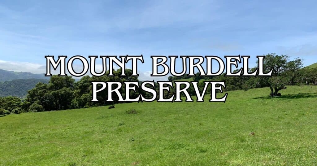
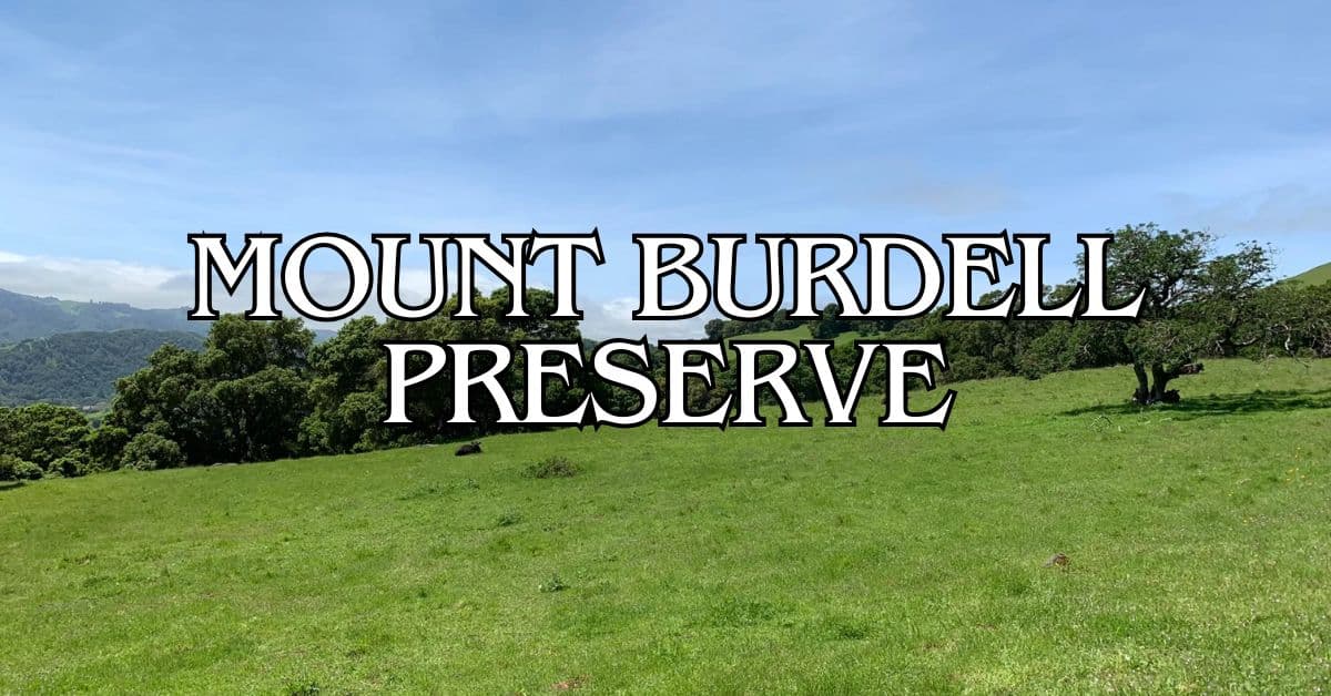
Mount Burdell Preserve is Marin County’s largest open space, and honestly, it’s one of the best spots for hiking in the Bay Area. The place feels wild but welcoming, with broad fire roads and meandering paths that work for everyone—total newbies, seasoned hikers, families, you name it. Mount Burdell Open Space Preserve gives you those sweeping views, a surprising mix of ecosystems, and trails that don’t feel intimidating, all just a quick drive from Novato.
If you head out there, stick to the marked trails—some of the natural areas are pretty delicate, and there’s private property around the edges. You’ll find several solid routes, with Deer Camp Fire Road, Old Quarry, and the Michako Loop drawing the most foot traffic. These are especially good for families—wide, easy to follow, and not too steep for kids.
Discover hand-picked hotels and vacation homes tailored for every traveler. Skip booking fees and secure your dream stay today with real-time availability!
Browse Accommodations Now
Wander a bit, and you’ll spot all sorts of wildlife and native plants that make this place special. Climb higher, and you’re rewarded with those “wow” views stretching across Marin. Whether you’re after a brisk morning outing or a long, rambling day, Mount Burdell is a breath of fresh air that really shows off what Marin County has to offer.
Overview of Mount Burdell Preserve
Mount Burdell Preserve really is the big one in Marin’s open space collection, with scenic trails and panoramic views that pull in hikers, mountain bikers, and nature lovers. The landscape is a patchwork of oak woodlands, open grasslands, and wildflower meadows, all crisscrossed by a web of trails.
Location and Accessibility
You’ll find Mount Burdell Preserve just north of Novato, tucked into northern Marin County. It’s easy to reach from San Marin Drive, and the main entrance sits at the end of San Andreas Drive, where there’s a small parking lot.
The gates open at sunrise and close at sunset—every day, all year. If you want a quieter experience, weekdays are your best bet. Weekends can get busy with locals out for a stroll.
There’s no entrance fee, which is always nice. If you’re bringing your dog, keep a leash handy—some spots require it to protect local wildlife.
Geology and Elevation
Mount Burdell tops out around 1,500 feet, and from up there, the views are pretty epic. The hills are dotted with ancient oaks and rolling grasslands that totally change character as the seasons shift.
Spring brings a riot of wildflowers blanketing the slopes, while rocky outcrops near the summit hint at the region’s geologic backstory.
The terrain ranges from gentle foothills to steeper climbs near the top. This mix supports all sorts of plant communities, like:
- Old-growth oak groves
- Native grasslands
- Wetlands that come and go with the rain
- Chaparral on the sunbaked slopes
Distance and Trail Networks
Mount Burdell’s trail system is extensive, with fire roads and single-track paths that let you mix and match your route.
If you start at the San Marin trailhead and head for the summit, you’re looking at 3-4 miles one way, with a decent amount of climbing. Most folks take 3-5 hours round-trip, depending on pace and stops.
Some favorite routes:
- Old Quarry Trail: about 2 miles, steady climb
- Middle Burdell Fire Road: wider, more gradual
- Michako Trail: steeper, a bit more technical
You can make loops as short as a mile or go big with 8-mile circuits. Trail markers and maps at the main junctions help you stay on track.
Exploring the Main Trails
Mount Burdell Preserve has a handful of distinct trails that really show off the natural beauty of Marin. Each one has its own vibe, depending on the season and your mood.
Dwarf Oak Trail
The Dwarf Oak Trail is a quirky little gem, winding for 1.2 miles through a woodland where the oak trees barely hit six feet tall—no joke. The weird soil here keeps them stunted, even though some are centuries old.
Spring is hands-down the best time for this trail, with wildflowers bursting out beneath the tiny trees. The path isn’t too tough, just a bit of gentle up and down. Wooden signs point out cool ecological features along the route. If you’re into photography, the twisted oaks and early morning fog make for some magic.
Hidden Lake Loop
Hidden Lake Loop is about 2.3 miles and leads you to a secret little lake that only appears after good rains. The trail starts from San Andreas Drive and climbs through oak woods, gaining around 500 feet.
You’ll probably spot deer, wild turkeys, and hawks overhead. The lake is at its best between January and April, when the water’s high. Benches along the way offer nice spots to catch your breath. The western side of the loop is shady, while the eastern half opens up with wide grassland views.
Seasonal Pond Path
This is the trail for an easy stroll—just a mile, mostly flat, and perfect for families or anyone wanting a mellow walk. You’ll wander past ephemeral ponds that fill with rainwater in winter and spring, then vanish by summer.
Look for vernal pool buttercups, downingia, and other plants that thrive in this wet-dry cycle. If you’re lucky, you’ll hear frogs or spot salamanders during the wet months. Interpretive signs along the way explain what’s happening ecologically.
Trail Surface and Terrain
Mount Burdell’s trails run the gamut—main fire roads with packed dirt (muddy after rain), and narrower single-tracks with roots and rocks to watch for.
Difficulty ranges from super easy (Seasonal Pond Path) to pretty challenging (upper Cobblestone Fire Road). Elevation gain can be minimal or up to 1,000 feet if you’re aiming for the summit.
Summer trails dry out and get dusty, with little shade on the exposed stretches. Winter brings lush green but also some slick, slippery spots.
Bring decent hiking shoes. Trail runners are fine when it’s dry, but waterproof boots are a lifesaver after rain.
Find the perfect hotel or vacation rental. Instant booking, no fees!
View Top Stays
Wildlife and Natural History
The diversity of plant and animal life at Mount Burdell is impressive and shifts with the seasons. The mix of oak woodlands, grasslands, and wetlands makes for a lively ecosystem.
Wildflowers and Native Plants
Come spring, Mount Burdell explodes with wildflowers. The open patches between the oaks are prime real estate for these blooms.
You’ll see:
- California poppies—so bright they almost glow
- Purple and blue lupines
- Yellow buttercups and goldfields
- Shooting stars in pink and purple
Massive old bay trees line Deer Camp Fire Road, offering much-needed shade in summer. Grasslands shift from green in spring to gold by late summer, and each phase supports its own set of plants.
Bird Watching Opportunities
Birders love Mount Burdell. The variety of habitats draws in both year-round residents and migratory species.
The Point Reyes Bird Observatory has tracked a bunch of species here. Bring binoculars and you might spot:
Raptors:
- Red-tailed hawks
- Rough-legged hawks (in winter)
- American kestrels
- Turkey vultures
Woodland Birds:
- Acorn woodpeckers
- Oak titmice
- Western bluebirds
- Sparrows
Get there early for the best bird activity. Higher trails give you a good vantage point for spotting birds in flight.
Insects and Other Fauna
It’s not just about the big stuff—Mount Burdell is buzzing with smaller critters, especially in spring and summer.
Expect to see:
- Monarchs and painted lady butterflies
- Native bees
- Dragonflies near the ponds
- Grasshoppers in the meadows
After the rains, frogs and salamanders show up around seasonal wetlands. If you’re out at dusk, you might hear the chorus of Pacific tree frogs.
Bigger mammals—black-tailed deer, coyotes, foxes—are around too, but you’ll have better luck spotting them early or late in the day.
Role of Naturalists
Local naturalists have played a big part in studying and protecting Mount Burdell’s biodiversity. Thanks to their work, you’ll find educational programs and conservation efforts happening year-round.
Marin County Parks sometimes hosts naturalist-led hikes. These are worth joining if you want to learn about seasonal changes or spot wildlife you’d otherwise miss.
You can also get involved by:
- Reporting wildlife sightings
- Joining bird counts
- Helping with habitat restoration
- Documenting wildflower blooms
The preserve acts as a living lab for understanding California’s natural history. The info gathered by naturalists helps guide how the area is managed and protected.
Best Times to Visit
Every season at Mount Burdell has its own personality, and the experience shifts with the weather and what’s blooming or active.
Seasonal Changes
Spring (March-May) is the showstopper—wildflowers everywhere, hillsides lit up with color. Honestly, you could start as early as February if it’s been a rainy winter, and catch blooms through late spring.
Summer (June-August) brings heat and golden hills. The trails can get toasty by noon, so aim for early mornings—before 10 AM is best. There’s not much shade, so an early start really helps.
Fall (September-November) is a sweet spot, with cooler air and dramatic skies. If you like photography, you’ll find plenty of inspiration.
Winter (December-February) turns the hills green after rain. On clear days, the views stretch forever, but fog sometimes rolls in and adds a moody vibe.
Weather and Climate
The climate here is classic Mediterranean—wet winters, dry summers. Summer temps usually run 70-90°F (21-32°C), and because so much of the trail network is exposed, it often feels even warmer. Don’t forget water.
Winters stay mild, 40-60°F (4-15°C), and you almost never have to worry about freezing. Trails are open all year.
Spring and fall are the most comfortable, with temps in the 60-75°F (15-24°C) range. Perfect for hiking.
Luxury stays to cozy cottages await, all with instant booking. Find the best deals!
Browse Marin Stays
Morning fog is pretty common, but it usually burns off by mid-morning. If you’re into photography, those early hours with soft light can be especially beautiful.
Snow and Rainfall
Snow at Mount Burdell? Pretty much unheard of. Maybe once in a blue moon you’ll catch a dusting, but don’t count on it—this isn’t Tahoe.
Rain is a different story. Most of it falls between November and April, with the heaviest showers landing from December through February. On average, you’ll see about 30 inches a year, thanks mostly to those winter storms.
Trails can get pretty slick after a downpour, especially the narrow ones. The wider fire roads tend to handle water better, but even they get muddy in spots.
Come spring, rain brings out seasonal streams and ponds that draw in wildlife. These little water features usually vanish by late spring, so if you want to see them, plan accordingly.
Nearby Attractions in Marin County
If you’re up for more after Mount Burdell, Marin County’s got plenty to keep you busy. The area is packed with jaw-dropping scenery and wildlife—sometimes you just stumble on something cool without even trying.
Bay Area Ridge Trail
The Bay Area Ridge Trail is a real treat for anyone who loves the outdoors. This 550-mile trail system weaves through Marin and eight other counties, circling the whole Bay Area. Near Mount Burdell, you can hop on the Ridge Trail via Cobblestone Fire Road. Expect huge views of the hills and valleys—honestly, it’s hard not to stop and stare.
You’ll see those blue trail markers with the logo along the way. Some sections are easy, others will get your heart pumping. Spring is wildflower season and fall means crisp air and clear skies—both are great times to go.
Trail Access Points in Marin:
- Mount Burdell (Cobblestone Fire Road)
- Lucas Valley
- China Camp State Park
- Mount Tamalpais
Point Bonita and Hawk Hill
Point Bonita and Hawk Hill are both within half an hour’s drive from Novato and absolutely worth the trip. Point Bonita sports a historic lighthouse from 1877 that’s still working. The lighthouse perches right at the mouth of San Francisco Bay, and to get there, you’ll cross a suspension bridge (open Thursday–Monday, 12:30–3:30 PM).
Hawk Hill is, unsurprisingly, a top spot for hawk watching, especially during the fall migration (September–November). You might see hundreds of raptors soaring overhead. The Golden Gate Raptor Observatory keeps track of them here.
Both spots deliver killer views of the Golden Gate Bridge, the city skyline, and the Pacific. Don’t forget a jacket—fog and wind are pretty much standard, even when it’s sunny.
Point Reyes Bird Observatory
The Point Reyes Bird Observatory (PRBO) runs several research stations in Marin. If you’re into birds, their Palomarin Field Station at the southern tip of Point Reyes National Seashore is a must. They’re all about bird conservation, tracking migration patterns, and banding birds for research.
Most Sundays at 9 AM, you can join a free guided tour (it’s smart to reserve ahead). Sometimes you’ll catch researchers banding birds—really fascinating if you’ve never seen it.
Trails nearby wind through coastal scrub, and the Palomarin Trailhead leads to Bass Lake and Alamere Falls. Birdwatchers should aim for spring or fall migration, or just get there early in the morning for the most activity. The field station also has some solid educational displays about local birds and the challenges they face.
Other Notable Bay Area Hikes
Mount Burdell is great, but let’s be honest—the Bay Area is packed with hiking gems, many just a short drive from Marin.
Twin Peaks and Nimitz Way
Twin Peaks is classic San Francisco. The 0.7-mile walk to the top isn’t much, but the 360-degree city and bay views are unbeatable, especially at sunrise or sunset. Just don’t be surprised if the fog rolls in and hides everything.
Nimitz Way, over in the East Bay, is a different vibe. This paved 4.3-mile path in Tilden Regional Park is easygoing and super accessible. You’ll get sweeping views of the bay, Mount Tamalpais, and sometimes the Golden Gate Bridge if the weather’s clear. Families, runners, and cyclists all use this trail. There are picnic spots along the way, and wildflowers in spring. Fall? Perfect hiking weather.
Berry Creek Falls and Purisima Creek Redwoods
Berry Creek Falls in Big Basin Redwoods State Park is one of those bucket-list hikes. The 10.5-mile loop winds through old-growth redwoods and features a stunning 70-foot waterfall. Go in winter or spring for the best water flow. Bring plenty of snacks and water—the hike takes 5–6 hours and has some steep bits and creek crossings.
If you want something cooler (literally), Purisima Creek Redwoods Preserve is a great coastal option. The 7-mile North Ridge and Craig Britton Trail loop takes you through shady redwoods and, on a clear day, offers ocean views. Early mornings or weekdays are quieter.
Chimney Rock and Alpine Lake
Chimney Rock Trail at Point Reyes is a short and sweet 1.8-mile round-trip with barely any elevation change. The coastal views are spectacular, especially if you hit it during wildflower season (February–May). In winter, keep an eye out for gray whales off the coast. It gets windy, so toss a jacket in your pack. If you’re around during elephant seal breeding season (December–March), check out the overlook nearby.
Alpine Lake in Marin’s watershed is peaceful and often overlooked. The 8.4-mile Kent Trail to Rocky Ridge Fire Road loop climbs about 1,300 feet, weaving through redwoods, by the lake, and along ferny canyons. It’s much less trafficked than other Bay Area trails. Spring brings wildflowers, while fall is a great time for mushroom hunters.
Scenic Locations Beyond Marin
Sure, Mount Burdell is fantastic, but sometimes you just want to see what’s beyond the county line. The Bay Area’s landscape is wild—coastlines, marshes, and endless trails with killer views.
Fitzgerald Marine Reserve and Pillar Point
Fitzgerald Marine Reserve in San Mateo County is a tidepool lover’s dream. At low tide, you’ll find sea stars, anemones, crabs—all kinds of critters. Waterproof shoes help, and it’s smart to check the tide charts before heading out.
Pillar Point is close by, known for its dramatic rock formation and as the spot where the Mavericks surf comp happens when the waves get huge. There’s a 1.5-mile trail along the coast connecting the two, with some pretty epic ocean views.
Parking is tight at both spots, especially on weekends, so try to arrive early. Fitzgerald also has a small visitor center with marine life exhibits.
Pescadero Marsh Natural Preserve and Carquinez Strait Regional Shoreline
Pescadero Marsh Natural Preserve covers 235 acres of wetlands about an hour and a half south of Marin. It’s a haven for over 160 bird species—bring binoculars if you’re into birding. There are a few easy trails, but the North Pond Trail is best for wildlife spotting.
Carquinez Strait Regional Shoreline, northeast of Marin in Contra Costa County, offers a different scene—rolling hills and steep canyons above the spot where the Sacramento and San Joaquin rivers meet San Pablo Bay. The 2.5-mile Carquinez Overlook Loop Trail gives you big water views and, in spring, lots of wildflowers.
Cowell Ranch Beach and Sawyer Camp Trail
Cowell Ranch Beach is one of those places that feels like a secret. It’s tucked away south of Half Moon Bay, and you’ll need to walk half a mile and head down some stairs to reach it. Once you’re there? Quiet, beautiful sand and dramatic bluffs. If you time your visit for low tide, you can check out a little cove separated by a rock wall—sometimes you’ll spot a harbor seal colony.
Sawyer Camp Trail, over in San Mateo County, is a totally different experience. This paved 6-mile path hugs the east shore of Crystal Springs Reservoir. It’s flat and easy, perfect for walkers, joggers, and cyclists who want views of the water and maybe a glimpse of deer or raptors along the way.
Crissy Field’s Panoramic Views
Crissy Field in San Francisco has some of the most unforgettable views you’ll find anywhere in the Bay Area. It’s a restored wetland with a 1.5-mile promenade—honestly, you can’t miss the Golden Gate Bridge from here.
East Beach is a sandy spot where you can just sprawl out and, if the wind’s up, watch kiteboarders zip by. The marsh in the middle draws all sorts of birds, plus there are signs around if you’re curious about the local ecosystem.
If you want to dodge the crowds, try going on a weekday morning. The Warming Hut nearby serves up snacks and drinks (nothing fancy, but it hits the spot). And if you’re into photography, late afternoon is magic—the sun dips behind the bridge and the whole place just glows.
Find available hotels and vacation homes instantly. No fees, best rates guaranteed!
Check Availability Now
Black Point Boat Launch Travel Guide – Accessibility, Amenities, Activities, and More!
Deer Island Preserve Travel Guide – Accessibility, Amenities, Activities, and More!
Ignacio Valley Preserve Travel Guide – Accessibility, Amenities, Activities, and More!
Indian Tree Preserve Travel Guide – Accessibility, Amenities, Activities, and More!
Indian Valley Preserve Travel Guide – Accessibility, Amenities, Activities, and More!
Little Mountain Preserve Travel Guide – Accessibility, Amenities, Activities, and More!
Loma Verde Preserve Travel Guide – Accessibility, Amenities, Activities, and More!
Mount Burdell Preserve Travel Guide – Accessibility, Amenities, Activities, and More!
Olompali State Historic Park Travel Guide – Accessibility, Amenities, Activities, and More!
Pacheco Valley Preserve Travel Guide – Accessibility, Amenities, Activities, and More!
Rush Creek Preserve Travel Guide – Accessibility, Amenities, Activities, and More!
Santa Margarita Island Preserve Travel Guide – Accessibility, Amenities, Activities, and More!
Stafford Lake Park Travel Guide – Accessibility, Amenities, Activities, and More!
Verissimo Hills Preserve Travel Guide – Accessibility, Amenities, Activities, and More!


