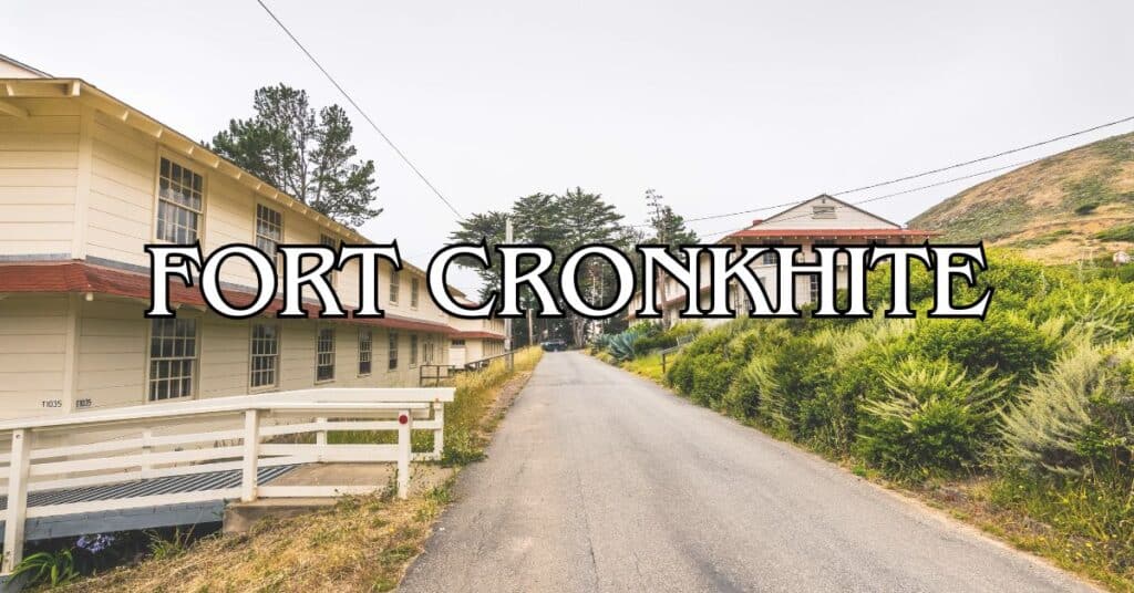
Tucked away in the Marin Headlands just north of San Francisco, Fort Cronkhite blends history and wild, rugged beauty. This old World War II military post hugs the Pacific, giving you those classic windswept views and a surprising range of things to do. You’ll stumble across beautiful beaches, abandoned bunkers, hiking trails, and those jaw-dropping Golden Gate Bridge vistas all in one spot.
If you make the trek out here, you’ll find yourself surrounded by relics of the past and the kind of coastal scenery that makes you want to take a million photos. The fort sits north of Rodeo Lagoon, tucked at the end of Rodeo Valley—a perfect place to escape the city grind for a few hours without a huge drive.
Discover hand-picked hotels and vacation homes tailored for every traveler. Skip booking fees and secure your dream stay today with real-time availability!
Browse Accommodations Now
Take your pick: wander through old military buildings, stroll along the sand, poke around in forgotten bunkers, or hit the trails. You might spot some wildlife, or—if you’re lucky—watch surfers braving the cold Pacific. It’s all part of the Golden Gate National Recreation Area, so you get that mix of outdoor adventure and fascinating stories from California’s past.
Overview Of Fort Cronkhite
Fort Cronkhite is a former military post nestled in the Marin Headlands, where history, natural beauty, and outdoor fun collide. You get those classic World War II structures paired with sweeping Pacific views.
History And Significance
The U.S. Army built Fort Cronkhite during World War II to help guard the Bay Area after Pearl Harbor. They threw up a series of distinctive barracks and support buildings in 1941, all in the “mobilization style” that was popular for its speed and utility.
After WWII, the Army kept using the site through the Cold War, adding things like Nike missile batteries and other defense systems. In 1974, they handed the place over to the National Park Service, folding it into the Golden Gate National Recreation Area. That move kept this slice of history around for all of us to explore.
Preservation And Restoration
These days, Fort Cronkhite stands out as one of the best-preserved WWII posts anywhere in the country. The National Park Service keeps the original vibe intact while making it safe and accessible.
Most of the old barracks and buildings look much like they did back in the day. Restoration efforts focus on keeping that authentic character—there’s a certain charm to the weathered wood and utilitarian style, if you ask me.
Some buildings have new lives now: visitor centers, classrooms, research spaces. The Marine Mammal Center and the Headlands Center for the Arts both use former Army spaces, which is a pretty cool twist. Interpretive signs dot the area, giving context to what you’re seeing and walking through.
Visiting Today
A visit to Fort Cronkhite is surprisingly packed with options, whether you’re a history nerd, a hiker, or just want to chill by the ocean.
Rodeo Beach is right there, with its black sand and dramatic Pacific views. People come here to surf, picnic, or just poke around for sea glass.
Hiking trails crisscross the area, linking Fort Cronkhite to other parts of the Headlands. The Coastal Trail is a favorite, with some of the best views around, and other paths wind up to old batteries and bunkers.
The visitor center nearby hands out maps and info, and sometimes you’ll catch a ranger-led walk or talk. Admission is free, and the fort is open year-round. Parking’s free too, but it fills up fast on weekends—if you’re coming on a sunny Saturday, get here early.
Location And Access
Fort Cronkhite sits right on the Pacific in the Marin Headlands, just north of San Francisco. You get that wild, open feeling but you’re not far from the city at all.
Getting To Fort Cronkhite
You’ll find Fort Cronkhite in Sausalito, California, about 5 miles northwest of the Golden Gate Bridge. The simplest way is to take Highway 101 North from San Francisco, then the Alexander Avenue exit. Follow the signs for Marin Headlands, go through the Baker-Barry Tunnel, and hang a left on Field Road. That’ll take you straight to the fort.
Public transit isn’t great out here. Golden Gate Transit’s Route 76X runs on weekends and holidays, with stops close by. On weekdays, you’ll need to drive or bike.
If you’re up for a ride, cycling through the Headlands is an adventure—plenty of hills, but the views pay off.
Parking And Facilities
There’s free parking in a few lots near Rodeo Beach, but on weekends or sunny holidays, they fill up fast. If you want a spot, try to get here before 10 AM.
Parking Options:
- Main lot by Rodeo Beach (biggest)
- Overflow along Field Road
- Small lot near the Visitor Center
Facilities are pretty basic:
- Restrooms
- Water fountains
- Picnic tables
- Trash and recycling bins
The main visitor center sits in the historic Fort Barry Chapel nearby. It’s open 9:30 AM to 4:30 PM most days (closed Tuesdays) and has maps, exhibits, and staff to answer questions.
There’s basically nowhere to buy food around here, so bring snacks and plenty of water.
Nearby Towns And Landmarks
Sausalito is the closest town, just three miles east. If you need a bite, want to shop, or just wander, it’s a great stop before or after your adventure.
Mill Valley is about five miles northeast and has even more restaurants and shops.
Nearby Landmarks:
- Golden Gate Bridge (5 miles southeast)
- Point Bonita Lighthouse (2 miles southwest)
- Muir Beach (5 miles northwest)
- Muir Woods National Monument (7 miles north)
All around Fort Cronkhite, you’ll find other historic sites like Battery Townsley and the Nike Missile Site. If you’re into military history, check out their tour schedules.
Trailheads And Navigation
Fort Cronkhite is a jumping-off point for a bunch of hiking trails in the Golden Gate National Recreation Area. The easiest trailhead starts at Rodeo Beach.
Popular Trails from Fort Cronkhite:
- Coastal Trail (heads toward Point Bonita)
- Miwok Trail (moderate climb, big views)
- Rodeo Lagoon Trail (flat, easy loop)
- Wolf Ridge Trail (tougher hike, epic panoramas)
Trails range from mellow to challenging. Most are marked, but grab a free map at the Visitor Center before heading out.
Cell service can drop out in the Headlands, so download maps or bring a paper one if you’re worried about getting lost.
Fog is a regular guest here, especially in summer afternoons. Honestly, just bring layers no matter the season.
Historical Background
Fort Cronkhite stands as a testament to America’s military past, with buildings and bunkers that have seen more than a few chapters of history. Its spot along the coast made it a key piece in the defense of San Francisco Bay.
Find the perfect hotel or vacation rental. Instant booking, no fees!
View Top Stays
World War II Era
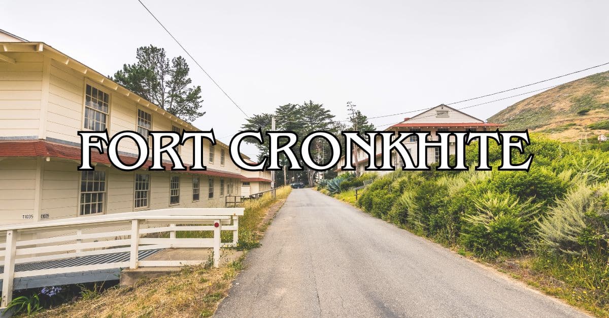
The Army bought 800 acres in the Marin Headlands in 1937, but construction at Fort Cronkhite really took off from 1940 to 1941, as war loomed. The place is the best-preserved example of a WWII mobilization post in the Golden Gate National Recreation Area. You’ll spot the classic 700-Series barracks—wooden, functional, set up in a U-shape with mess halls and admin buildings.
Barracks #1059 has been restored to show what life was like for the soldiers. Back then, troops manned coastal defense guns, always on alert for a Japanese attack that, thankfully, never happened.
Harbor Defenses of San Francisco
Fort Cronkhite played a big role in the Harbor Defenses of San Francisco, working alongside Fort Barry, Fort Baker, and the Presidio. Huge artillery pieces pointed out to sea, ready to defend the bay. Fire control stations on the hills fed them targeting info.
Soldiers kept up with constant drills and equipment checks. From here, the guns could cover anyone approaching the Golden Gate. Underground tunnels and bunkers stored ammo and gave troops safe spots—some are still open to explore.
Role During The Spanish-American War
Technically, Fort Cronkhite didn’t exist during the Spanish-American War in 1898. But the land itself gained military importance around that time.
The Spanish-American War made the U.S. rethink its coastal defenses, especially around San Francisco. Fort Baker and similar installations grew during this period. The “Endicott Program” kicked off a wave of new coastal fortifications, laying the groundwork for what would become Fort Cronkhite.
Military strategists saw the value in this stretch of coast, even if it took a few more decades to build the fort.
Transformation Post-World War I
After World War I, military thinking shifted. Fixed gun placements were no longer enough—planners wanted more flexible, mobile defenses. This mindset shaped the design and use of Fort Cronkhite down the line.
The years between the wars brought new tech: better range finding, improved communications, and advances in artillery. The Great Depression slowed military building, but by the late 1930s, with trouble brewing overseas, coastal defenses became a priority again. That’s how Fort Cronkhite finally came to be.
Natural Sights And Views
Fort Cronkhite is where wild coastal landscapes and old military outposts collide. The setting is dramatic, with sweeping views and wildlife popping up when you least expect it.
Rodeo Beach And Rodeo Lagoon
Rodeo Beach hugs the fort’s western edge, famous for its dark, mineral-rich sand and the colorful pebbles scattered everywhere. It’s not your typical California beach—the sand looks almost black, thanks to the nearby cliffs.
Surfers show up year-round, braving the chilly water. The waves get especially good in winter, but honestly, you’ll want a wetsuit no matter when you go.
Right behind the beach, Rodeo Lagoon stretches out—a freshwater wetland that’s a haven for birds and amphibians. Depending on the season, the lagoon either connects to the ocean or sits as a quiet pond. Walking paths circle the water, making for easy birdwatching or just a peaceful stroll. The calm of the lagoon is a nice contrast to the roar of the Pacific just over the berm.
Coastal Views And Overlooks
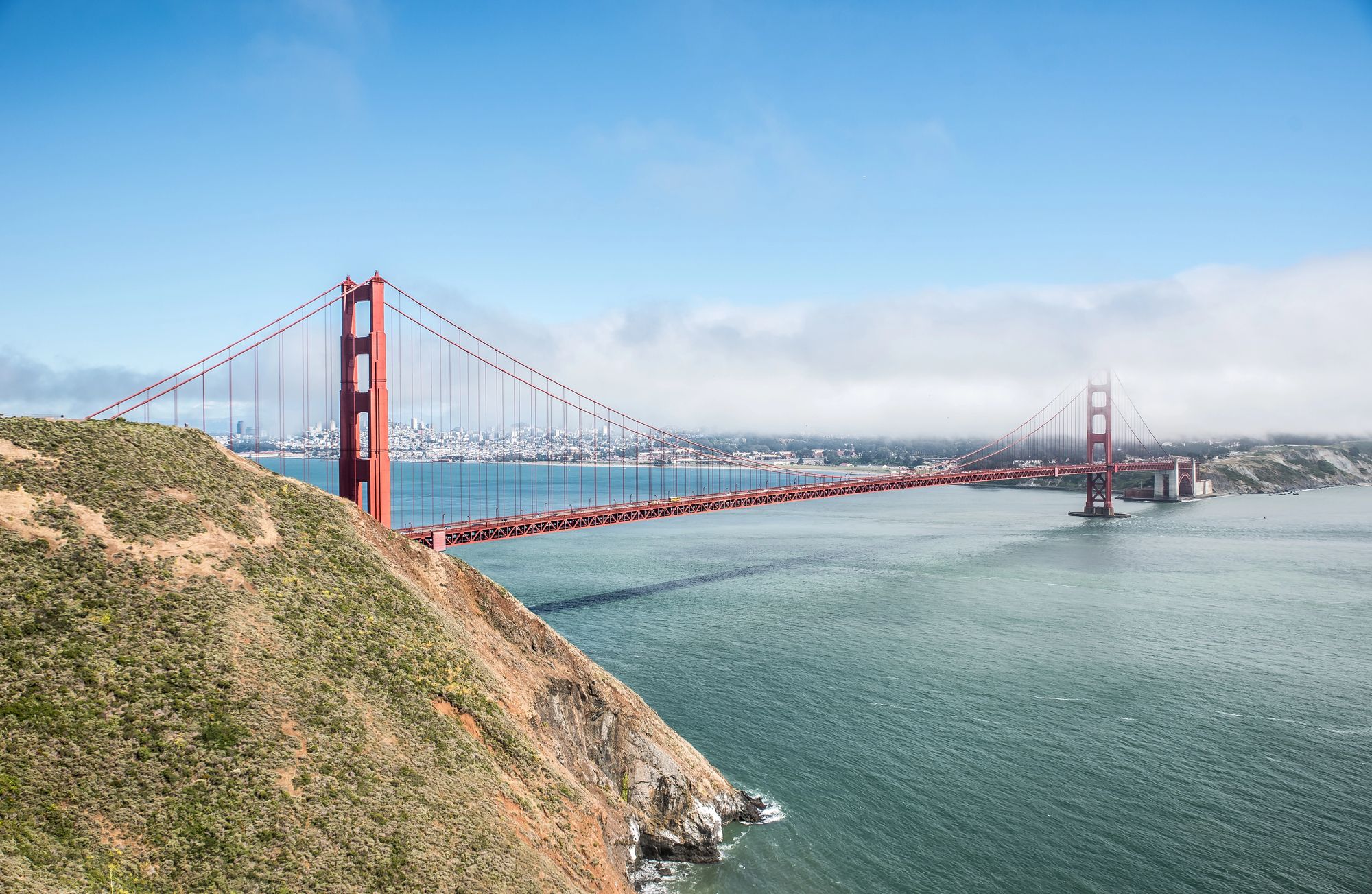
Fort Cronkhite hugs the coastline and dishes up some of the best views around. From the Coastal Trail, you’ll get clear looks at the Golden Gate Bridge to the south and, on good days, Point Reyes up north.
Battery Townsley, perched above Fort Cronkhite, is probably the top spot for taking it all in. The view stretches from the San Francisco skyline to the Marin Headlands and out across the Pacific—honestly, it’s hard not to just stand there for a while and soak it up.
Photographers love the early morning fog rolling over the hills, and late afternoon brings out those golden colors that make the coast look almost unreal.
Benches dot the trails, giving you a place to stop and let the scenery sink in. The weather’s always shifting, so the views keep changing—never really the same twice.
Wildlife Watching
Fort Cronkhite’s mix of habitats attracts a surprising variety of wildlife. Harbor seals haul out on rocks just offshore, and you can spot them from Rodeo Beach if you bring binoculars.
Birders, you’re in for a treat—over 300 species pass through the Golden Gate National Recreation Area. You’ll see raptors like red-tailed hawks and peregrine falcons riding the air currents, and shorebirds poking around for snacks in the sand.
Spring migration (March–May) turns the place into a bird superhighway. In winter, Rodeo Lagoon fills with waterfowl.
If you’re lucky and out early or near dusk, you might cross paths with bobcats, coyotes, or deer. And during whale migration (December through April), keep your eyes on the horizon from the overlooks—gray whales sometimes make an appearance.
Farallon Islands And Pacific Ocean
On those rare, ultra-clear days, you can spot the Farallon Islands about 27 miles offshore. They’re just little bumps on the horizon, but knowing they’re out there—home to huge seabird colonies and marine mammals—adds a sense of wild remoteness. You’ll need binoculars or a spotting scope to see them well, and visiting requires special permission, so most of us just settle for the distant view.
The Pacific dominates the western edge, always shifting moods. Storms send waves crashing against the shore, putting on a show. In summer, morning fog rolls in thick, but by afternoon the clouds usually pull back, revealing a deep blue ocean. Sunsets here? Pretty hard to beat, with the sun dropping straight into the sea.
Hiking And Outdoor Activities
Fort Cronkhite’s trail system weaves through coastal hills, opening up to ocean views and a variety of landscapes. Whether you’re after a tough hike, a stroll by the water, or some wildlife spotting, there’s something to keep you busy all year.
Popular Trails And Routes
The Coastal Trail is the main artery, hugging the cliffs and linking up with other routes. Start from the main Rodeo Beach parking lot and head out for as long or short a walk as you like.
The Miwok Trail gives you a moderate 3-mile climb with killer Pacific views, especially in spring when wildflowers go wild.
If you’re after something easier, the Rodeo Lagoon Trail is a flat 1.5-mile loop—perfect for birdwatching or just stretching your legs.
Wolf Ridge Trail connects to Hill 88 and cranks up the difficulty, but the panoramic views at the top are worth every step.
Hill 88 And Scenic Vistas
Hill 88 rises to 1,053 feet and dishes out some of the best vistas in the Marin Headlands. The hike up gains about 800 feet in 1.8 miles—not easy, but doable if you take your time. Weather can flip fast, so pack water and a jacket.
At the summit, you’ll find an abandoned radar station—kind of eerie, but great for photos. A lot of folks aim for sunset, when the light turns everything dramatic. Watch for hawks and raptors gliding on the thermals around you.
Beach And Coastal Recreation
Rodeo Beach, right at Fort Cronkhite’s edge, is known for its dark sand and colorful pebbles. Surfers love the tough breaks offshore, but it’s also a good spot for beachcombing, picnics, or just watching the waves. You’ll often spot harbor seals and sea lions in the water, plus plenty of shorebirds.
If you want something quieter, head to Tennessee Valley Beach via a 1.7-mile flat trail from Tennessee Valley Road. It’s a secluded alternative and family-friendly.
Luxury stays to cozy cottages await, all with instant booking. Find the best deals!
Browse Marin Stays
Tidepooling is best at the north end of Rodeo Beach during low tide—look for sea stars, anemones, and little crabs tucked among the rocks.
Uphill Climbs And Elevation Changes
The Marin Headlands don’t mess around—most trails start at sea level and climb fast. The Bobcat Trail, for example, gains about 400 feet in its first mile and links up with the Miwok Trail for longer loops.
If you’re heading out, a few tips:
- Start early to dodge heat and fog
- Bring at least a liter of water each
- Wear shoes with grip (trust me)
- Trekking poles help on the steeps
The Battery Townsley Trail is a moderate climb and rewards you with both historical sites and knockout ocean views.
Historic Military Sites
Fort Cronkhite’s old military sites give you a peek into America’s WWII coastal defenses. These sturdy structures tell the story of how the Bay once braced for attacks that, thankfully, never came.
Battery Townsley
Built in 1940, Battery Townsley was a secretive beast—massive concrete walls, two 16-inch guns capable of lobbing shells 25 miles out to sea. Camouflage once hid it from view, but now you can wander inside during guided tours (first Sunday of each month, noon to 4 PM).
The main gun room is jaw-dropping in scale. Check out the displays to see how soldiers lived and worked here. If you’re curious about the deeper corners, bring a flashlight—some spots are pretty dark.
Fort Barry And Historic Barracks
Just east of Fort Cronkhite, Fort Barry’s wooden barracks and admin buildings show off 1940s military style. You can stroll through rows of identical white buildings—some now host educational programs, others serve as hostels or exhibit spaces.
The Fort Barry Chapel, with its simple design and bell tower, still hosts the occasional service or event.
Picture the parade ground full of soldiers drilling; info panels fill in the details if you’re curious about the buildings’ past lives.
Fire Control Towers
Concrete fire control towers dot the headlands, once used to spot enemy ships and help the big guns target them. You’ll see these square bunkers and stepped platforms along various hiking trails, always positioned for the best view over the water.
Operators relayed info to the batteries using a web of phones and plotting rooms—pretty advanced for the time. Some towers are open for exploring, others are sealed up, but most have killer views.
Graffiti And Preservation Efforts
Over the years, graffiti artists have left their mark on many bunkers and buildings. The mix of old military concrete and bright paint is a weird but oddly compelling contrast.
The National Park Service tries to balance protecting history with the reality of remote sites—there are fences and locked gates, but some folks still find their way in.
Preservation here focuses on keeping things safe and stable rather than restoring everything to perfection. If you want to help, stick to paths, don’t add graffiti, and maybe pitch in on a volunteer cleanup if you’re around when one happens.
Nature And Wildlife Experiences
Fort Cronkhite is a fantastic spot for seeing California’s coastal wildlife up close. If you’re into birds, marine life, or just being outside, you’ll find plenty to keep you interested.
Marine Mammal Center
The Marine Mammal Center at Fort Cronkhite is a world leader in rescuing and healing sick or injured seals, sea lions, and other marine mammals along 600 miles of California coast. You can visit to learn about their work—if you’re lucky, you’ll see sea lions or elephant seals being cared for in the outdoor pens.
Displays explain threats like ocean pollution, fishing nets, and climate change. Public tours (about 45 minutes) run daily.
Admission’s free, but donations help. The center’s open 10 AM to 4 PM for visitors.
Birdlife And Observation
Rodeo Lagoon, where fresh and saltwater meet, attracts a wide mix of birds and is one of the area’s birdwatching hotspots.
Year-round regulars include:
- Brown pelicans
- Western gulls
- Great blue herons
- Great egrets
- Red-tailed hawks
During migration, the action really picks up. Bring binoculars to spot sandpipers on the shore or ospreys hovering above. Early mornings or late afternoons are your best bet for sightings. Trails around the lagoon give you lots of vantage points, and there are signs to help you identify what you’re seeing.
Tide Pools And Coastal Ecosystems
The rocky shore near Fort Cronkhite hides tide pools teeming with life—sea stars, purple urchins, green anemones, hermit crabs, and all sorts of seaweed. Go at negative low tide for the best look, and check tide charts before you head out.
Be gentle: walk carefully, don’t collect creatures, and if you touch, use a wet finger. These spots are delicate, and a little respect goes a long way.
Coastal scrub nearby is full of plants tough enough to handle the fog and wind.
Nearby Attractions And Day Trips
Fort Cronkhite makes a great jumping-off point for exploring Marin County’s natural and historic gems. There’s a lot more to see nearby, from redwoods to dramatic coastlines.
Muir Woods National Monument
About 20 minutes away, Muir Woods protects one of the last old-growth redwood forests in the Bay Area. Some trees tower over 250 feet and have stood for 800 years—walking here feels almost otherworldly.
Trails range from the easy 1-mile main loop to more challenging hikes that connect with Mount Tamalpais State Park. The Bohemian Grove Trail is a quieter option if crowds aren’t your thing.
You’ll need a reservation for parking or the shuttle, especially on weekends. Arrive early (before 9 AM) or late (after 4 PM) to skip the worst of the crowds.
The visitor center offers exhibits on the forest and conservation. Restrooms and a café are near the entrance, so you’re covered for basics.
Golden Gate Bridge And Crissy Field
The Golden Gate Bridge is just 15 minutes by car from Fort Cronkhite—closer than most people expect. For those classic city-and-bridge photos, Battery Spencer or the north Vista Point are tough to beat.
You can walk or bike the 1.7-mile stretch across the bridge itself. Pedestrians stick to the east sidewalk during daylight, while cyclists get the west side. It’s usually windy, sometimes foggy, so bring layers; nobody likes freezing halfway across.
Crissy Field, which used to be a military airstrip, is now a lovely wetland and beach. The wide, flat path is great for a stroll, a jog, or a bike ride, with wide-open views of the bridge and the city behind it.
At the west end, there’s the Warming Hut—coffee, snacks, a few souvenirs, and a place to thaw out if the wind gets to you. Parking doesn’t cost anything, but on weekends, you’ll need luck or patience to snag a spot.
Point Bonita Lighthouse
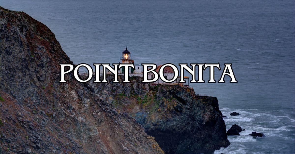
Point Bonita Lighthouse juts out on a rocky tip at the mouth of San Francisco Bay, just 10 minutes from Fort Cronkhite. For over 150 years, it’s guided ships through the fog and currents.
You’ll reach the lighthouse via a half-mile trail that goes through a tunnel and across a suspension bridge. The views? Pretty epic—ocean, bridge, skyline, all at once.
It’s open on Sundays and Mondays from 12:30 to 3:30 PM. Rangers hang around and share stories about shipwrecks and the lighthouse’s wild history.
If you’ve got binoculars, bring them—there’s a good chance you’ll spot seabirds, sea lions, maybe even a whale if you’re lucky. The wind can get strong, so a windbreaker and a hat that won’t fly away are smart. Heads-up: the trail is steep in spots and can be tough for some, so plan accordingly.
Point Reyes National Seashore
About 45 minutes north of Fort Cronkhite, you’ll hit Point Reyes National Seashore—a wild peninsula packed with diverse ecosystems: beaches, grasslands, forests, you name it.
The Point Reyes Lighthouse, built back in 1870, sits 300 steps below the parking lot. Sure, the climb down (and back up!) is a bit of a workout, but the ocean views make it absolutely worth it—especially if you catch the whales migrating between January and April.
If you’re into wildflowers or just want to spot some elephant seals, check out Chimney Rock. The 1.6-mile trail isn’t too tough and the coastline views are honestly pretty stunning.
Tule elk wander around the northern part of the park. Sometimes you’ll see whole herds from Pierce Point Road or along the Tomales Point Trail. Bring your binoculars if you’re hoping for a closer look.
The Bear Valley Visitor Center hands out maps, has exhibits, and the rangers usually have some solid tips. There’s a lot of ground to cover—over 71,000 acres, actually—so you’ll want to set aside a full day if you really want to soak it all in.
Find available hotels and vacation homes instantly. No fees, best rates guaranteed!
Check Availability Now
Angel Island State Park Travel Guide – Accessibility, Amenities, Activities, and More!
Aramburu Island Travel Guide – Accessibility, Amenities, Activities, and More!
Blackie’s Pasture Travel Guide – Accessibility, Amenities, Activities, and More!
Fort Cronkhite Travel Guide – Accessibility, Amenities, Activities, and More!
Gerbode Valley Travel Guide – Accessibility, Amenities, Activities, and More!
Golden Gate National Recreation Area Travel Guide – Accessibility, Amenities, Activities, and More!
Hawk Hill Travel Guide – Accessibility, Amenities, Activities, and More!
Marin Headlands Travel Guide – Accessibility, Amenities, Activities, and More!
Old Saint Hilary’s Preserve Travel Guide – Accessibility, Amenities, Activities, and More!
Paradise Beach Park Travel Guide – Accessibility, Amenities, Activities, and More!
Point Bonita Travel Guide – Accessibility, Amenities, Activities, and More!
Tiburon Ridge Preserve Travel Guide – Accessibility, Amenities, Activities, and More!
Tiburon Uplands Travel Guide – Accessibility, Amenities, Activities, and More!


