
Marin County’s hiking scene is hard to beat in Northern California. You’ve got coastal paths hugging the Pacific, redwood forests, and sweeping mountain views—all packed into one region. Trails snake through places like Muir Woods National Monument, Point Reyes National Seashore, and Mount Tamalpais. It’s a little wild, a little serene, and honestly, there’s a trail for just about everyone.
Some of the best hikes here? Dipsea Trail, Tomales Point Trail, and the Matt Davis to Steep Ravine loop. Each one serves up its own vibe—foggy coastlines, sunlit ridges, peaceful woods. Whether you’re after a leg-burning climb or just an easy stroll with views, Marin’s trail network is full of options for every mood and season.
Discover hand-picked hotels and vacation homes tailored for every traveler. Skip booking fees and secure your dream stay today with real-time availability!
Browse Accommodations Now
Dipsea Trail
The Dipsea Trail is probably Marin’s most legendary hike. This tough 9.7-mile out-and-back starts near Mill Valley and usually takes about 5-6 hours, depending on your pace and how often you stop for photos or snacks.
It’s not just the distance—the elevation changes will keep you busy. The Dipsea dives through redwood groves, open meadows, and out to the coast, all with some truly jaw-dropping scenery.
The Dipsea Race, which kicked off in 1905, is the oldest trail race in the country. Hiking the same route adds a layer of history to your day, if you’re into that kind of thing.
For a classic loop, many people link the Dipsea with Steep Ravine and Matt Davis trails. It’s a favorite for good reason—you get a little bit of everything, and the views are just unreal.
The Steep Ravine section climbs about 1,000 feet to Pantoll Ranger Station in only 1.5 miles. It’s a workout, but honestly, it’s one of the most beautiful stretches of trail around here.
Webb Creek runs alongside parts of the trail, adding a calming soundtrack as you hike. The changing landscape keeps things interesting—you never really get bored.
If you’re doing the loop, plan for 2-3 hours. Bring lots of water and wear sturdy shoes; some parts are no joke, especially if it’s been raining recently.
Steep Ravine Trail Loop
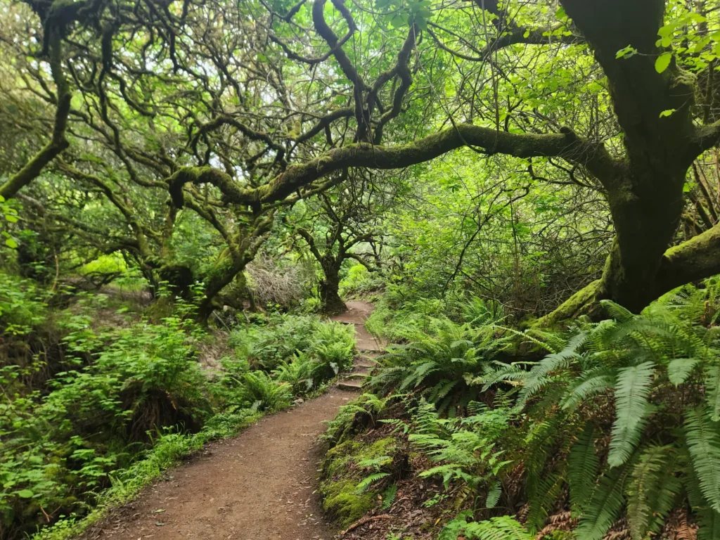
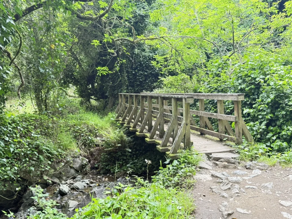
The Steep Ravine Trail Loop is a local favorite. It’s a 7.3-mile loop that kicks off at Stinson Beach and climbs about 1,600 feet into Mount Tamalpais State Park.
You follow Webb Creek through thick redwoods, cross wooden bridges, and even climb a quirky ladder. It’s got a bit of everything, honestly.
What really makes this hike stand out is the mix of ocean views and lush, shaded forest. The climb to Pantoll Ranger Station is steep—about 1,000 feet in 1.5 miles—but totally worth it.
Most folks start on the Dipsea from Stinson, link up with Steep Ravine, and then loop back via Matt Davis. The scenery keeps changing, so you never really get tired of it.
The climb’s tough in places, but the payoff is some of the best views Marin has to offer. Definitely bring water, especially if it’s warm out.
Good hiking shoes are a must. The stairs and bridges can get slick after rain, so watch your step.
Spring is amazing for wildflowers, and fall means fewer crowds. Summer fog can actually be a blessing—it keeps things cool when the rest of the Bay Area is baking.
Set aside 3-4 hours for the whole loop. Pantoll Ranger Station is a perfect spot to take a breather; there are bathrooms and water if you need them.
Parking at Stinson fills up fast on weekends. If you’re not an early riser, you might be circling for a while.
Matt Davis Trail
The Matt Davis Trail is a go-to route for locals and visitors alike. It’s got a great mix of scenery and killer views. You can jump on from Stinson Beach or the Pantoll Ranger Station up on Mount Tam.
Most people hike it as part of the classic Dipsea-Steep Ravine-Matt Davis loop—about 7 miles and 1,900 feet of elevation gain. With breaks, you’re looking at 4-5 hours.
Heading up from Stinson Beach, you’ll cross golden hillsides and get some epic panoramas. The trail flips between open meadows and shady forest, so you never get stuck in one type of scenery for too long.
Starting from Pantoll, you descend through cool, dark redwoods and end up on the sand at Stinson. Honestly, going downhill is a lot easier if you’re not looking for a challenge.
Rushing water is a theme, especially on Steep Ravine. Locals rave about that section—climbing 1,000 feet to Pantoll in a short burst is tough but memorable.
Pack plenty of water and layer up. The weather out here can turn on a dime. The trail’s in good shape, but you’ll want solid shoes for those steeper sections.
Tomales Point Trail
(Photo Courtesy of Alyshia Fleming)
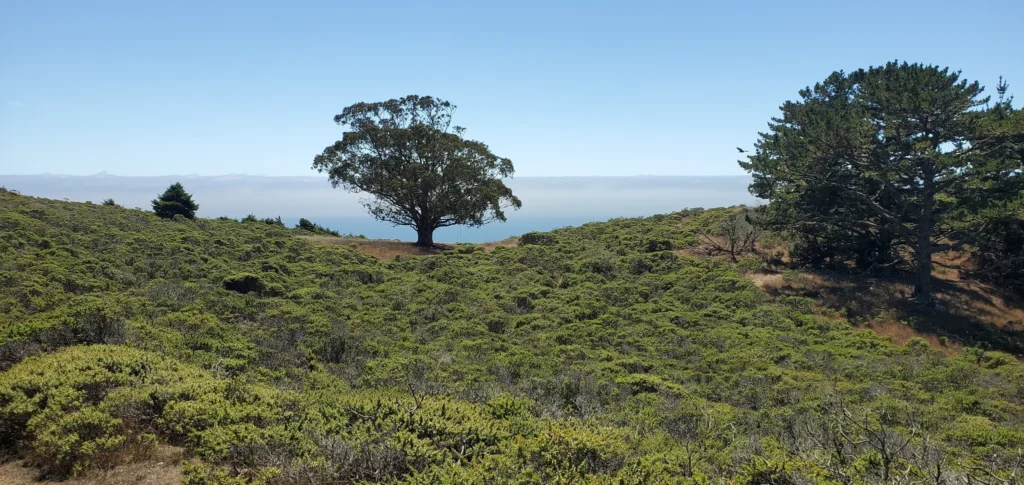
Tomales Point Trail might be the most scenic hike in Marin. It’s way up at the north end of Point Reyes National Seashore, and the views just go on forever.
Walking along the ridge, you’ll spot Tomales Bay, Bodega Bay, and the Pacific. There’s something about the wide-open landscape here that feels different from the rest of Marin.
Find the perfect hotel or vacation rental. Instant booking, no fees!
View Top Stays
The full hike is 9.4 miles round trip, but you don’t have to go the whole way. Lots of folks turn around at the pond and Monterey cypresses, which makes it a manageable 6-mile outing.
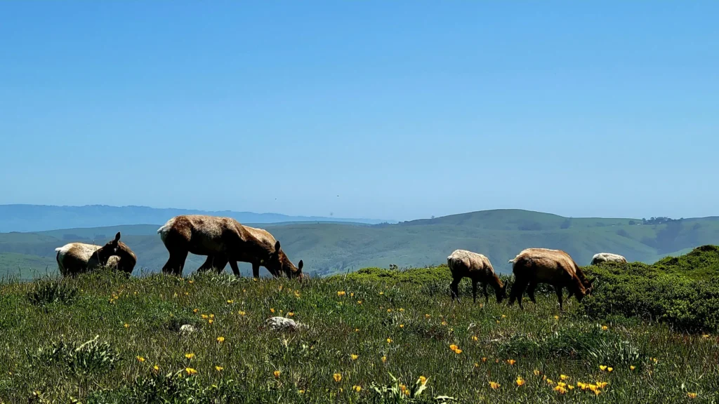
Wildlife’s a big draw—tule elk roam the area, and you’ll probably see a few. If you have binoculars, bring them along.
The trail’s mostly moderate—gentle ups and downs, though the sandy stretches near the end can slow you down a bit.
Getting to the trailhead means a scenic drive through Point Reyes. It’s a bit out of the way, but honestly, the journey is half the fun.
Spring brings wildflowers, fall brings clear skies, and summer mornings are often foggy (but in a magical, otherworldly way).
Bring water and snacks since you won’t find any services along the way. Layers are smart—coastal weather is unpredictable, even when it looks sunny at the start.
Point Reyes Lighthouse Path

The Point Reyes Lighthouse Path takes you right out to one of Marin’s most iconic spots. It’s a short 0.4-mile walk from the parking lot to the historic lighthouse perched on the edge of a cliff.
You start with a mellow stroll, then tackle the famous 308 steps down to the lighthouse. The climb back up is a real calf-burner, but those ocean views are worth every step.
The weather here is unpredictable. The headlands are famously windy and foggy, and sometimes the lighthouse closes if it gets too wild out there.
If you can, go on a clear fall or winter day. Between January and April, you might spot gray whales migrating—definitely a highlight if you catch it.
At the lighthouse, check out the visitor center and soak in a little maritime history. The place kept ships safe from 1870 to 1975, which is pretty cool to think about.
The trail’s paved and easy to follow, but the stairs can be tough for anyone with mobility issues.
Bring a jacket, even if it’s sunny when you park. The wind and chill sneak up fast out here.
Parking fills up early on weekends or holidays. If you want a spot without hassle, aim to get there before 10 AM.
If you’re into photography, this spot is a dream. The rugged coast and endless Pacific make for dramatic shots every time.
Tennessee Valley Trail
(Photo Courtesy of April Strong-Murrell)
Tennessee Valley Trail is a favorite for good reason. It’s close to Sausalito and an easy 3.6-mile out-and-back, taking most people just over an hour.
The trail is mostly flat, following the valley floor. It’s super accessible—families, casual walkers, and even folks with strollers can enjoy it. No fancy gear needed, just comfortable shoes.
The payoff is a lovely beach at the end, perfect for a picnic or just soaking in the ocean air. A lot of people bring snacks and hang out for a bit before heading back.
If you’re feeling ambitious, you can connect to other trails in the Marin Headlands. Heading north, it’s about 3.5 miles to Muir Beach, or you can go south toward Rodeo Beach.
Tennessee Valley is a gentle intro to Marin’s wild side—coastal views, birds, and wildflowers, but none of the tough climbs you’ll find elsewhere.
Weekday mornings are peaceful, but weekends get busy, especially in spring and summer. If you want parking, get there early.
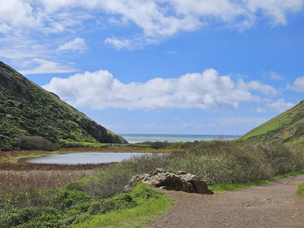
Palomarin to Alamere Falls

The Palomarin to Alamere Falls hike is a true adventure. It’s a long 13.7-mile out-and-back from the Palomarin Trailhead near Bolinas, and your reward is a rare tidefall—water pouring straight onto the beach.
This hike is tough and takes around 6 hours, so come prepared. Water, snacks, good shoes—don’t skimp, because the terrain changes a lot along the way.
The Coast Trail gives you sweeping Pacific views as you head north. You’ll pass lakes like Bass Lake and Pelican Lake, which are perfect for a break if you need one.
There’s plenty of wildlife—deer, rabbits, and all kinds of birds. Keep your eyes peeled; you never know what you’ll spot.
The last stretch to Alamere Falls is tricky. Some side trails lead down to the falls, but they can get steep and dicey, especially after rain when things get slick.
When you finally reach Alamere Falls, it’s pretty stunning—water pouring right onto the sand isn’t something you see every day. That alone makes the trek worth it.
Luxury stays to cozy cottages await, all with instant booking. Find the best deals!
Browse Marin Stays
Spring is the sweet spot for this hike—strong waterfalls, wildflowers, and fewer crowds if you go on a weekday.
Check the tide charts before you go. High tide can shrink the beach or make it hard to reach the falls at all.
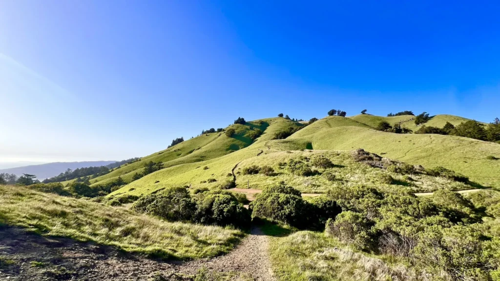
Southern Marin Fire Road
The Southern Marin Fire Road is a bit of a hidden gem for hikers looking for a flat, accessible trail. This path gives you a low-effort hike with surprisingly great rewards. It’s one of those trails you pick for days when you just want to be outside, not sweating up a mountain.
The trail follows an old pipeline route that curves with the hills instead of cutting straight through. So, you get a gentle walk—no brutal climbs, just a steady, easy pace.
You’ll catch beautiful views the whole way, and it’s a favorite with locals. The fire road is also a good spot for seeing local wildlife and native plants if that’s your thing.
If you’re new to hiking or have limited mobility, this trail makes a great intro to Marin’s outdoors. You get all the scenery without the tough parts you’d find on trails like Cataract Falls or Steep Ravine.
The Southern Marin Fire Road links up with other trails nearby, so you can extend your hike if you feel like it—or just keep it short and sweet.
Bring water and some sun protection, even though this one’s easier. Marin weather can flip fast, and some stretches don’t have much shade.
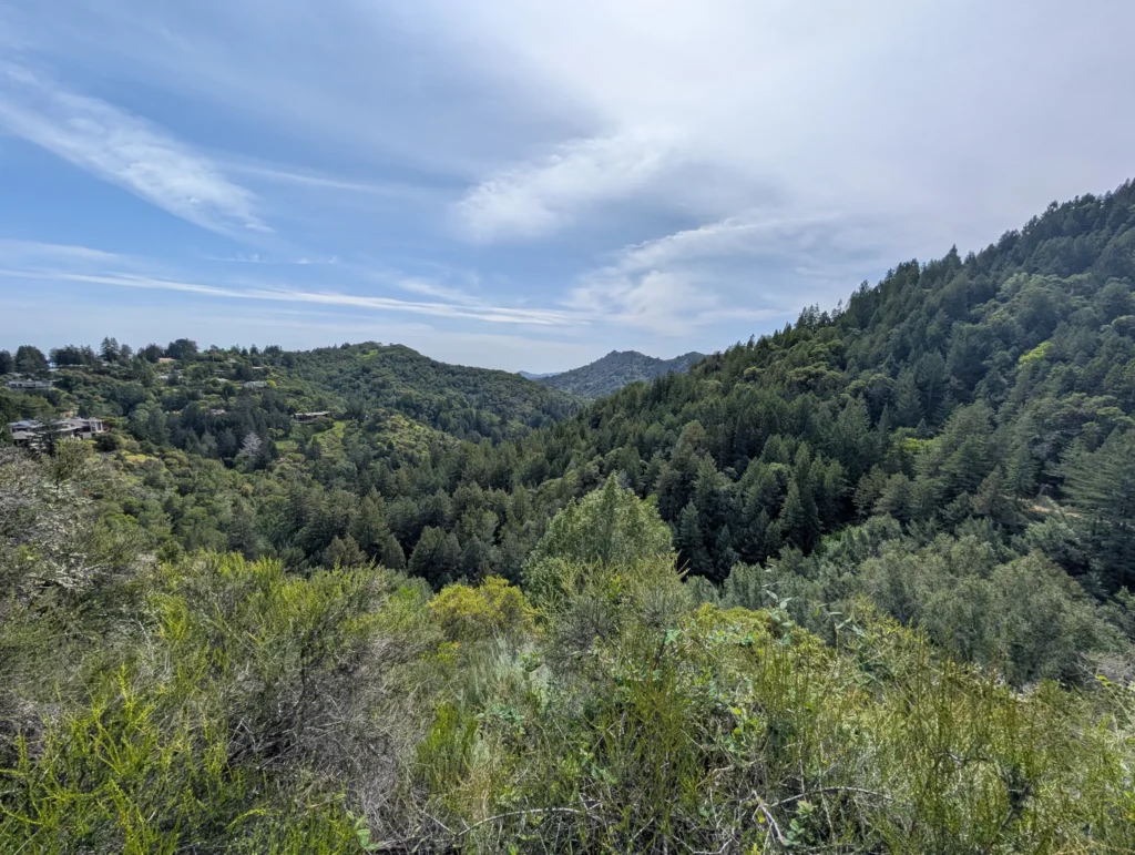
Cataract Trail Loop
The Cataract Trail Loop might be Marin County’s most spectacular waterfall hike. It’s tucked near Alpine Lake, right off Bolinas-Fairfax Road, and really shows off the best of Mount Tamalpais’ northern slope.
The whole loop is about 7 miles, packed with nine cascading waterfalls along Cataract Creek. If you go during or after rain, the falls put on an incredible show.
The hike kicks off with a steep climb through a narrow ravine full of redwoods and bay trees. You gain elevation fast, keeping things challenging right from the start.
You’ll pass through the Laurel Dell picnic area and connect with the High Marsh Trail for the full loop. The landscape changes a lot along the way, so you never get bored.
Plan for at least 2 hours, but honestly, you’ll want extra time to stop and just watch the waterfalls. The trail gets slick when it’s wet, so wear shoes with good grip.
This hike is at its best on misty or rainy days, when the falls are wild and the whole place feels almost enchanted. There’s nothing else quite like it in Marin.
Phoenix Lake Trail
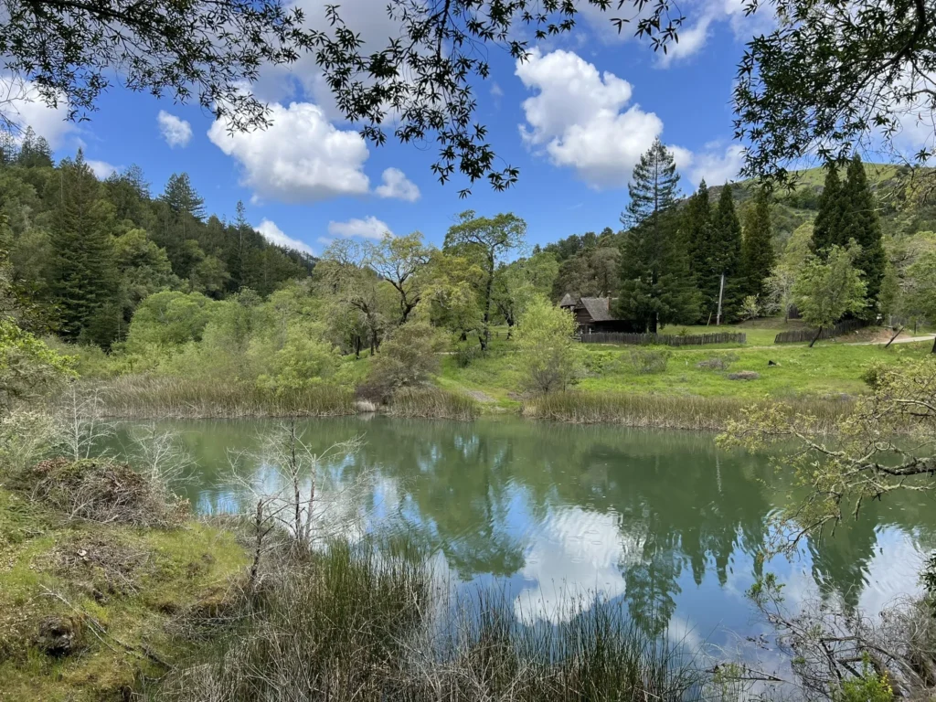
Phoenix Lake Trail is a favorite among Marin County hikers. The 4.8-mile loop near Ross treats you to gorgeous views and moderate terrain that’s doable for most people.
Start at the Phoenix Lake parking lot. The trail circles the lake and branches off to Fish Gulch Trail, Fish Grade, Eldridge Grade, and Yolanda Trail if you want to mix things up.
Most folks finish the loop in about two hours. There are gentle hills and plenty of shade, so it’s a good pick any time of year.
The trail’s well-kept and easy to follow. Expect to run into other hikers, families, and sometimes mountain bikers out there.
What I like about Phoenix Lake is how accessible it feels. You can walk in from nearby neighborhoods like Kentfield and Ross, so it’s super convenient if you’re local or just staying nearby.
If you want something easy, just circle the lake. For a bit more adventure, link up with steeper trails that head into the Mount Tamalpais network.
The scenery keeps things interesting—peaceful lake, woods, open grasslands. Watch for birds and little critters; wildlife sightings are pretty common here.
Planning Your Hike in Marin County
Being ready makes all the difference for a good hike in Marin. Weather, trail rules, and having the right tools can totally shape your experience.
Best Time of Year to Hike
Spring (March-May) is hands-down the best for hiking here. Wildflowers explode across the hills, and waterfalls are at their peak after the winter rain. Expect temps in the 60s to mid-70s.
In summer (June-August), fog rolls into coastal spots like the Marin Headlands, but inland trails like Phoenix Lake can get up to 85°F. Try to start early before the heat kicks in.

Fall (September-October) brings mellow weather and fewer crowds. It’s a great time for longer hikes—everything just feels more relaxed.
Winter (November-February) turns Marin bright green after the rains. Most trails stay open, but mud can be a pain. Waterproof boots are a must, and it’s smart to check trail conditions before you go.
Skip hiking right after big storms—trails can get damaged or even dangerous.
Trail Etiquette and Safety
Stick to marked trails to help protect Marin’s delicate ecosystems. Poison oak is everywhere, so remember: “leaves of three, let it be.”
When you see other hikers:
- Let uphill hikers go first
- Mountain bikers yield to everyone
- Say something if you’re coming up behind someone
- Leash your dog where it’s required

Don’t forget these basics for safety:
- At least 1 liter of water per person for every 2 hours
- Sun protection (even if it looks cloudy)
- First aid kit
- Cell phone (though service is spotty)
- Extra layer in case the weather shifts
Keep an eye out for wildlife. Mountain lions almost never bother people, but give them space if you spot one. Ticks are common, so wear long pants and check yourself after your hike.
Navigation and Trail Maps
Cell service drops out on a lot of Marin trails, especially out in Point Reyes or the western hills. Definitely grab offline maps before you head out—trust me, you’ll be glad you did.
Some mapping tools I keep coming back to:
- AllTrails app (the paid version lets you use maps offline)
- Marin County Parks website—solid PDF maps you can download
- National Park Service maps, especially for Muir Woods and Point Reyes

Trail markers? All over the place. Point Reyes posts numbers at intersections, but in the local open spaces, you’ll spot colored arrows or random painted symbols instead.
Parking’s a whole thing at busy trailheads like Tennessee Valley or Muir Woods. If you want a spot, roll in before 9am on weekends, or try a shuttle if that’s an option.
Planning a longer trek, say Tomales Point Trail? Keep an eye on sunset times—park gates close at sunset, and nobody wants their car trapped overnight.
Find available hotels and vacation homes instantly. No fees, best rates guaranteed!
Check Availability Now


Cities and Towns in Marin County

Things to Do in Marin County

Places to Stay in Marin County
