
Just across the Golden Gate Bridge from San Francisco sits one of California’s most rewarding outdoor escapes. The Marin Headlands has miles of hiking trails for every skill level, dramatic coastal views, and a handful of fascinating historic sites. This unique coastal area blends sweeping vistas of the Golden Gate Bridge, the San Francisco skyline, and the wild Pacific with easy-access trails—perfect for a quick adventure or a full-day wander.
When you visit the Marin Headlands, you’ll find a landscape shaped by wild geology and often cloaked in fog. The panoramas here are just ridiculous—sometimes you can see all of San Francisco Bay, and other times, the fog rolls in and transforms everything into something out of a dream.
Discover hand-picked hotels and vacation homes tailored for every traveler. Skip booking fees and secure your dream stay today with real-time availability!
Browse Accommodations Now

But there’s more than just scenery. The Headlands is packed with California history—think old military forts, lighthouses, and relics from another era. Bring layers (the wind can be fierce), wear shoes you don’t mind getting dusty, and definitely don’t forget your camera. Some of the Bay Area’s most iconic views are waiting here.
Getting to Marin Headlands
Getting to the Marin Headlands is pretty straightforward whether you’re coming from San Francisco or anywhere else in the Bay Area. Several routes lead to this gorgeous patch of coast, with its historic military sites and knockout views.
Directions from San Francisco
If you’re starting in San Francisco, the easiest way is over the Golden Gate Bridge. Cross heading north and take the first exit (Alexander Avenue) right after the bridge. It comes up fast, so stick to the right lane.

Follow Alexander Avenue as it winds down, then hang a left on Bunker Road. This takes you through the Baker-Barry Tunnel (locals call it the Five-Minute Tunnel). It’s one-way at a time, so pay attention to the traffic light.
Or, you can take the Spencer Avenue exit after the bridge and head to the Morning Sun Trailhead for hiking access to the Headlands.
Access via Golden Gate Bridge
The Golden Gate Bridge is the main gateway. If you’re heading south back to San Francisco, there’s a toll, but northbound into Marin County is free.
Be ready for fog, especially on summer mornings—it can get thick. The wind on the bridge can be wild, so take it slow.

Cyclists and walkers use the west side of the bridge to reach the Headlands. Once across, just follow the bike paths down to Conzelman Road for those coastal views, or take Bunker Road into the valley.
Parking and Transportation
You’ll find parking lots at a few key spots:
- Visitor Center lot – Small, right by the main info center
- Rodeo Beach parking area – Bigger, near the beach
- Battery Spencer – Tiny, with epic bridge views (fills up fast)
- Conzelman Road – Pullouts with panoramic views (watch for time limits)
Public transit? There’s the MUNI 76X bus from San Francisco on weekends, but it doesn’t run often and only stops at a few places.

Rideshare apps can drop you off, but cell service is spotty for pickups—so if you’re not driving, try to plan your way back ahead of time.
Overview of Marin Headlands
The Marin Headlands is a wild mix of natural beauty, fascinating geology, and layers of history—all just minutes from San Francisco. Its dramatic coastline, foggy hills, and killer views of the Golden Gate Bridge make it a standout among California’s outdoor escapes.
History and Formation
The Headlands’ story goes back millions of years. Tectonic plates shoved oceanic rock skyward to shape these cliffs. Before Europeans showed up, Coast Miwok people lived off the land here.

In the 20th century, the Headlands became a military zone. You’ll stumble across old gun batteries and bunkers from the world wars. Fort Barry and Fort Cronkhite are still standing as reminders.
In 1972, the land joined the Golden Gate National Recreation Area, so now everyone gets to enjoy it.
Geographic Features and Landscape
The rugged cliffs here just shoot up from the Pacific. The landscape flips between coastal prairie, rolling hills, and hidden beaches you might not expect so close to a city.

Some standout spots:
- Point Bonita Lighthouse: You get there by crossing a suspension bridge
- Rodeo Beach: Pebbly, with stones in wild colors
- Gerbode Valley: Rolling hills full of native plants
- Tennessee Valley: Sheltered cove with a quiet beach
The wildlife is surprisingly diverse. Coyotes, bobcats, and loads of birds call this place home. In spring, wildflowers go nuts—coastal sage and coyote brush are everywhere.
Freshwater lagoons here pull in migratory birds all year long.
Climate and Best Time to Visit
The Headlands has that classic Bay Area coastal weather—mild, but with plenty of fog thanks to the Pacific. Summer mornings are often socked in, but the fog usually burns off by afternoon.

Seasonal rundown:
- Summer (June-August): Foggy mornings, 60-70°F
- Fall (September-November): Warmest and clearest, less fog
- Winter (December-February): Rainy, 45-60°F
- Spring (March-May): Wildflowers, but weather’s all over the place
Honestly, September through November is probably the sweet spot—less fog, mild temps, and those classic bridge views. But no matter when you go, bring layers. The wind can make it feel way colder than you’d expect.
Top Attractions and Landmarks
The Marin Headlands packs in some of the Bay Area’s best scenery and quirky historic sites. From visitor centers to lighthouses to wildlife rescue spots, there’s a little something for everyone—whether you’re into nature, history, or just soaking up the views.
Marin Headlands Visitor Center
Set in old Fort Barry, the Marin Headlands Visitor Center is a great place to start. It’s inside a restored 1941 chapel, so you get a taste of the area’s military history right away.

Inside, rangers answer questions, and exhibits cover everything from geology to military life. You’ll find free maps and trail guides to plan your day. The little bookstore has field guides and Golden Gate souvenirs if you’re into that sort of thing.
They offer guided walks and talks—check the schedule when you arrive. Parking’s right outside, and the restrooms are clean (always a bonus before you hit the trails).
Point Bonita Lighthouse
Point Bonita Lighthouse is perched on a cliff, keeping ships safe since 1855. It’s only open Saturday to Monday, 12:30 to 3:30 PM, so plan ahead.

The half-mile walk out there is part of the fun—you’ll go through a hand-carved tunnel and cross a suspension bridge. The views? Unreal. You get the Golden Gate Bridge, the city, and open ocean all at once.
Volunteer docents share stories about shipwrecks and what it was like to keep the light burning. The trail gets windy and steep, so wear sturdy shoes and take a jacket, even if it feels warm in the parking lot.
Marine Mammal Center
This rescue and rehab center helps sick, injured, and orphaned marine mammals. It’s open daily, 10 AM to 4 PM, and you can take a self-guided or docent-led tour to see seals and sea lions recovering.

The viewing platforms let you watch the animals getting care before they’re released. Displays explain threats like plastic pollution and fishing nets—honestly, it’s eye-opening.
The center rescues hundreds of animals each year—mostly sea lions, elephant seals, and harbor seals. Admission is free (donations are always appreciated), and the gift shop is all about eco-friendly stuff that helps fund their work.
Natural Beauty and Scenic Vistas
The Marin Headlands really delivers when it comes to epic landscapes. Rugged hills, dramatic cliffs, and those sweeping views of the Pacific, the Bay, and the Golden Gate Bridge—yeah, it’s all here.
Scenic Drives and Viewpoints
Conzelman Road is your go-to scenic drive. It winds up from the north end of the Golden Gate Bridge, with pullouts for jaw-dropping views. Seriously, don’t rush it—stop often.

Hawk Hill is a favorite spot. At 923 feet, you get the city, the bridge, and the ocean all in one shot. In fall, it’s also a prime hawk-watching spot—birders love it.
Battery Spencer is another classic viewpoint. It’s an old fort with an eye-level look at the bridge’s north tower. Early mornings or weekdays are best if you want it (almost) to yourself.
Rugged Cliffs and California Coastline
The cliffs here are wild—dropping straight into the Pacific. Tectonic action along the San Andreas Fault shaped this whole place, giving it that rugged look.
Rodeo Beach sits right at the base of the cliffs, with its weirdly colorful pebbles. It’s popular but rarely packed, so you can usually find a quiet spot to watch the waves crash in.

The Coastal Trail hugs the Headlands’ western edge, leading to viewpoints you’d never see from the road. Keep your eyes peeled—seabirds, harbor seals, and even whales pass by if you’re lucky and patient.
Sunrise and Sunset Spots
Slacker Ridge is a classic spot for sunrise in the headlands. When the first light hits, the Golden Gate Bridge and San Francisco skyline warm up with a golden glow. Try to get there about a half hour before sunrise—you’ll catch the colors changing fast.
Find the perfect hotel or vacation rental. Instant booking, no fees!
View Top Stays

Kirby Cove is a favorite for sunset. This little beach gives you a unique view back toward the bridge, and those last rays are something else. You’ll hike about a mile downhill to get there, so plan for a bit of a walk.
Point Bonita Lighthouse and its surroundings are also prime for sunsets. The lighthouse itself keeps odd hours, but the area around it stays open. The sun dropping into the Pacific from there is hard to beat.
Outdoor Activities
The Marin Headlands is packed with ways to get outside. Whether you’re into coastal trails, wildlife, or just want a quiet spot to take it all in, there’s something here for everyone—no matter your energy level.
Hiking Trails for All Levels
The Coastal Trail is a go-to hike in the Headlands. You’ll get wide-open views of the Pacific, the city, and the bridge. Pick a section that works for you—some parts are mellow, others will get your heart pumping.

Tennessee Valley Trail is great for beginners. It’s a 3.4-mile round trip through a peaceful valley to a quiet beach. The path is mostly flat and easy to follow.
Want more challenge? Try the Rodeo Beach to Point Bonita Lighthouse loop. It’s about five miles, with some steep bits and big views. Bring water and good shoes—fog can make things slick.
Bobcat Trail is a nice moderate option. You’ll walk through different habitats, spot wildflowers in spring, and see plenty of birds year-round.
Read more about hiking in Marin County.
Cycling Routes
Cyclists love the Headlands for good reason. Conzelman Road’s main loop is a classic: big climbs, big views.
If you’re just starting out, stick to the flatter roads near Rodeo Beach and Fort Cronkhite. They’re paved and gentle, with lots of places to stop and take in the scenery.

More advanced riders can take on the full Headlands loop—about ten miles, steep climbs, and killer vistas. The downhill from Hawk Hill is a rush, but you’ll want to be careful with your brakes.
Mountain bikers can hit the Miwok and Old Springs trails, which link up with longer routes toward Mount Tam and Point Reyes. Tons of options if you want to go farther.
Read more about mountain biking in Marin County.
Wildlife Watching
The Headlands’ mix of habitats means lots of wildlife. Rodeo Lagoon is a birding hotspot—over 300 species have been spotted here. Bring binoculars for herons, egrets, and migrating ducks.
Sea lions often haul out on rocks near Point Bonita. Early morning or late afternoon is your best bet to see them. From December to May, keep an eye out for gray whales from the overlooks.

Hawk Hill is the place for raptor fans during fall migration, August through November. You might catch up to 19 types of hawks and eagles—sometimes there are organized counts you can join.
Deer and coyotes show up all over, especially around dawn and dusk. Just watch from a distance and don’t feed them. Spring brings wildflowers and butterflies, too—worth slowing down for.
Beaches of Marin Headlands
The Headlands coastline is rugged and beautiful, where California’s cliffs meet the Pacific. These beaches are dramatic and wild, a real taste of Northern California.
Rodeo Beach
Rodeo Beach is the main one in the Headlands, right by Fort Cronkhite. It’s famous for its dark sand and colorful pebbles—look for bits of jade, carnelian, or jasper after storms or high tide.
Surfers love the waves here (if they don’t mind the cold). Swimming isn’t great because of strong currents, but it’s perfect for beachcombing or just soaking up the view. Dogs can run off-leash, which makes it a hit with locals.

There’s parking close by, plus restrooms and picnic tables. Low tide exposes more sand, so check the tide charts if you want extra room to roam.
Other Nearby Beaches
Rodeo Beach gets the spotlight, but the Headlands hides a few smaller gems. Kirby Cove is more secluded, with epic bridge views. It’s a mile hike down, but you’ll probably have it to yourself.
Black Sands Beach is another option—steep trail down, but dark sand and quiet. Heads up, it’s clothing-optional.

Muir Beach is just north of the Headlands, not technically in it, but worth a side trip. It’s crescent-shaped, less windy than Rodeo, and a little more sheltered.
Stay alert for safety signs—rip currents and sneaker waves can sneak up on you out here.
Read more about Marin County’s Beaches.
Historic Sites and Military History
The Marin Headlands is dotted with historic military sites—reminders of the area’s role in coastal defense from the early 1900s through WWII. Old bunkers, batteries, and restored buildings give you a window into America’s military past.
Fort Cronkhite
Fort Cronkhite is one of the best-preserved WWII army posts around. Built in 1941, its simple barracks are still lined up in a U-shape facing the beach, barely changed since the war.
The visitor center, tucked in a restored barrack, has exhibits about daily life here—how soldiers lived, worked, and passed the time at this coastal outpost.

Some of the old buildings now serve as park offices or environmental centers. The fort sits at the end of Bunker Road, so it’s easy to find by car or shuttle.
Rodeo Lagoon, right next door, was a recreation spot for troops—now it’s a peaceful place for birders and history buffs alike.
Fort Barry
Fort Barry went up between 1901 and 1905 as part of San Francisco’s defenses. Perched above Rodeo Beach, it’s got impressive military structures and sweeping views.
The white chapel with its steeple stands out among the old army buildings. They still use it for special events, and it’s a quiet break from the rest of the fort.

The Nike Missile Site SF-88L is here too—the only fully restored Nike missile site in the country. Saturday tours sometimes feature former Nike veterans sharing stories from the Cold War days.
Check out the old parade ground and officers’ quarters for a glimpse of how things were organized back then.
Old Military Batteries
Huge concrete batteries line the Headlands, built from the late 1800s to early 1900s to guard the Bay. Battery Townsley, once home to 16-inch guns that could hit targets 25 miles out, opens for tours the first Sunday of each month.
You can wander Battery Wallace and Battery Smith-Guthrie on your own. Thick walls, underground rooms, and gun mounts show off some serious engineering.

Most batteries double as scenic overlooks now, with killer views of the ocean and bridge.
Trails connect the batteries, winding through the hills. Bring a flashlight if you want to poke around inside, and sturdy shoes for the rough concrete floors.
Museums, Arts, and Cultural Experiences
The Headlands isn’t just about nature—there’s a creative side, too. Artist communities and interactive exhibits pop up in unexpected places, blending art, history, and wild landscapes.
Headlands Center for the Arts
Headlands Center for the Arts fills several old military buildings at Fort Barry. This nonprofit arts center hosts about 50 artists a year through its residency programs.

Open house events—usually five or six times a year—let you wander studios, peek at works in progress, and chat with the artists. The main building’s ground floor hosts rotating exhibits.
Luxury stays to cozy cottages await, all with instant booking. Find the best deals!
Browse Marin Stays
The buildings themselves are worth a look. They’ve kept a lot of the original military feel, but now they’re buzzing with creative energy. Make sure to check the website for event dates—public hours are limited.
Visitor Exhibitions and Programs
The Marin Headlands Visitor Center, in the old Fort Barry Chapel, is a good place to start exploring. You’ll find exhibits on the area’s geology, native Miwok history, and military past.
Rangers run free programs year-round—wildlife, native plants, old defense systems, you name it.

The center also rotates in art shows that tie back to the landscape and history. Lots of hands-on stuff for kids, too.
Grab a map or get trail tips at the info desk. The center is usually open Friday to Sunday, 9:30 to 4:30, though hours can shift around holidays.
Where to Stay in and Near Marin Headlands
Staying near the Marin Headlands is easy—choices range from luxury lodges to budget hostels, all close to the trails and beaches.
Cavallo Point Lodge
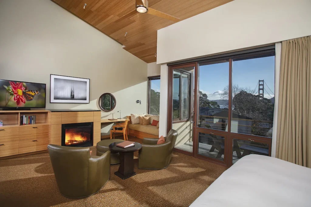
Cavallo Point Lodge is the top luxury spot nearby. Right at Fort Baker, it has jaw-dropping views of the bridge and bay.
You can pick from historic rooms in the old officers’ quarters or go for the modern wing with big windows and sleek design.
Murray Circle Restaurant serves up California cuisine with local ingredients, and the Healing Arts Center & Spa is a treat after a day outside.
Rates start around $450 a night—definitely a splurge. But you’re minutes from both the Headlands and Sausalito.
Read more about Cavallo Point Lodge here.
Bed and Breakfasts
There are plenty of cozy bed and breakfasts scattered around the Marin Headlands, especially in Sausalito and Mill Valley.
The Inn Above Tide in Sausalito has waterfront rooms with sweeping bay views. Most rooms have private decks and upgraded touches, plus you get a complimentary breakfast and evening wine.
Mountain Home Inn in Mill Valley feels tucked away in the woods, yet you’re right by the hiking trails. Their breakfast gets rave reviews for its local ingredients—honestly, it’s hard to beat the setting.
Casa Madrona Hotel & Spa blends historic details with modern perks on a hillside above Sausalito’s harbor.
Expect to pay between $200 and $400 a night at these B&Bs. They’ve got more personality and local flavor than your average chain hotel, and the innkeepers usually have tips you won’t find in any guidebook.
Click here to see more great lodging options in Marin County.
Nearby Destinations and Day Trips
The Marin Headlands makes a great jumping-off point for exploring nearby spots. You’ll find all sorts of places within a short drive—think quirky waterfront towns or ancient forests, depending on your mood.
Exploring Sausalito

Sausalito sits right across the Golden Gate Bridge from San Francisco. This charming waterfront town is famous for its colorful houseboats and Mediterranean vibe. It’s just a 10-minute drive from the Headlands.
Bridgeway, the main waterfront drag, is packed with shops, galleries, and restaurants. Grab pizza at Bar Bocce or fresh seafood at Scoma’s—both have outdoor seating with knockout bay views.
Princess Street is the place for shopping if you’re in the mood to browse. The Heath Ceramics factory store is a fun stop for locally-made pottery and home goods.
Rent a bike to get around, if you’re feeling active. Riding from San Francisco across the bridge to Sausalito takes about an hour, and you can always hop on the ferry with your bike for the trip back—pretty cool way to see the city from the water.
Click here to learn more about Sausalito.
Visiting Muir Woods
Muir Woods National Monument protects one of the last old-growth redwood forests in the Bay Area. It’s only 8 miles from the Headlands, and some of the trees are over 250 feet tall and more than 1,000 years old—kind of mind-blowing, honestly.

The main trail is a 2-mile loop with wooden boardwalks, so it’s accessible for just about everyone. Want a longer walk? You can branch off onto the Ben Johnson or Dipsea trails.
Heads up: You’ll need reservations for both parking ($9) and the shuttle ($3.50). During busy times, book at least a week in advance.
If you can, go early—before 10 AM is best. The light is gorgeous and you’ll beat the crowds. Plan on spending a couple hours wandering the groves and soaking up the peace and quiet.
Click here to learn more about Muir Woods National Monument.
Trip to Point Reyes National Seashore

Point Reyes is about 30 miles northwest of the Headlands—a wild, windswept peninsula with epic cliffs and quiet beaches. The hour-long drive takes you through some beautiful countryside, so don’t rush it.
Start at the Bear Valley Visitor Center for maps and updates. A few must-sees:
- Point Reyes Lighthouse: It’s 308 steps down, but the views are worth it.
- Chimney Rock: In spring, you’ll see wildflowers and elephant seals.
- Drake’s Beach: Wide sandy stretch with dramatic white cliffs.
- Tule Elk Reserve: Spot the protected elk herd, especially late summer into fall.
Weather here changes fast. Fog can roll in out of nowhere, so bring layers. If you want to really enjoy it, give yourself a full day—trying to cram it all in just feels rushed.
Click here to learn more about Point Reyes National Seashore.
Fort Baker and Alcatraz
Fort Baker sits right at the base of the Golden Gate Bridge, just five minutes from the Headlands. The old military buildings now house Cavallo Point Lodge, and the bridge views are pretty unbeatable.
The Bay Area Discovery Museum is here too, which is great if you’ve got kids. It’s all about hands-on exhibits and local nature—kids burn off energy, parents get a coffee break.

From Sausalito, you can catch a ferry to Alcatraz Island. The prison once held infamous figures like Al Capone. The audio tour, narrated by former guards and inmates, really brings the place to life.
Alcatraz tips:
- Book tickets early—weeks ahead in summer.
- Tours take about 2.5 hours.
- The ferry ride gives you some of the city’s best views.
- Wear comfy shoes and bring layers. It gets chilly.
If you’re up for it, the night tour is extra atmospheric, with special programs you won’t get during the day.
Click here to learn more about tours and excursions in Marin County.
Tips for Visiting Marin Headlands
The Marin Headlands packs in amazing views and outdoor fun, but you’ll have a better time if you plan ahead. The weather changes fast, park rules matter, and timing your visit makes a real difference.
Safety and Regulations
It gets windy and foggy out there, especially by the coast. Even on sunny days, bring a windbreaker or jacket. Don’t forget sunscreen and a hat—sun sneaks up on you here.
Stick to marked trails to protect both yourself and the fragile habitat. Some cliffs have no railings, and drop-offs are no joke. Give cliff edges a wide berth—at least 6 feet.

Most of the Golden Gate National Recreation Area requires pets on leashes. Some trails and beaches don’t allow dogs at all, so check the signs before you go.
Fire risk runs high in dry months. No smoking on trails, and only use barbecues where they’re allowed.
Cell service is spotty, so download maps ahead of time or grab a paper one at a visitor center.
Accessibility
The main visitor center is wheelchair accessible and has adapted restrooms. Some viewpoints, like Battery Spencer, offer accessible parking and paved paths.
Certain sections of the Coastal Trail between Rodeo Beach and Point Bonita are accessible, but conditions can change—ask a ranger if you’re unsure.
Public transit is an option: Golden Gate Transit runs buses from San Francisco, with better service on weekends.

Parking fills up fast on weekends and holidays. If you want to avoid circling, aim to arrive before 10 AM or after 3 PM, especially at busy spots like Battery Spencer.
Plenty of roads here have bike lanes, so cycling is a solid way to get around if you’re up for it.
Planning Your Trip
Weekdays are usually quieter, so you’ll dodge the crowds. If you have to go on a weekend, aim to get there before 9 AM—parking fills up fast and the trails are way more peaceful early on.
Fog tends to roll in during summer mornings but usually burns off by afternoon. Spring? You’ll catch wildflowers everywhere. Fall’s probably your best bet for clear skies if you’re into photography.
Definitely bring water and snacks; there aren’t many places to grab food inside the Headlands itself. The nearest restaurants are in Sausalito, and that’s a 10-minute drive.

Why not squeeze in a few spots while you’re out there? Point Bonita Lighthouse, Rodeo Beach, and the Marine Mammal Center all fit nicely into a half-day adventure—maybe four or five hours if you’re not rushing.
Battery Spencer has that iconic Golden Gate Bridge view, but wow, it gets packed. If you’d rather skip the crowds, Hawk Hill or the Coastal Trail give you similar scenery with a lot more breathing room.
Find available hotels and vacation homes instantly. No fees, best rates guaranteed!
Check Availability Now

Angel Island State Park Travel Guide – Accessibility, Amenities, Activities, and More!

Aramburu Island Travel Guide – Accessibility, Amenities, Activities, and More!

Blackie’s Pasture Travel Guide – Accessibility, Amenities, Activities, and More!

Fort Cronkhite Travel Guide – Accessibility, Amenities, Activities, and More!

Gerbode Valley Travel Guide – Accessibility, Amenities, Activities, and More!

Golden Gate National Recreation Area Travel Guide – Accessibility, Amenities, Activities, and More!

Hawk Hill Travel Guide – Accessibility, Amenities, Activities, and More!

Marin Headlands Travel Guide – Accessibility, Amenities, Activities, and More!

Old Saint Hilary’s Preserve Travel Guide – Accessibility, Amenities, Activities, and More!

Paradise Beach Park Travel Guide – Accessibility, Amenities, Activities, and More!

Point Bonita Travel Guide – Accessibility, Amenities, Activities, and More!

Tiburon Ridge Preserve Travel Guide – Accessibility, Amenities, Activities, and More!

Tiburon Uplands Travel Guide – Accessibility, Amenities, Activities, and More!


Cities and Towns in Marin County

Things to Do in Marin County

Places to Stay in Marin County
