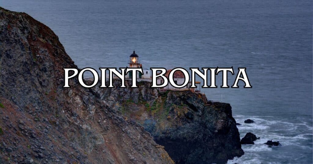
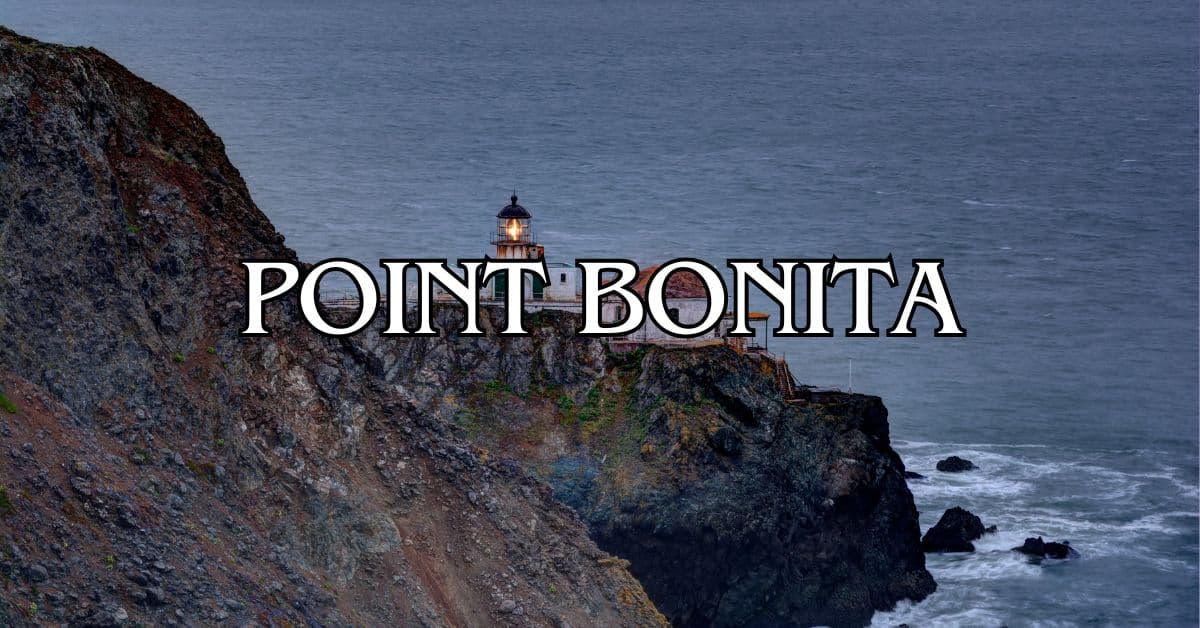
Perched on the rugged edge of Marin County, Point Bonita Lighthouse is a bit of a hidden treasure—just a quick drive from San Francisco, but it feels a world away. Built back in 1855, it was only the third lighthouse on the West Coast, and for generations, it’s helped ships navigate the Golden Gate’s tricky waters. Getting there is half the fun (and challenge)—the half-mile trail is steep in spots, parking’s tight, but the coastal views? Unbelievable.
Honestly, reaching the lighthouse is part of the adventure. The trail, often called “the path to world’s end” by locals, lives up to its name once you hit those dramatic cliffs. Even now, the lighthouse still works, blending its original job with a peek into California’s seafaring past.
Discover hand-picked hotels and vacation homes tailored for every traveler. Skip booking fees and secure your dream stay today with real-time availability!
Browse Accommodations Now
If you’re planning a visit, treat it like a little expedition, not just a stroll. Between the wild surf, the sweeping views of Marin Headlands, and the San Francisco skyline, the effort pays off. And here’s a tip: even on weekends, it’s usually much quieter than most Bay Area hotspots. You might even get a little solitude.
Overview of Point Bonita
Point Bonita marks the northern mouth of San Francisco Bay, a place where wild coastal scenery and maritime history meet. This rugged slice of the Marin Headlands packs a punch—natural beauty and historical intrigue all in one spot.
History of Point Bonita
When Point Bonita Lighthouse went up in 1855, it was the third of its kind on the West Coast. Back then, ships badly needed a beacon to get them through the treacherous Golden Gate. The original structure sat 300 feet above the sea, but fog kept hiding its light.
So, in 1877, they moved it lower so ships could actually see it. The keepers lived out there, pretty much on their own, keeping the light burning no matter what.
Today, the National Park Service manages the lighthouse as part of the Golden Gate National Recreation Area. It’s a living piece of California’s maritime story and still guides ships, just like it always has.
Significance in the Marin Headlands
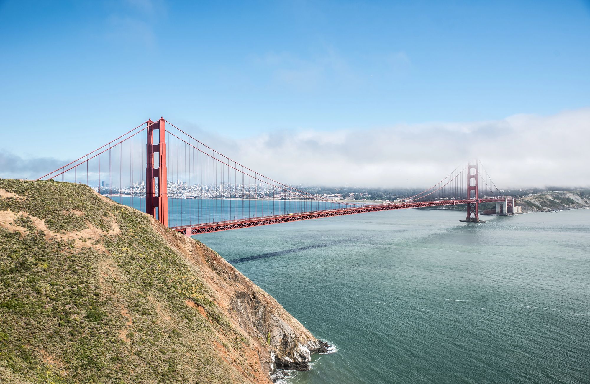
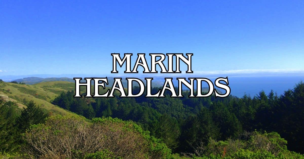
Point Bonita is a real landmark in the Marin Headlands, drawing folks who love both wild places and old stories. You get some of the best views of the Golden Gate Bridge, the city, and the Pacific from here.
People sometimes call it the Bay Area’s “secret jewel” because it doesn’t get mobbed like other attractions. If you’re after a peaceful experience, this is the place.
The Marin Headlands around Point Bonita have a military past, too. Old fortifications still dot the hills, reminders of when the Golden Gate needed defending.
Unique Geological Features
The cliffs at Point Bonita tell a story millions of years old. These rocks used to be ocean floor until tectonic forces shoved them up.
Powerful waves constantly gnaw at the coastline, carving out those dramatic cliffs and rocky points. It’s a landscape that feels alive and always changing.
Wildlife seems to love it here, too. You might catch sight of harbor seals, sea lions, or seabirds along the cliffs. During migration, there’s even a shot at spotting whales offshore.
The hike to the lighthouse is no joke—steep in places, and there’s a suspension bridge at the end that adds a bit of thrill.
Getting to Point Bonita
You’ll find Point Bonita at Marin County’s southwestern tip, and getting there takes a little planning. There are a few different routes, depending on where you’re coming from and how you want to travel.
Directions from San Francisco
If you’re starting in San Francisco, hop on Highway 101 north, cross the Golden Gate Bridge (no toll heading north), and keep going. Take the second Sausalito exit before the tunnel.
Follow signs for the Marin Headlands and Conzelman Road—this road climbs and winds, showing off killer views of the bridge and city.
When you hit Field Road, turn left, then follow it to Bunker Road. Hang a right on Bunker, and look for the Point Bonita Lighthouse signs. Parking is tiny, so try to get there early, especially on busy days.
Access via Sausalito
Want to swing through Sausalito? Exit 101 at Sausalito, check out the waterfront shops or grab a bite.
To get to Point Bonita from there:
- Go west on Bridgeway
- Right on Alexander Avenue
- Follow Marin Headlands signs
- Left on Bunker Road
- Straight to Field Road
- Then just follow the signs
Bunker Road runs through the one-way Baker-Barry Tunnel. The tunnel alternates traffic every 5-10 minutes, so you might have to wait a bit.
Public Transportation Options
Public transit isn’t great, but you do have options. The MUNI 76X-Marin Headlands Express runs weekends and holidays from San Francisco to the Headlands.
It won’t drop you at the lighthouse, but you can get off at the Marin Headlands Visitor Center. From there, it’s a two-mile walk to Point Bonita.
Another idea: ferry from San Francisco to Sausalito, then grab a rideshare or bike the five miles to Point Bonita.
Transit schedules change, so double-check before you go. And don’t forget—the lighthouse trail only opens Sundays and Mondays starting April 13, 2025.
Point Bonita Lighthouse Experience
Point Bonita Lighthouse sits perched on the Marin Headlands, a beacon since 1855. It’s still guiding ships through the Golden Gate, just like it always has.
Visiting Hours and Entry Requirements
You can visit the lighthouse Saturday through Monday, 12:30 to 3:30 PM. The hours are short because the trail needs supervision for safety. If the weather turns nasty, they’ll close it for everyone’s protection.
To get there, you’ll hike a half-mile trail that gets steep and narrow in spots. Good shoes and some stamina help. You’ll walk through a hand-carved tunnel and finish by crossing a suspension bridge.
Parking at the trailhead is limited, so showing up early is smart, especially on weekends or holidays. There’s no entrance fee, so it’s a budget-friendly outing.
Kids need to stick with adults, and the trail just isn’t doable with strollers or wheelchairs—too rough.
Guided Tours and Interpretive Programs
Park rangers run tours during open hours. They’re full of stories about the lighthouse’s construction, the keepers who braved isolation, and how lighthouse tech has changed over the years.
You’ll learn about:
- The lighthouse’s unusual design
- The lives of keepers out on the edge
- How technology evolved over 165+ years
- The local marine wildlife you might spot
No need to reserve for ranger talks, but crowds can mean smaller groups. Schools can book special programs if they plan ahead through the visitor center.
The Marin Headlands Visitor Center nearby is worth a stop for more background on the area’s nature and history.
Hiking and Trails Near Point Bonita
Point Bonita is surrounded by great hiking—from easy strolls to challenging climbs, all with knockout views and a bit of history.
Point Bonita Trail
The main lighthouse trail is a must for anyone visiting Marin County. It’s just half a mile, takes about an hour round-trip, and drops about 75 feet in elevation. The route leads straight to the lighthouse, with epic views of the Pacific and Golden Gate Bridge.
Parts of the trail are pretty steep (up to 27% grade), and the coastline below is wild and beautiful.
The lighthouse is only open Sundays and Mondays, 12:30-3:30 pm, so plan ahead. The last bit of the trail is a suspension bridge—kind of nerve-wracking, but memorable.
Coastal Trail Adventures
The Coastal Trail offers sweeping ocean views and links up with other cool spots near Point Bonita. You’ll walk cliff edges, snap photos of the bridge and city, and just soak up the meeting of land and sea.
Start at Rodeo Beach for a moderate hike with plenty of scenic stops. In spring, wildflowers—lupine, poppies, mustard—light up the hillsides.
Find the perfect hotel or vacation rental. Instant booking, no fees!
View Top Stays
The trail surface changes from dirt to rocky patches, so sturdy shoes are a must. It’s open to the elements: wind, sun—bring layers and sunscreen.
Exploring Batteries to Bluffs Trail
The Batteries to Bluffs Trail mixes old military sites with stunning coastline. You’ll pass Fort Barry and other concrete batteries, relics from the days when San Francisco Bay was a fortress.
Expect moderate climbs and a few steep bits. The payoff? Jaw-dropping views of cliffs, waves, and the bridge from unusual angles.
Wildlife is part of the show—hawks overhead, maybe seals in the surf. Late afternoon brings especially gorgeous light.
Connecting Trails and Scenic Routes
A network of trails lets you mix and match hikes based on mood or fitness. The Miwok Trail links up with the Coastal Trail, so you can create your own loops.
A favorite is the 4.5-mile round trip from Rodeo Beach, around Rodeo Lagoon, out to the lighthouse. You’ll see dunes, water, and endless coast in one hike.
Birdwatchers love the area around Rodeo Lagoon—shorebirds and waterfowl hang out here. Bring binoculars if you’re into that.
Trails are usually well-kept but can get muddy after rain. Winds can be fierce, so don’t trust a sunny forecast—bring layers. You can grab trail maps at the Marin Headlands Visitor Center.
Spectacular Views and Wildlife
Point Bonita delivers some of the Bay Area’s most jaw-dropping coastal scenery. There’s just something about those cliffs and wild surf—and if you keep your eyes open, wildlife is everywhere.
Best Viewpoints and Photography Spots
The lighthouse trail itself is packed with great viewpoints. Near the lighthouse, you’ll find a main overlook with a 270-degree sweep of the Pacific, San Francisco, and the Golden Gate Bridge. If you time it right, sunset is pure magic.
Photographers love the suspension bridge—lots of drama in those shots. A wide-angle lens helps capture all that coastline.
Early mornings tend to be clearer and less crowded. If there’s a winter storm, the waves put on a show, but stick to the safe side of the barriers.
For a quieter spot, check out the Battery Mendell area—less traffic, equally impressive vistas.
Observing Seals and Otters
The waters around Point Bonita are teeming with marine life. Harbor seals often sprawl out on offshore rocks, especially during their spring pupping season (April-May). If you want a closer look without bothering the animals, binoculars are your best friend.
Every now and then, sea otters show up in the kelp beds below the cliffs. They’re a treat to watch—sometimes they wrap themselves in kelp or just float around on their backs. If you’re hoping to spot wildlife, early mornings are usually your best bet.
Dolphins and porpoises pass through these waters, too, mainly during migration. Scan the horizon for their fins and the occasional splash.
Just a quick reminder: always keep your distance from wildlife. No feeding, no approaching—let them do their thing.
Seasonal Wildflower Blooms
Spring turns Point Bonita’s coastal slopes into a riot of color. From March through May, California poppies, lupines, and seaside daisies pop up all along the hillsides.
The maritime climate here creates some oddball growing conditions—plants like douglas iris and coastal buckwheat thrive in the grasses, and you might not find them anywhere else nearby.
When summer rolls around, you’ll see different blooms—coastal sage and tough succulents take over. Even on foggy days, the plants add a surprising amount of texture and interest to a hike.
There’s a native plant garden near the trailhead, complete with labels and info about the local flora. It’s a great spot for photos, especially with flowers framing those far-off Golden Gate views.
Exploring the Marin Headlands
The Marin Headlands isn’t just about jaw-dropping views of the Golden Gate Bridge. This rugged area is full of military history and old installations that are honestly pretty fascinating.
Fort Barry and Military History
Fort Barry sits right at the heart of the Headlands. Built in the early 1900s, it was designed to defend San Francisco Bay. The historic buildings are still in good shape and give you a sense of what life was like for the soldiers stationed here.
You’ll spot the Fort Barry Chapel—a simple white church that stands out against all the military structures. Original barracks and officer quarters still line the road, though these days they’re used for things like park offices and even a hostel.
Walking around, you can almost picture the drills that once took place on the parade grounds. Info panels scattered around help you piece together the fort’s story.
Bunkers, Batteries, and the Nike Missile Site
The Headlands are dotted with old concrete bunkers and gun batteries from the 1870s through the 1950s. Battery Townsley is a standout—it once held massive 16-inch guns that could fire shells way out into the Pacific. You can actually walk inside during ranger-led tours, which is wild.
Don’t skip the Nike Missile Site SF-88 on Bunker Road. This Cold War relic is the only fully restored site of its kind open to the public in the U.S.
Tours take you right up to actual Nike missiles and into the control room where soldiers used to stand by, just in case. Volunteers (often veterans) lead the way and share stories.
Bunkers here make for some unique photos—crumbling concrete set against dramatic coastlines. Even if military history isn’t your thing, the views from some batteries are worth the detour.
Nearby Attractions and Scenic Spots
Point Bonita’s location gives you quick access to a bunch of highlights in the Marin Headlands. There’s a little something for everyone—beaches, wildlife, history, and some of the best Golden Gate Bridge views you’ll find.
Rodeo Beach and Lagoon
Rodeo Beach is just down the road from the lighthouse and offers a different kind of coastline. The pebbly sand is famous for colorful stones—jasper, carnelian, agate—you might find a few if you look closely.
Next door, Rodeo Lagoon forms a freshwater haven that draws in all sorts of birds and the occasional seal. Bring binoculars if you want to spot herons or egrets.
There’s plenty of parking, restrooms, and picnic tables. Surfers love it here, but the water’s cold and the currents can be rough—swimming isn’t recommended.
Families like the flat beach for kite flying and beachcombing. Dogs are allowed off-leash in certain spots.
Hawk Hill and Conzelman Road
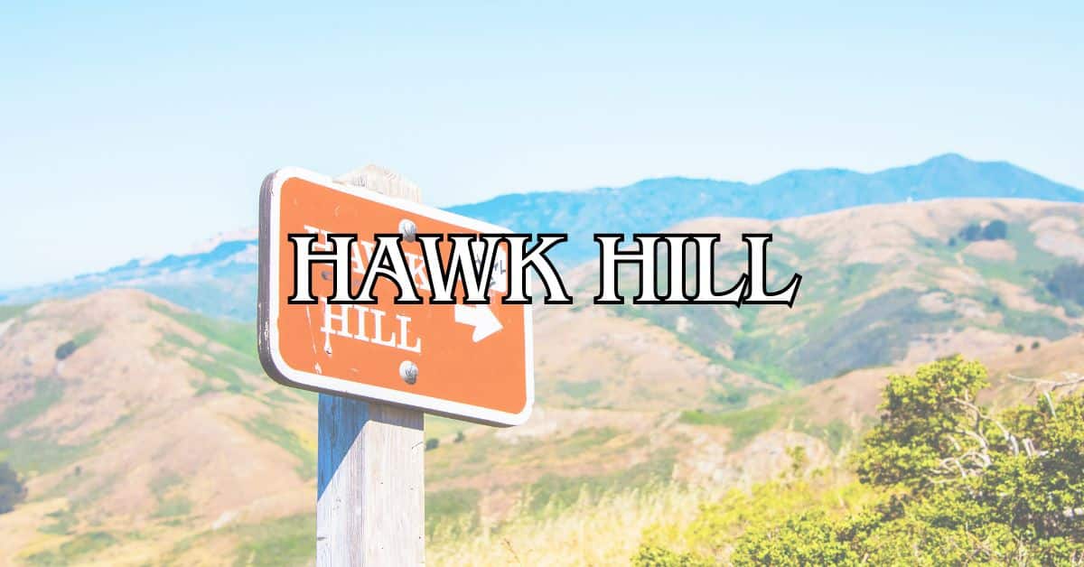
Hawk Hill rises 923 feet, serving up epic views of San Francisco, the Pacific, and the whole Bay Area. In fall (September-November), it’s a hotspot for bird-watchers during migration.
Conzelman Road snakes along the cliffs up to Hawk Hill, with several places to pull over for photos. The official viewpoints let you safely soak in the scenery.
If you want the clearest views, try for early morning or late afternoon—fog can roll in at any time. And trust me, it gets windy up there, so bring a jacket.
Here’s a quick tip: afternoon light is perfect for snapping shots of the Golden Gate Bridge with the city behind it.
Fort Baker and Golden Gate Overlook
Fort Baker, once a military post, now hosts the Cavallo Point Lodge and Bay Area Discovery Museum. The historic buildings and parade ground offer a glimpse into the area’s past.
Nearby, the Golden Gate Overlook gives you one of the most striking bridge views around. You’ll see the bridge from below, with San Francisco’s skyline behind it.
Vista Point, at the north end of the bridge, has easy parking and viewing platforms. At sunset, the bridge seems to glow—definitely worth seeing if you time it right.
Luxury stays to cozy cottages await, all with instant booking. Find the best deals!
Browse Marin Stays
A gentle path connects Fort Baker to the overlook, and most people can handle the 20-minute walk each way.
Practical Information for Visitors
A trip to Point Bonita Lighthouse takes a bit of planning. The area’s rugged beauty is part of the draw, but it does mean there are a few things to keep in mind.
Parking and Accessibility
The lighthouse itself is only open Sundays and Mondays, from 12:30 PM to 3:30 PM. Make sure you plan around those hours if you want to go inside.
Parking is tight near Point Bonita. The main lot fills up quickly, especially on weekends. Arrive early if you can. If it’s full, the North Tower lot is a backup, but you’ll have a longer walk.
You’ll find the nearest visitor center at the Marin Headlands, where you can grab maps and info before heading out.
The walk to the lighthouse is half a mile each way, with about 170 feet of elevation gain. Be ready for steep stretches and a tunnel.
Unfortunately, wheelchair access is pretty limited due to the rough terrain and narrow suspension bridge.
Safety Tips for Rugged Terrain
Bring your own water—there’s none available on the trail or at the lighthouse.
Wear sturdy shoes with good grip. The path can get slippery after rain, and some sections are uneven or steep.
Dress in layers. Weather here is unpredictable—wind, fog, and sudden temperature drops happen all the time. Even when it’s sunny inland, it might be chilly by the coast.
Stick to the marked trails. The cliffs are unstable, and wandering off can be dangerous for both you and the local plants.
Binoculars are handy for spotting wildlife like harbor seals from a safe distance.
If you’re bringing kids, keep them close, especially on the suspension bridge and near steep drop-offs.
Recommended Day Trips from Point Bonita
Point Bonita is a great jumping-off point for exploring Marin County and San Francisco. There’s no shortage of places nearby with amazing views, natural beauty, and a bit of local culture—easy to fit into a single day.
Crissy Field and Baker Beach
Crissy Field, just across the Golden Gate Bridge, mixes history with scenic walking paths. The waterfront promenade is perfect for a morning stroll, with sailboats and windsurfers gliding by.
The Warming Hut café is a cozy place to grab coffee or a snack while you watch the bay.
Baker Beach is west of Crissy Field—a mile of sand with dramatic bridge views. It’s a favorite for picnics and sunset photos, when the bridge lights up in orange.
Heads up: the northern part of Baker Beach is clothing-optional. The southern end is more family-friendly and has picnic tables and grills.
Lands End and Marshall’s Beach
Lands End boasts some of San Francisco’s most dramatic coastline, just a short drive from Point Bonita. The Coastal Trail weaves through cypress trees and offers cliffside views of the bridge and Headlands.
The Sutro Baths ruins are a must-see—what’s left of a once-grand indoor swimming complex, now a haunting spot above the waves.
Marshall’s Beach sits below the Lands End trails and is a secluded spot worth the hike down the stairs. You’ll get unique bridge views and interesting rock formations.
It’s usually less crowded than other beaches nearby. Bring your own water and snacks—there aren’t any facilities on the beach.
Muir Woods and Twin Peaks
Muir Woods National Monument, just 11 miles north of Point Bonita, is home to towering coastal redwoods. The easy trails wind through a peaceful, almost cathedral-like forest.
You’ll need a reservation to visit. Arrive early to beat the crowds and really soak up the calm. The main trail loop takes about an hour, give or take.
Twin Peaks, back in San Francisco, delivers the city’s most sweeping views. These 922-foot hills sit near the center of town, offering a 360-degree look at the Bay Area.
The summit’s viewing platform gives you a clear shot of the bridge, downtown, and the East Bay. Sunset is a popular time, but it gets windy—bring an extra layer.
San Francisco Bay Area Connections
Point Bonita is a handy gateway to all sorts of Bay Area adventures. You can easily pair your lighthouse visit with classic San Francisco outings for a full Northern California experience.
Bay Cruises and Water Activities
The San Francisco Bay is best seen from the water, honestly. Bay cruises leave from Pier 39 and the Ferry Building, showing off Point Bonita, the Golden Gate Bridge, and Alcatraz from new angles.
Many tours highlight the lighthouse as they pass through the Golden Gate. Cruises usually last one or two hours and are great for photos.
If you’re feeling active, try a kayaking tour—paddle near harbor seals and sea lions. Sausalito has several outfitters with rentals and beginner-friendly guides.
Fishing charters are an option, too, if you’re hoping to catch salmon, halibut, or striped bass in the waters near Point Bonita.
Essential San Francisco Attractions
The Golden Gate Bridge is just minutes from Point Bonita. Walking or biking across this famous landmark gives you unbeatable views of the lighthouse and Headlands.
Golden Gate Park is a peaceful alternative to the coast, with gardens, museums, and meandering paths. The de Young Museum and California Academy of Sciences are perfect for foggy days.
Alcatraz tours pair nicely with a Point Bonita visit—both share a maritime history. Book early, though; spots fill up fast.
The Presidio, once a military base, now mixes history with hiking trails and cultural sites. It connects with Point Bonita’s defense story and is well worth a visit if you have the time.
Dining and Shopping in Sausalito
Sausalito, just a short hop—maybe 15 minutes—from Point Bonita, has some seriously good waterfront dining with killer bay views. Fish Restaurant is a go-to for sustainable seafood, while Scoma’s has those classic, old-school dishes and panoramic windows that make you want to linger.
The Barrel House Tavern sits right in a historic ferry building, with tables outside facing the San Francisco skyline. Grab some local oysters, maybe a glass of California wine, and it’s hard not to feel like you’re living the good life after a lighthouse hike.
Downtown Sausalito’s main drag, Bridgeway, is full of art galleries, quirky boutiques, and specialty shops. You’ll find handmade ceramics, maritime art, and local food products that actually make decent souvenirs—way better than a generic T-shirt.
If you’re in the mood for something upscale, Le Garage and Poggio both serve French-inspired dishes and source ingredients from Marin County farms. Honestly, it’s hard to go wrong with either, especially if you want to treat yourself after a day outdoors.
Classic Experiences: Fisherman’s Wharf to Lombard Street
Fisherman’s Wharf is totally touristy, but sometimes you just want that kind of fun. Pier 39’s sea lions do their thing, Boudin Bakery dishes out those famous sourdough bread bowls, and Musée Mécanique is packed with vintage arcade games. It’s a solid spot for families or anyone who likes a little nostalgia.
Ghirardelli Square is basically chocolate heaven—great for a pit stop after hiking. The old chocolate factory’s now a cluster of shops and restaurants, but it still feels historic in the best way.
Lombard Street, with its famously crooked block, is just a quick drive from the wharf. Eight tight hairpin turns and a zillion photo ops—might as well snap a pic, right?
Coit Tower and Telegraph Hill offer sweeping views, and on a clear day, you can spot Point Bonita across the bay. Inside, you’ll find murals from the 1930s that show off slices of California life from way back when.
Tips for the Ideal Visit
A trip to Point Bonita Lighthouse takes a little planning—weather, timing, and what you pack all make a difference.
Best Times to Visit and Weather
The lighthouse only opens Sundays and Mondays from 12:30 to 3:30 PM, so you’ll want to plan ahead. With such a short window, timing’s everything.
Fog can roll in and block those epic views, especially in summer. I’d definitely check the forecast before you go. Spring (April-May) usually brings clear skies and wildflowers along the trail. Fall (September-October) is more mellow—good weather, fewer crowds.
Mondays are usually quieter than Sundays. Try to get there at least half an hour before closing so you have time for the half-mile trail and the suspension bridge.
Sunset and Photography Recommendations
The lighthouse sits facing west, so sunsets here can be unreal. Even though the lighthouse itself closes at 3:30, the trails stay open until sunset.
Best Photography Spots:
- Suspension bridge (great for shots of the lighthouse with the ocean behind)
- Trail overlooks (big, sweeping coastline views)
- Point Bonita Cove (watch for harbor seals down below)
A zoom lens is handy for snapping wildlife, especially seals. Wide-angle lenses make the most of those dramatic coastal scenes. Bring a tripod if you’re into sunset shots, but keep an eye out for the narrow spots on the trail. The golden hour before sunset lights everything up—honestly, even a phone camera gets you amazing photos.
Planning for Camping and Longer Stays
Point Bonita itself doesn’t offer camping, but nearby options make it pretty easy to stick around and really soak in the area.
Nearby Camping Options:
- Kirby Cove Campground (1.8 miles away, reservation required)
- Bicentennial Campground (2.5 miles away, first-come basis)
- Hawk Camp (3.7 miles, accessible via hiking trails)
Kirby Cove and Bicentennial both have those classic Golden Gate Bridge views, plus you get easy access to some tucked-away beaches. If you’re aiming for Kirby Cove, definitely try to snag a reservation early—summer weekends fill up fast.
No matter when you go, pack plenty of layers. The weather out there has a mind of its own, and it can get chilly in a hurry. Forgot something? The closest place for supplies is Sausalito, and that’s about a 15-minute drive, so it’s best to come prepared.
You can hike from these campgrounds right over to Point Bonita. There are all sorts of trails that wind through the Marin Headlands, perfect if you want to wander a bit or just see where the path takes you.
Find available hotels and vacation homes instantly. No fees, best rates guaranteed!
Check Availability Now
Angel Island State Park Travel Guide – Accessibility, Amenities, Activities, and More!
Aramburu Island Travel Guide – Accessibility, Amenities, Activities, and More!
Blackie’s Pasture Travel Guide – Accessibility, Amenities, Activities, and More!
Fort Cronkhite Travel Guide – Accessibility, Amenities, Activities, and More!
Gerbode Valley Travel Guide – Accessibility, Amenities, Activities, and More!
Golden Gate National Recreation Area Travel Guide – Accessibility, Amenities, Activities, and More!
Hawk Hill Travel Guide – Accessibility, Amenities, Activities, and More!
Marin Headlands Travel Guide – Accessibility, Amenities, Activities, and More!
Old Saint Hilary’s Preserve Travel Guide – Accessibility, Amenities, Activities, and More!
Paradise Beach Park Travel Guide – Accessibility, Amenities, Activities, and More!
Point Bonita Travel Guide – Accessibility, Amenities, Activities, and More!
Tiburon Ridge Preserve Travel Guide – Accessibility, Amenities, Activities, and More!
Tiburon Uplands Travel Guide – Accessibility, Amenities, Activities, and More!


