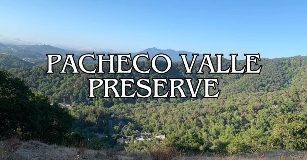
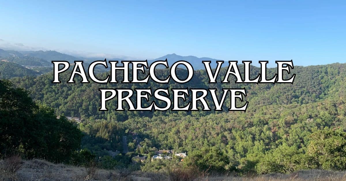
Tucked away in Marin County, Pacheco Valley Preserve sprawls across 519 acres of natural beauty just waiting to be explored. Oak woodlands, rolling grasslands, and a creek with seasonal waterfalls make this a perfect spot to escape city noise. It’s a bit off the beaten path, and honestly, that’s part of the charm. Wildlife like coyote, deer, and bobcat call this place home, so keep your eyes peeled.
There’s a surprisingly good network of trails here—some easy, some with steep ridges that’ll test your legs. If you’re up for the climbs, you’ll get breathtaking views of the bay and southern Marin. The quiet trails make it a favorite for bird watchers and anyone who just wants a peaceful, outdoor day without crowds.
Discover hand-picked hotels and vacation homes tailored for every traveler. Skip booking fees and secure your dream stay today with real-time availability!
Browse Accommodations Now
Before you go, check the season—creek levels and trails can change a lot depending on the time of year. If you’re after less-crowded nature, this spot’s a solid pick for your Marin County itinerary. It’s a great place to actually feel connected to the landscape, not just look at it from a distance.
Overview of Pacheco Valley Preserve
Pacheco Valley Preserve covers 519 acres in southern Novato, giving you access to oak woodlands, grasslands, and a seasonal creek. It links up with a larger network of protected lands and offers a haven for wildlife and outdoor lovers alike.
History and Preservation
You’ll find Pacheco Valley Preserve along Novato’s southern edge. The preserve protects a key watershed, including Pacheco Creek, which winds right through the property. Marin County Parks manages the area as part of their bigger conservation push in the North Bay.
The oak woodlands here are classic Northern California—big, shady groves that somehow survived the wave of development. Walking through, you get a sense of what this region looked like before everything got built up.
It doesn’t get as much attention as some other Marin open spaces, but this place matters. It’s an ecological corridor that links up different habitats across the county.
Ecological Significance
Inside the preserve, you’ll wander through a mix of oak woodlands and open grasslands. The oaks shelter birds and small mammals, creating a layered ecosystem that’s always changing.
Grasslands open up the landscape, especially in spring when wildflowers show off in bursts of color. Pacheco Creek, with its seasonal waterfalls, slices through the preserve and supports a whole different set of plants and animals.
If you’re into wildlife viewing, you’re in luck. You might catch deer, raptors, or smaller critters darting through the brush.
Connection to Other Marin Open Spaces
Pacheco Valley Preserve ties into roughly 3,000 acres of wildlands, so it’s not just a standalone park—it’s part of a much bigger web of open space. That’s a big deal for wildlife, giving them room to roam.
The ridgeline trails offer spectacular views of Mount Burdell, Mount Tamalpais, and the surrounding hills. It’s a great way to see how this preserve fits into Marin’s patchwork of protected land.
You can link up with trails that cross into neighboring preserves, whether you’re hiking, biking, or on horseback. The interconnectedness is a big part of Marin County’s open space strategy. Exploring these links can turn a short hike into a much bigger adventure.
Trailheads and Access Points
Pacheco Valley Preserve has a handful of entry points for hikers and nature fans. It’s easy to connect with neighboring open spaces, and the trail network is more extensive than you might expect.
Main Trailhead Locations
The main way in is near the Chicken Shack Trail. From here, you can hop onto the short 0.25-mile Pacheco Creek Trail, which leads straight to the seasonal waterfall—a highlight if you’re here during the wet months.
There are other access points too, linking up with neighboring preserves: Loma Verde, Ignacio Valley, and Lucas Valley. These connections let you stretch your hike well beyond Pacheco Valley.
Big Rock Ridge Road is your gateway to the ridge trails and those wide-open Marin views. From there, the Ponti Trail Loop is a local favorite.
Parking Options
Parking isn’t abundant, but it’s usually enough. The main lot by the Pacheco Creek trailhead fits about 8-10 cars.
You can also find street parking in some of the residential areas around the preserve, but watch for “No Parking” signs and be respectful—nobody likes blocked driveways.
On weekends and holidays, parking fills up fast—sometimes by mid-morning. If you want a guaranteed spot, try arriving before 9 AM or later in the afternoon, especially if you’re aiming to see the waterfall in peak season.
San Francisco and Bay Area Access
Coming from San Francisco? It’s about a 30-minute drive up Highway 101. Take the Ignacio Boulevard exit in Novato and follow the local roads to the entrance.
If you’re relying on public transit, Golden Gate Transit buses will get you to Novato, and then you’ll need a short rideshare or taxi to the trailhead. Plan on about 1 hour and 15 minutes for the whole trip.
East Bay folks can cross the Richmond-San Rafael Bridge and head north on 101. If you’re coming from the South Bay, give yourself 45 to 60 minutes, depending on traffic.
Nearby Towns and Services
Novato is just five minutes away by car and has everything you might need—restaurants, coffee, grocery stores, and even an REI if you forgot your hiking socks.
Fairfax is about 15 minutes south. It’s got a laid-back downtown with good food and a few local shops, perfect for a post-hike bite.
Gas stations are easy to find in Novato and along 101. Public restrooms are scarce at the preserve, so plan ahead and use the facilities in town before you hit the trails.
If you need medical help, Novato has urgent care and other services not far from the trailheads.
Top Hiking Trails at Pacheco Valley Preserve
There are several solid hikes within the preserve’s 230 acres. You’ll find both easy, family-friendly trails and tougher routes with rewarding views.
Out and Back Hike Routes
The Pacheco Creek Trail is a classic for families. It’s an easy quarter-mile stroll along the creek, ending at a seasonal waterfall that really shows off in spring. Great for kids or anyone who wants a short, scenic walk.
If you’re looking for more challenge, check out the Chicken Shack Trail. It weaves through varied terrain and offers some nice viewpoints. The surface ranges from smooth dirt to rocky patches.
Big Rock Ridge Road is another good bet if you want a longer hike. It’s a wider trail with bigger views, and you can connect to other preserves to keep going as long as your energy lasts.
Distance and Elevation Gain Details
Trail lengths and difficulty vary. The Pacheco Creek Trail is just 0.25 miles with almost no elevation—great for little ones or those not up for a workout.
For something moderate, try linking Chicken Shack, Big Rock Ridge Road, and the Ponti Trail loop. That’s about 4 miles with some ups and downs—enough to get your heart rate up without being brutal.
If you’re ambitious, you can piece together routes up to 9 miles by crossing into neighboring open spaces like Loma Verde and Ignacio Valley. Expect:
- Distance: 7-9 miles total
- Elevation gain: 800-1,200 feet
- Hiking time: 4-5 hours
Connection to Bay Area Ridge Trail
Pacheco Valley Preserve is a key link in the Bay Area Ridge Trail system—a 550+ mile network circling San Francisco Bay.
Hiking north from the preserve, you’ll find Ridge Trail segments with expansive views of Marin. The signage is usually pretty clear.
The most direct Ridge Trail access is via Big Rock Ridge Road. It’s a multi-use path, so you’ll see hikers, cyclists, and horseback riders all sharing the trail.
If you want to mix things up, try a partial loop using Ridge Trail connections. You’ll get both woodland shade and open ridge views in a single hike.
Find the perfect hotel or vacation rental. Instant booking, no fees!
View Top Stays
Scenic Highlights and Natural Beauty
Pacheco Valley Preserve packs a lot of variety into its 519 acres. The landscape shifts with the seasons, and there’s always something new to notice.
Panoramic Views
Climb the trails and you’ll get those classic Marin views—Mount Burdell to the north, Mount Tamalpais to the south. On clear days, the vistas are just stunning.
The main ridge trail is your best bet for sweeping panoramas. Bring a camera, or at least your phone; the lighting is especially good early or late in the day.
If you head east, you’ll catch glimpses of San Pablo Bay—a nice contrast to the wooded areas.
Wildflowers and Flora
Spring is wildflower season here, usually March through May. California poppies, lupines, and buttercups paint the grasslands in orange, purple, and yellow.
You’ll notice several types of oaks:
- Coast live oak (evergreen, small spiny leaves)
- Black oak (loses leaves in winter, big lobed leaves)
- Valley oak (tall, deeply lobed leaves)
These trees offer much-needed shade and shelter for wildlife. The understory shifts with the seasons—grasses, ferns, and native shrubs fill in the gaps.
After rain, the creek comes alive, and mosses and lichens add subtle color to rocks and tree trunks.
Bird Watching Opportunities
Birders will have a field day here. Bring binoculars if you can—they’ll come in handy.
You might spot:
- Red-tailed hawks riding the thermals
- Acorn woodpeckers drilling away at oaks
- Western bluebirds flashing blue in the sunlight
- White-crowned sparrows singing from the shrubbery
Early mornings are best for bird activity. The edge between woodland and grassland attracts a mix of species, so wander both for a better list.
During spring migration, keep an eye out for warblers passing through. The creek draws one set of birds, while the grasslands attract another—explore both for the full experience.
Best Times to Visit
Pacheco Valley Preserve shifts with the seasons, and honestly, each one brings its own vibe. Weather shapes everything here—sometimes for better, sometimes for muddier.
Seasonal Considerations
Spring (March-May) is hard to beat. Wildflowers are everywhere, Pacheco Creek actually looks like a creek, and those seasonal waterfalls put on a decent show. The oaks are fresh and green, and temps usually hang out between 60 and 75°F.
Fall (September-November) is another sweet spot. The oaks turn color, the air is comfortable—think 65-75°F—and the trails stay dry. Not too hot, not too chilly. Just right for hiking or biking.
Winter (December-February) is when the rain comes. Trails can get pretty sloppy, so if you’re heading out, waterproof boots are a must. On the plus side, Pacheco Creek Falls gets wild after a storm. Just watch your step on those steeper bits.
Weather and Trail Conditions
Summer (June-August) can get toasty. Sometimes it spikes past 85°F, and there’s not much shade up on the ridges. Early morning or late afternoon is your friend—midday sun is just brutal. Don’t forget sunscreen and more water than you think you’ll need.
Trails swing wildly with the weather. After a downpour, Pacheco Creek Trail can turn into a mudfest, maybe even flood in spots. Ridgeline trails? They’re gorgeous but can get slick if it’s been raining.
Fog sometimes drifts in from the bay on summer mornings. It’ll cool things down, but you might miss out on those big views. Always a good idea to check the local Marin County forecast before you go—nobody likes surprises out there.
Connections to Nearby Parks and Trails
Pacheco Valle Preserve sits smack in the middle of a web of open spaces. If you’re feeling adventurous, you can link up with other parks and stretch your hike into something bigger.
Cascade Canyon and Cataract Falls
Cascade Canyon connects to Pacheco Valle via a handful of trails. You’ll notice the scenery shift from oak woodlands to lush creekside as you go.
If you time it right in winter or spring, you can reach Cataract Falls—one of Marin’s best waterfall hikes. After rain, the falls really put on a show, tumbling down the mountainside.
How to get there:
- Start on Chicken Shack Fire Road
- Link up with High Water Trail
- Follow signs toward Cascade Canyon
These trails aren’t exactly a stroll in the park—some parts get steep. If you want to do both preserves, plan for a full day.
Indian Valley and Indian Tree
Indian Valley Open Space connects directly to Pacheco Valle with solid fire roads. You’ll get access to another 5-ish miles of trails, wandering through grasslands and shady oaks.
Heading toward Indian Tree Preserve takes a little more navigation, but it’s worth it. Some of the oldest trees around are waiting. From Pacheco Valle’s northwest side:
- Take Valley Trail to Indian Valley Fire Road
- Keep west for about 1.2 miles
- Watch for Indian Tree access signs
Indian Valley also has Pacheco Pond—great if you’ve got kids or just want something mellow. Flat trails, wildlife, and easy walking.
Buck Gulch Falls and Deer Island
You can reach Buck Gulch Falls from the eastern side of Pacheco Valle. This waterfall is best right after heavy rain in winter.
Here’s the route:
- Take Oak Ridge Trail heading east
- Drop down through Buck Gulch
- Expect some rocks and moderate ups and downs
Deer Island isn’t directly connected, but it’s just a quick drive away. It’s a small, peaceful spot—easy trails looping through wetlands.
To do both in a day:
- Hike Buck Gulch in the morning (give it 2-3 hours)
- Drive 10 minutes to Deer Island
- Walk the 1-mile loop
Both spots are solid for spotting birds and small critters.
Regional Attractions and Day Trips
Pacheco Valle Preserve makes a handy launchpad for exploring Marin and the Bay Area. You’re close to all sorts of landscapes, not to mention some surprisingly cool cultural stops.
Exploring the Bay Area
San Francisco is only a half hour south. Honestly, it’s an easy day trip. Cross the Golden Gate Bridge and you’re in a whole different world—Fisherman’s Wharf, Alcatraz, Golden Gate Park, the works.
For killer views of the city, check out Battery Spencer or the Marin Headlands. Sunset up there? Not bad at all.
Got kids (or just like science stuff)? The Exploratorium and California Academy of Sciences are always a hit.
If you’d rather skip city parking headaches, BART stations in southern Marin make it easy. Some folks like to hike in the morning, then head into SF for the afternoon.
Nearby Open Space Preserves
Loma Verde Preserve is right next door and has more trails through similar hills. You can link up for a bigger hike without moving your car.
Luxury stays to cozy cottages await, all with instant booking. Find the best deals!
Browse Marin Stays
Ignacio Valley Preserve is also close by, with rolling grasslands and wildflowers (March-May is best). Birdwatchers seem to love it.
China Camp State Park sits on San Pablo Bay. You’ll find hiking, plus bits of history from its days as a Chinese shrimp-fishing village. Good spots for a picnic by the water.
Ring Mountain Preserve in Tiburon is famous for rare plants and some old petroglyphs. Plus, the views of the bay are something else. It’s about a 15-minute drive from Pacheco Valle.
Nearby State Parks
Mount Tamalpais State Park is the big one—tons of trails, sweeping coastal views, and a 2,571-foot summit that’s legendary on a clear day.
Samuel P. Taylor State Park has shady redwood groves and Papermill Creek, where endangered salmon still spawn. It’s a great escape from the summer heat if Pacheco Valle is baking.
Angel Island State Park is a short ferry ride from Tiburon. The old immigration station is worth a look, and the views in every direction are ridiculous.
Muir Woods National Monument protects ancient redwoods just 20 minutes away. Weekdays are quieter, or reserve ahead if you’re going on a weekend.
Connection to Local Vineyards
Sonoma County’s vineyards are just up the road—about 30 minutes north. Carneros is the first stop, famous for Pinot Noir and Chardonnay.
Some of the best tastings are at small family-run wineries in southern Sonoma. Cline Cellars and Gloria Ferrer both have great views and a relaxed vibe.
If you’re after a full wine day, guided tours leave from Novato and usually include transport, tastings at a few wineries, and lunch.
Cheese fans, don’t skip the Marin Cheese Trail. Nicasio Valley Cheese Company and Cowgirl Creamery both offer tours and samples—they’re a perfect match with local wines.
Planning Your Visit
A good day at Pacheco Valley Preserve starts with a little planning. It’s 519 acres of trails and wild spaces, but you’ll have a better time if you come prepared.
Visitor Guidelines and Safety
Open sunrise to sunset, no entrance fee. Parking is tight at the trailheads, especially on weekends—arrive early if you can.
Trails can be muddy in spring, and summer heat can sneak up on you. Always check the weather before you go.
Cell service is spotty, so let someone know your plans if you’re hiking solo. Some of those ridgeline trails are steep—be honest about your fitness level before tackling them.
Watch out for poison oak. “Leaves of three, let it be”—that old saying still works.
No drinking water on-site, so bring at least 1-2 liters per person. More if it’s hot.
Recommended Gear and Preparation
Don’t forget:
- Sturdy shoes with decent grip
- Sun hat, sunscreen, sunglasses
- Plenty of water (seriously, no fountains)
- Layers—weather can change fast
- Trail map (grab one at the entrance or download ahead)
- Small first aid kit
Trekking poles help on the steeper climbs. The elevation can sneak up on you.
Bug spray is smart in spring and summer. Ticks love the grasslands—do a check after your hike.
A few snacks or a picnic lunch make the views even better. Mount Tam and Mount Burdell look fantastic from the ridge.
Dog and Wildlife Policies
Dogs are welcome, but keep them leashed. It’s safer for wildlife and your pup. Bring waste bags and pack them out.
You might spot deer, coyotes, bobcats, or a bunch of birds. Give wildlife space and don’t feed them.
In spring, birds nest along some trails. Occasionally, parts of the trail close to protect them.
Stay on marked trails—oak woodlands and creek habitats are sensitive.
Rattlesnakes show up in warmer months. They’re shy, but watch your step and keep dogs out of brush piles and rocks.
Other Notable Destinations Nearby
If you’re making a weekend of it, there are some pretty cool natural spots nearby—more waterfalls, more trails, more views. Marin County really does pack it in.
Alamere Falls and Uvas Canyon
Alamere Falls is one of those rare California waterfalls that drops right onto the beach. You’ll find it in Point Reyes National Seashore, about 45 minutes from Pacheco Valley. The hike is 8.4 miles round-trip—coastal scrub, woods, then a 40-foot waterfall pouring onto Wildcat Beach.
Uvas Canyon County Park, down near Morgan Hill, is different but worth the drive. The 1-mile Waterfall Loop Trail passes several falls, most dramatic from January to May after good rains.
Heads up: For Alamere Falls, get there early for parking at Palomarin Trailhead, and check the tide chart before you go.
Berry Creek Falls and Black Mountain
Berry Creek Falls, tucked in Big Basin Redwoods State Park, is a 70-foot stunner surrounded by ancient redwoods. The 10.5-mile loop also passes Golden and Silver Falls. Some areas are still recovering from the 2020 fires, but new growth is coming back.
Black Mountain in the Santa Cruz Mountains offers big views out to the bay. It’s a moderate 4-mile hike with a 500-foot climb—spring wildflowers are a bonus.
Both are decent day trips:
- Berry Creek Falls: about 2.5 hours away
- Black Mountain: roughly 1.5 hours
Bring extra water and snacks for these longer treks.
Alpine Lake and Mt. Tam Watershed
Alpine Lake sits about 20 minutes from Pacheco Valley Preserve, tucked into the Mt. Tamalpais Watershed. The reservoir feels peaceful, ringed by thick forests and crisscrossed with hiking trails—Kent Trail’s 5.3-mile loop gets most of the attention, and for good reason.
The Mt. Tam Watershed covers seven lakes and more than 100 miles of trails. Bon Tempe Lake and Lake Lagunitas have easier, family-friendly paths where you can also fish (just remember you’ll need a permit).
Cataract Falls Trail really comes alive after winter rains, with a string of waterfalls that are honestly worth the climb. The 3-mile out-and-back trail is steep in spots, but the views? Unreal.
Visitor Info:
- Day-use fee: $8 per vehicle
- Swimming isn’t allowed in the watershed lakes
- Dogs can’t go on trails or near the water
Fort Baker and Bolinas Road
Fort Baker sits right by the Golden Gate Bridge. Once a military post, now it’s home to Cavallo Point Lodge and some of the best bay views around. The Chapel Steps Trail is an easy 1.5-mile loop—great for photos of the San Francisco skyline and the bridge.
Bolinas Road twists through west Marin, linking up natural areas along the way. If you’re driving, you’ll pass:
- Bolinas Lagoon: A tidal estuary full of birdlife
- Audubon Canyon Ranch: Open certain seasons for wildlife viewing
- Alpine Dam: Historic, with trails starting nearby
Honestly, the road itself feels like a scenic byway—pullouts pop up here and there, and if it’s a clear day, you might catch a glimpse of the Pacific.
Tips for Sustainable Recreation
If you want Pacheco Valley Preserve to stay wild and welcoming, a little care goes a long way. Responsible visits keep this 519-acre spot thriving for everyone who comes after.
Leave No Trace Principles
Stick to marked trails in Pacheco Valley Preserve. Cutting through the brush tramples plants and messes with wildlife habitats—plus, the oak woodlands and grasslands really deserve the respect.
Whatever you pack in, pack it out. Bring a small bag for trash, and if you see litter, maybe just grab it—even if it’s not yours.
Check out wildlife from a distance. Binoculars help a ton, and you’ll get to watch animals doing their thing without stressing them out.
Skip picking flowers or taking home rocks and sticks. Snap some photos instead—honestly, that memory will last longer, and it leaves the place just as beautiful for the next person.
Supporting Conservation Efforts
You can volunteer with Marin County Parks to help maintain Pacheco Valley Preserve. Most workdays revolve around trail upkeep, pulling invasive plants, or restoring habitats. When you pitch in, you’re making a real difference for the preserve’s ecology.
Thinking about donating? Local conservation groups put those funds toward things like education and keeping the preserve healthy.
If you’re curious about what the preserve needs at different times of year, it’s worth checking before you go. Try visiting on weekdays or during quieter hours to keep trail wear down. Sometimes, certain spots close for a while—maybe for nesting birds or after big storms.
Got tips about sustainable hiking or nature etiquette? Don’t hold back. Chatting with other visitors is an easy way to spread the word and help protect this special place.
Find available hotels and vacation homes instantly. No fees, best rates guaranteed!
Check Availability Now
Black Point Boat Launch Travel Guide – Accessibility, Amenities, Activities, and More!
Deer Island Preserve Travel Guide – Accessibility, Amenities, Activities, and More!
Ignacio Valley Preserve Travel Guide – Accessibility, Amenities, Activities, and More!
Indian Tree Preserve Travel Guide – Accessibility, Amenities, Activities, and More!
Indian Valley Preserve Travel Guide – Accessibility, Amenities, Activities, and More!
Little Mountain Preserve Travel Guide – Accessibility, Amenities, Activities, and More!
Loma Verde Preserve Travel Guide – Accessibility, Amenities, Activities, and More!
Mount Burdell Preserve Travel Guide – Accessibility, Amenities, Activities, and More!
Olompali State Historic Park Travel Guide – Accessibility, Amenities, Activities, and More!
Pacheco Valley Preserve Travel Guide – Accessibility, Amenities, Activities, and More!
Rush Creek Preserve Travel Guide – Accessibility, Amenities, Activities, and More!
Santa Margarita Island Preserve Travel Guide – Accessibility, Amenities, Activities, and More!
Stafford Lake Park Travel Guide – Accessibility, Amenities, Activities, and More!
Verissimo Hills Preserve Travel Guide – Accessibility, Amenities, Activities, and More!


