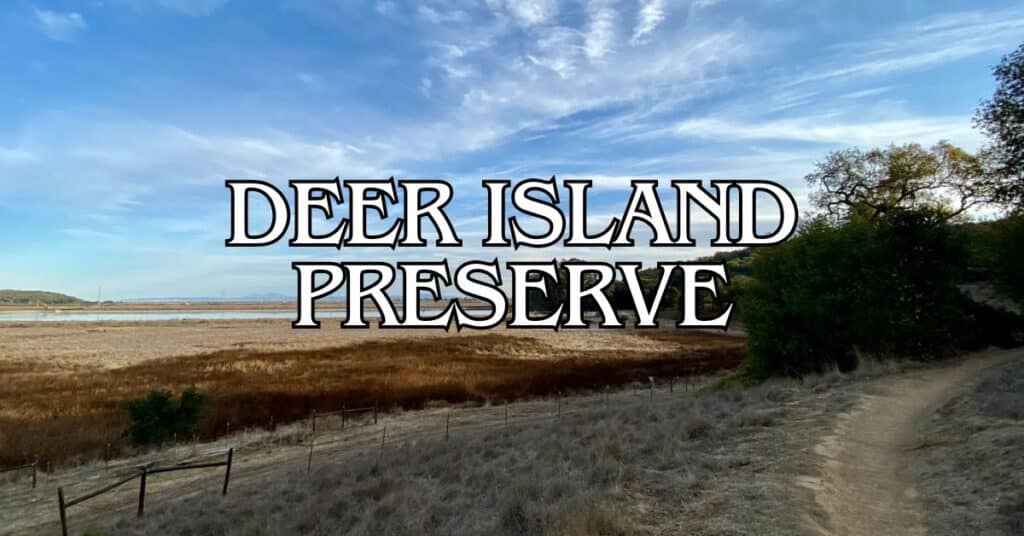
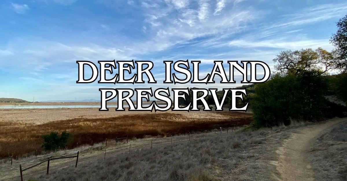
Tucked away on the eastern edge of Novato, Deer Island Preserve is kind of a secret spot for folks looking to escape the usual city clamor. The preserve covers 154 acres and has a mellow 1.8-mile loop trail that’s easy enough for families, kids, or anyone who just wants a walk without a workout. The trail’s mostly flat, so you don’t need to be a fitness buff to enjoy it.
Deer Island Open Space Preserve really is one of Marin County’s hidden gems. You can wander around without bumping elbows with crowds or worrying about steep climbs. The loop takes you around a little hill—the “island”—with nice views out to wetlands and Mount Burdell. You might even spot a deer or two, or at least some birds, as you stroll under the oaks and through the grass.
Discover hand-picked hotels and vacation homes tailored for every traveler. Skip booking fees and secure your dream stay today with real-time availability!
Browse Accommodations Now
You can bring your dog (on leash), ride a horse if that’s your thing, or just enjoy a bit of quiet that’s surprisingly close to neighborhoods but still feels like a real break. Parking is pretty limited—especially on weekends—but if you go on a weekday, you’ll probably find a spot.
Overview of Deer Island Preserve
Deer Island Preserve is a small, scenic patch of open space in Marin County—a quick way to get into nature. There’s a popular 2-mile loop trail and some pretty sweet views of the North Bay.
Location and Geography
You’ll find Deer Island Preserve in Novato, up in the northern part of Marin County. It’s at the end of Olive Avenue, with the entrance off Deer Island Lane. Despite the name, it’s not actually an island anymore. Back in the day, marshland surrounded it, but now it’s connected to the mainland.
The main loop is just under 2 miles, with a gentle climb of about 130 feet—so, nothing too crazy. You get a look at the wetlands, Novato Creek, and bits of the North Bay as you go. The hills here gently rise above what used to be marsh, so you get that “island” vibe without needing a boat.
Ecology and Wildlife
The preserve’s got a nice mix of oak woodlands, grassy areas, and shrubs—pretty typical for Marin open space. Native oaks provide good shade in places, and in spring, wildflowers like poppies and lupines pop up everywhere.
Wildlife? Well, there are deer (obviously), a bunch of birds, and smaller critters running around. Since it’s close to wetlands, it’s a solid spot for bird watching, especially when birds are migrating.
You’ll see a slice of Marin’s natural diversity here, even though the preserve is surrounded by neighborhoods.
History and Conservation
Deer Island has some history—it really was an island, surrounded by marsh, until folks drained the wetlands and connected it to the mainland.
Marin County Parks manages the area as part of their open space system. They focus on keeping native plants healthy and protecting wildlife. It’s a small preserve, but it’s part of the bigger effort to hang onto wild places as the Bay Area grows.
You can visit any time, day or night, and there’s no fee. Just a heads-up: there aren’t any restrooms or water fountains. Dogs are fine, but keep them leashed to avoid disturbing wildlife.
Getting to Deer Island Preserve
Getting to Deer Island Preserve is actually pretty easy from most of Marin and the Bay Area. It’s a quick drive off the highway—just enough to feel like you’re sneaking away.
Directions from Major Bay Area Hubs
From San Rafael, jump on Highway 101 North for about 10 miles to Novato. Take the De Long Avenue exit, head east, then right on Reichert Avenue and left on Olive Avenue. Keep going—Olive turns into Deer Island Lane and you’ll hit the preserve.
From San Francisco, head north on 101 for about 25 miles. Same exit and directions as above.
Driving from the East Bay? Cross the Richmond-San Rafael Bridge, keep north on 101, and follow the San Rafael route.
If you’re coming from Fairfax or West Marin, take Sir Francis Drake east to 101, then north to Novato and follow the rest.
Parking and Trailhead Information
There’s a small parking lot at the trailhead on Deer Island Lane. Not many spots, so if you’re coming on a weekend, get there early.
If the lot’s full, you might find some street parking along Deer Island Lane.
The entrance is marked with a Marin County Parks sign, and there’s an info board with a map and some basic rules.
No permits or fees—just park and go.
Accessibility Considerations
The main loop is about 1.9 miles and usually takes around 40 minutes, give or take. It’s an easy walk with small hills.
The trails aren’t paved, but they’re pretty well maintained. After rain, they can get muddy—so maybe skip it if you’re not up for that.
There are no restrooms or water fountains, so bring what you need, especially on warmer days.
If you’re coming from Larkspur or southern Marin, be prepared for possible traffic on 101 during rush hour. Mornings on weekends are usually the easiest for parking and a more relaxed experience.
Exploring the Trails
Deer Island Preserve has a handful of hiking options, from easy strolls to a few more challenging bits. The trails wind through open space and give you a good chance to spot wildlife any time of year.
Main Loop and Flat Paths
The main Deer Island Loop Trail circles the whole preserve. It’s about 2 miles and gives you a nice overview of what’s here. You’ll hit different terrain—some flat, some with gentle slopes.
Flat sections are mostly near the entrance and on the eastern side, so if you want an easy, breezy walk, stick to those.
The map at the entrance shows all the trails and connectors, so you can make your walk as short or long as you like.
Find the perfect hotel or vacation rental. Instant booking, no fees!
View Top Stays
Family-Friendly Walking Routes
If you’ve got kids, the De Borba Trail is a good pick. It’s shorter than the main loop and doesn’t have much climbing. The eastern side’s got wider, shadier trails—great for families, especially on hot days. Most families can finish these sections in about half an hour, maybe a bit more if you stop to look for critters.
Kids love spotting birds, squirrels, and sometimes even deer. Bring snacks and water since there aren’t any facilities.
Seasonal Trail Conditions
Trail conditions change a lot with the seasons. Winter and spring can get muddy, especially near the creek, so waterproof shoes are smart from December to April.
Summer is dry but hot—there’s not a ton of shade in some spots. Best to go early or later in the day. The landscape turns golden, which is a totally different vibe than the green of spring.
Fall is probably the sweet spot—mild temps, dry trails, and lots of animal activity.
Check the Marin County Parks website before you go; sometimes trails close for maintenance or weather.
Hiking Experiences and Safety Tips
Deer Island Preserve is a go-to for an easy, scenic loop hike with plenty of wildlife and some seasonal quirks. It’s beautiful, but you’ll want to be ready for whatever the weather and trails throw at you.
Wildlife Encounters and Plant Life
Even though it’s not huge, Deer Island is packed with wildlife. Early mornings and evenings are best for spotting deer. Rabbits, squirrels, and lots of birds are around all year.
The trail cuts through oak woods where you’ll see ferns and, in spring, wildflowers everywhere. Watch out for poison oak—“leaves of three,” reddish stems—just stay on the trail and you’ll be fine.
The look and feel of the place shifts with the seasons. Winter brings mushrooms, summer is all dry grasses and tough little plants. If you’re into birding, bring binoculars—hawks and woodpeckers are common.
Staying Safe: Hazards and Precautions
Stick to the marked trails to protect the habitat and avoid wandering onto private land. Deer Island borders some neighborhoods, so it’s easy to accidentally cross a boundary if you’re not paying attention.
Wear shoes with good grip, especially if it’s rained recently. Even though it’s a short loop, bring water—shade is limited in some spots, and it can get warm.
Check trail conditions before heading out. After heavy rain, some spots get slippery or even flooded.
Sunscreen and a hat are a good idea, since a lot of the trail is exposed. Long pants help keep poison oak off your skin.
Best Times to Visit
Spring (March to May) is hard to beat—wildflowers everywhere, temps in the 60s and 70s, and everything’s green. Fall is also great: fewer people and good weather. In summer, aim for early morning hikes before it heats up.
Weekday mornings are the quietest. If you want to see wildlife, go early or late in the day.
Winter hikes can be peaceful, especially if you catch a dry spell. It’ll likely be muddy, but you might get the whole place to yourself. Foggy mornings can make it feel almost magical before the sun burns it off.
Planning Your Visit
A trip to Deer Island Preserve is pretty straightforward, but there are a few things to know before you go. It’s all about the natural experience here—no frills, just trails and open space.
Picnic Areas and Facilities
Facilities are, well, minimal. There aren’t any picnic tables, BBQs, or playgrounds. The preserve is about hiking and soaking up the outdoors, not hanging out for hours with a big group.
There’s a small parking lot at the trail entrance, but it fills fast on weekends. Early birds definitely have the advantage.
No restrooms, no water fountains, and no trash cans—so bring water and pack out whatever you bring in.
If you’re after a proper picnic, you might want to check out one of the bigger regional parks nearby before or after your hike.
Rules, Hours, and Regulations
Deer Island Preserve is open 24/7, and there’s no entrance fee—just walk right in.
Dogs are welcome but need to stay on leash. Don’t forget bags to clean up after them.
Bikes can use the wider fire roads, but not the narrow trails. If you’re on horseback, check the Marin County Parks site for up-to-date trail access.
A few things aren’t allowed:
- Smoking
- Alcohol
- Camping
- Fires
- Taking plants or wildlife
For the latest info on closures or special events, it’s worth a quick look at the Marin County Parks website before you head out.
Nearby Nature Parks and Open Spaces
Marin County’s full of gorgeous preserves not far from Deer Island. Each one brings its own vibe, so if you’re itching for something a little different, you’ve got options.
Ring Mountain and Baltimore Canyon
Ring Mountain Open Space Preserve sprawls across the Tiburon Peninsula, showing off jaw-dropping Bay views. It’s 367 acres of rare wildflowers, and that big ol’ “Turtle Rock” formation. In spring, the endangered Tiburon mariposa lily pops up everywhere—kind of a wildflower jackpot.
Luxury stays to cozy cottages await, all with instant booking. Find the best deals!
Browse Marin Stays
Trails here? They range from moderate to “whew, that’s steep,” but the summit rewards you with panoramic scenes—San Francisco, Bay Bridge, Mount Tamalpais, all laid out like a painting.
Baltimore Canyon Open Space Preserve in Larkspur, meanwhile, flips the script with shady redwood groves and the lovely Dawn Falls. Within its 193 acres, you’ll find:
- A stream that never really dries up
- Towering, ancient redwoods
- Plenty of birds to spot (bring binoculars!)
- 2.3 miles of hiking trails
Dawn Falls Trail gets especially magical after the winter rains, when the waterfall really puts on a show.
Cascade Canyon and Blithedale Summit
Cascade Canyon Open Space Preserve covers 498 acres of oak woodlands and grassy meadows. Cascade Falls is the star, especially when the rains have been generous. The preserve features:
- Elliot Nature Preserve tucked inside
- Spring wildflowers
- Meandering creeks and streams
- Decent odds of spotting wildlife
Blithedale Summit Open Space Preserve connects right to Cascade Canyon, stretching over 900 acres along the ridge between Mill Valley and Corte Madera.
The Southern Marin Line Fire Road runs pretty flat, and every now and then, you catch a view that makes you stop. Owls, foxes, deer—they all hang out here.
Bothin Marsh and King Mountain
Bothin Marsh Open Space Preserve is only about 15 minutes from Deer Island, but it feels like a different world. This 106-acre tidal marsh hugs Richardson Bay and offers:
- Flat, easy trails (great for a stroll)
- Bird watching—over 125 species, if you’re counting
- Bay views and classic wetland scenery
- A well-loved stretch of the Mill Valley-Sausalito multi-use path
King Mountain Open Space Preserve in Larkspur is 108 acres of steep slopes and mixed forests. The loop trail climbs quick, but the payoff is those sweeping views of central Marin.
In spring, wildflowers like California poppies and lupine line the trails. Plus, you can link up with Baltimore Canyon for longer hikes if you’re feeling ambitious.
Top Nearby Hiking Destinations
Deer Island Preserve is a solid spot, but honestly, Marin County’s hiking scene is next level. From coastal bluffs to redwood forests, there’s a trail for whatever mood you’re in.
Mount Tamalpais and Surrounding Trails
Locals just call it Mt. Tam—the county’s signature peak, rising 2,571 feet above it all. The summit? Unreal 360-degree views of the Bay, the Pacific, and way beyond.
East Peak’s a quick but steep 0.7-mile climb from the parking lot. Want a longer trek? The 7.3-mile Matt Davis-Steep Ravine Loop drops you to Stinson Beach and back.
The Ridge Trail follows the mountain’s spine with moderate grades and open vistas. On a clear day, you might spot San Francisco, the Farallon Islands, even Mount Diablo if you squint.
MMWD (Marin Municipal Water District) lands on Tam have over 100 miles of trails. Phoenix Lake is a favorite—gentle, wildlife everywhere, and easy to get to.
Stinson Beach and Marin Headlands
Stinson Beach isn’t just for sunbathing. The legendary Dipsea Trail starts here—a tough 7.4-mile route from Mill Valley to the sand, and home to America’s oldest trail race.
The Marin Headlands are all about wild coastal hikes and ocean drama. The Tennessee Valley Trail is a 5.5-mile round trip to a quiet cove—perfect for a picnic if you can snag a spot.
Rodeo Beach links up with the Coastal Trail, where cliffs drop to the sea. The Bobcat Trail loop (about 3 miles) is a nice sampler of the Headlands’ wild side.
History nerds will dig the trails near Battery Townsley and Point Bonita Lighthouse—nature and old military ruins in one go. If you’re crowd-averse, weekdays are your friend.
Mill Valley and Tennessee Valley
Mill Valley’s kind of a launchpad for all kinds of hikes. The Cascade Falls Trail is a quick 1.2-mile out-and-back to a seasonal waterfall—kids and parents both love it.
Bald Hill stands 1,141 feet above town, with a moderate 3-mile loop and killer views. The Yolanda Trail connects in for a quieter stroll through oaks.
Tennessee Valley is always buzzing. Besides the main trail to Tennessee Cove, you can hit the Fox Trail for steeper climbs and fewer people.
Dawn Falls Trail in Baltimore Canyon Open Space follows Larkspur Creek through a lush, ferny redwood canyon. It’s 2.4 miles round trip and really shines after a good rain.
Muir Woods and Point Reyes
Muir Woods National Monument is famous for its old-growth coastal redwoods and easy, peaceful walking paths. If you want to dodge the crowds, the 4-mile Bootjack Trail climbs out of the main valley.
The Dipsea Trail links Muir Woods to Pantoll Campground on Mt. Tam via the Old Mine Trail—about 3 miles of classic forest scenery.
Point Reyes National Seashore, just north of Deer Island, is a hiker’s dream with over 150 miles of trails. Tomales Point Trail (4.5 miles) is great for wildlife—tule elk sometimes wander right past you.
For epic coast views, the 9.5-mile Alamere Falls Trail leads to a waterfall that drops straight onto the beach. If you want something easier, Bear Valley Trail is an 8-mile round trip through meadows, woods, and everything in between.
Regional Attractions in the Bay Area
Deer Island Preserve is a chill escape, but honestly, the Bay Area is packed with places worth your time. From city parks to towering redwoods and rugged coastline, there’s a bit of everything nearby.
San Francisco Bay Area Highlights
The Presidio is a former military base turned 1,500-acre national park, with those postcard views of the Golden Gate Bridge. There are trails, historic buildings, and beaches—right inside the city.
Golden Gate Park stretches over 1,000 acres. It’s got gardens, museums, and even a bison paddock. The Japanese Tea Garden and de Young Museum are both worth a visit, if you ask me.
Lands End is all about dramatic cliffs, shipwrecks, and the ruins of Sutro Baths. The 3-mile coastal trail here serves up ocean views you’ll remember.
Looking for something more low-key? Sausalito’s waterfront and Fort Baker’s old buildings both offer up-close views of the city and a laid-back vibe.
Redwood Parks and State Preserves
Big Basin Redwoods State Park is California’s oldest, with ancient coast redwoods—some over 1,000 years old. The 10.5-mile Berry Creek Falls loop winds past multiple waterfalls and massive trees.
Henry Cowell Redwoods State Park has a 40-acre grove with giants over 250 feet tall. The visitor center’s displays on redwood ecology are actually pretty interesting.
Closer to Marin, Muir Woods National Monument offers an easy way to see redwoods—just get there early if you want some peace.
If you prefer solitude, Butano State Park and Purisima Creek Redwoods Open Space Preserve are less crowded and just as awe-inspiring. Sometimes, you just want the trees to yourself, right?
Scenic Coastal Trails
The Dipsea Trail, known as America’s oldest trail race route, winds from Mill Valley to Stinson Beach. At just over seven miles, it pushes across Mount Tamalpais and rewards you with some wild ocean views. It’s not an easy stroll—expect some sweat and maybe a few moments where you question your life choices.
Point Reyes National Seashore? That place is a mixed bag in the best way. You can trek out to Alamere Falls, which drops right onto the sand (how many waterfalls do that?), or scramble up Mount Wittenberg if you’re after sweeping views and a bit of a leg burn.
If wildlife is your thing, swing by Año Nuevo State Park during the elephant seal breeding season—December through March is prime time. Rangers lead guided walks, so you won’t accidentally wander too close to those massive seals. It’s loud, a little smelly, and totally unforgettable.
Mori Point in Pacifica is a bit of a hidden gem. The trails are short but pretty steep, and at the top, you get those classic California coastal views. In spring, the blufftop bursts with wildflowers—honestly, it’s hard to beat.
Find available hotels and vacation homes instantly. No fees, best rates guaranteed!
Check Availability Now
Black Point Boat Launch Travel Guide – Accessibility, Amenities, Activities, and More!
Deer Island Preserve Travel Guide – Accessibility, Amenities, Activities, and More!
Ignacio Valley Preserve Travel Guide – Accessibility, Amenities, Activities, and More!
Indian Tree Preserve Travel Guide – Accessibility, Amenities, Activities, and More!
Indian Valley Preserve Travel Guide – Accessibility, Amenities, Activities, and More!
Little Mountain Preserve Travel Guide – Accessibility, Amenities, Activities, and More!
Loma Verde Preserve Travel Guide – Accessibility, Amenities, Activities, and More!
Mount Burdell Preserve Travel Guide – Accessibility, Amenities, Activities, and More!
Olompali State Historic Park Travel Guide – Accessibility, Amenities, Activities, and More!
Pacheco Valley Preserve Travel Guide – Accessibility, Amenities, Activities, and More!
Rush Creek Preserve Travel Guide – Accessibility, Amenities, Activities, and More!
Santa Margarita Island Preserve Travel Guide – Accessibility, Amenities, Activities, and More!
Stafford Lake Park Travel Guide – Accessibility, Amenities, Activities, and More!
Verissimo Hills Preserve Travel Guide – Accessibility, Amenities, Activities, and More!


