
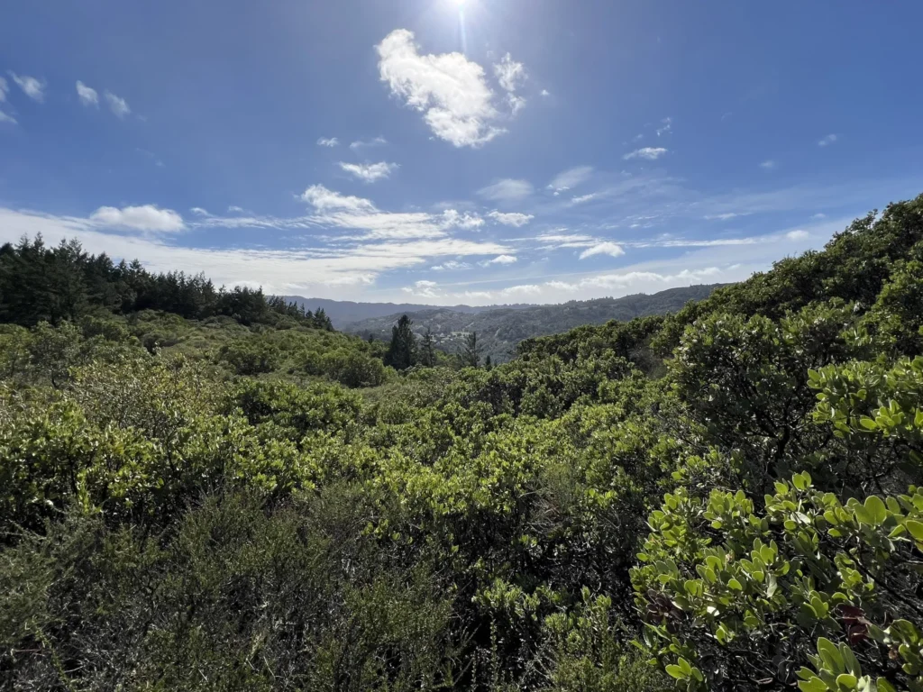
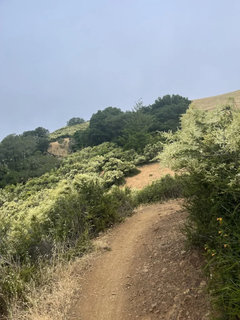
Marin County really does have some of the best mountain biking trails in California, no matter your skill level. From the mellow loops at China Camp State Park to the gnarlier terrain on Mount Tamalpais, there’s a little something for everyone who loves to ride. These trails mix up Marin’s natural beauty with a real sense of adventure—honestly, it’s hard not to be impressed.
Marin County’s trails are more than just fun—they’re iconic, with deep roots in mountain biking history. Legendary routes like Tamarancho and Repack have drawn riders for decades. You’ll get everything from buttery singletrack to rocky, technical descents, all set against backdrops of redwoods, ocean views, and those classic Northern California hills. For any mountain biker, Marin is kind of a bucket-list spot.
Discover hand-picked hotels and vacation homes tailored for every traveler. Skip booking fees and secure your dream stay today with real-time availability!
Browse Accommodations Now
Camp Tamarancho Loop
Camp Tamarancho Loop is often called the best singletrack riding in the Bay Area. Right in Fairfax, this trail gives mountain bikers a technical, challenging ride that’ll definitely push your skills.
If you want to ride here, grab a one-day permit for $5 at Sunshine Bicycles in Fairfax before you hit the trail.
This isn’t really a beginner trail—there’s a lot of technical stuff and some tough sections. More experienced riders love the well-kept singletrack and the variety of obstacles.
The loop has options from 8 up to 20 miles. You can do the classic loop, try the Great Kid’s Lake Ride, or link up with other trails nearby if you’re feeling ambitious.
Expect a nice mix of climbs, descents, and technical bits along the way. The trail system is marked well enough that even first-timers won’t get too lost at Camp Tamarancho.
Plenty of locals ride this trail regularly—it’s got great terrain and it’s just a short hop from Fairfax, so it’s easy to get to if you’re coming from anywhere in the Bay Area.
China Camp State Park Loop

China Camp State Park Loop is a longtime favorite for Marin cyclists. It’s right in the heart of the county and gives you some killer views of San Francisco Bay as you ride.
The loop’s wide, smooth trails are perfect for beginners who want to dip their toes into singletrack. Even if you’re completely new to mountain biking, the terrain is forgiving.
China Camp gets busy, but the trails are wide enough that passing people isn’t much of a hassle. Even on weekends, it doesn’t feel too crowded.
You’ll pedal through a mix of wooded sections and open stretches with bay views. There are some gentle climbs and fun descents, but nothing too wild.
If you’re just starting out, this is a great spot to build confidence before moving on to tougher Marin trails. You’ll see plenty of other bikers—this place is popular for a reason.
You can combine trails like Shoreline, Oak Ridge Drive, and Bayview to make loops that fit your skill level and schedule.
Click here to see our guide to China Camp State Park.
Mt Tam Summit Loop

The Mt Tam Summit Loop is a classic Marin mountain biking ride. You start in the shade of redwoods and climb all the way to the top of Mount Tamalpais, where the views are just unreal.
Kick things off with a steady climb up the Old Railroad Grade Trail—a former railway path that’s pretty manageable for most intermediate riders.
As you climb, you’ll catch glimpses of San Francisco Bay on one side and the Pacific on the other. Honestly, the scenery makes the uphill feel less painful.
At the summit, take a breather and soak in the 360-degree views. On a clear day, you can spot the Golden Gate Bridge, downtown San Francisco, and even parts of the East Bay.
The descent is pure fun—flowy sections mixed with some technical bits, but nothing too sketchy if you keep your wits about you.
The full loop is about 15 miles with around 2,000 feet of climbing. Give yourself 3-4 hours if you want to stop for photos or just hang out for a bit.
Spring and fall usually have the best conditions. Summers can be foggy down low, but it’s often sunny up top—sometimes you’re literally riding above the clouds.
Bring water and snacks; there’s not much in the way of facilities once you’re out there. Helmet’s a must, and I’d recommend knee pads for the downhill.
Click here to read our guide to Mount Tamalpais State Park.
Marin Three Lakes Loop

(Photo Courtesy of Dave Nugent)
The Marin Three Lakes Loop is a go-to for a lot of local riders. You start in Ross, where there’s parking at Ross Commons Park by the Post Office.
The ride gets its name from the three lakes you’ll pass in the Mt. Tamalpais Watershed. It’s a nice mix of terrain, best for intermediate riders.
You can link this route up with other trails if you want a longer day. Many locals say it’s a must if you’re exploring Marin’s trail network.
The landscape shifts a lot—one minute you’re in the woods, the next you’re out in the open with big views. There’s a good balance of climbs and descents, and you’ll see pretty quickly why Marin has such a reputation.
There are water spots along the way, but honestly, just bring your own. The trail’s in good shape, but you’ll want to pay attention on the more technical stretches.
Tamarancho to Repack Trail
(Photo Courtesy of Erica Meyer)
Tamarancho to Repack Trail is about as classic as Marin mountain biking gets. You start on Camp Tamarancho’s singletrack and then link up with the famous Repack Road—basically a piece of mountain biking history.
Kick things off in Fairfax, but don’t forget to buy your $5 day permit at Sunshine Bicycles first. That money helps keep the trails running and supports the local Boy Scouts who manage the land.
For the route, start with Alchemist Trail, then hang a left onto Goldman, take a right on Serpentine, and keep going onto B-17. Just follow the main trail—it’s pretty straightforward once you’re out there.
This one’s definitely not for beginners. There are technical sections and some real challenges, but experienced riders say it’s some of the best singletrack in the Bay Area.
The highlight? Dropping down the legendary Repack Road. Back in the day, riders had to “repack” their coaster brakes after bombing down—hence the name.
Find the perfect hotel or vacation rental. Instant booking, no fees!
View Top Stays
Riding Tamarancho’s flowy singletrack and finishing with Repack’s historic descent is a real taste of Marin’s mountain biking heritage. You’ll climb part of Pine Mountain before the payoff downhill.
B-17 Trail

(Photo Courtesy of steveoh)
B-17 Trail in Fairfax, California, gives you a mostly downhill cruise through dense forest. It’s not super technical, so riders with a bit of experience will be right at home.
This trail drops more than it climbs, which means you get that fun, flowing feeling as you weave through the trees.
B-17 connects with a bunch of other trails in the area. You can tack on the B-17 Extension or nearby routes like Serpentine and Endor (Flow Trail) to make a longer loop.
There are a few technical descents, but nothing too crazy for intermediate riders.
The area’s trail network is solid and draws riders from all over. If you’re planning a day in Fairfax, definitely consider adding B-17 to your route.
Endor Flow Trail

(Photo Courtesy of satchscratch)
Endor Flow Trail is a highlight for Marin County mountain bikers. It’s in Fairfax and gives riders a fast, playful downhill with sculpted berms that twist through the woods.
There’s a small pump track and skills area at the top, perfect for warming up or practicing. You’ll find a few jumps and doubles, but you can skip them if you’re not feeling it.
There’s even a little one-foot drop by the skills area for anyone who wants to try something extra. Honestly, it’s fun enough to ride a couple times if you’re in the mood.
Lots of folks link Endor with nearby trails. Some pedal the B-17 Extension uphill to get here, which makes for a nice loop.
Most people say Endor is the park’s best feature. The design is all about flow, not just technical challenge, so it’s great for intermediates and still a blast for more advanced riders.
Alchemist Trail

(Photo Courtesy of Jonathan Henriques)
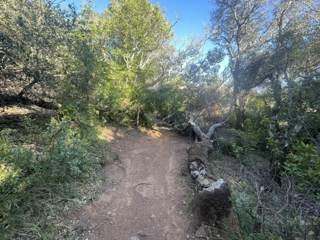
Alchemist Trail is a favorite among Fairfax mountain bikers. This switchback singletrack has roots and rocks to keep things interesting, but it’s not over-the-top technical.
The climb is a decent workout, and you’ll need to stay focused, especially on the descents—things can sneak up on you if you’re not paying attention.
It’s one of the more technical sections if you’re doing the Camp Tamarancho Loop, and a lot of locals call it a highlight of Marin’s trail system.
You’ll wind through natural obstacles and some truly beautiful scenery—classic Marin woodland vibes. The trail strikes a nice balance between challenge and flow.
Spring and fall are the best times to ride here—good weather, good dirt, and not too crowded.
If you’re an intermediate or advanced rider, Alchemist Trail really gives you that authentic Marin mountain biking feel. It’s ranked #2 in the region on Trailforks, and honestly, it lives up to the hype.
Broken Dam Trail
(Photo Courtesy of Juliana Nunes)
Broken Dam Trail is woven into the Camp Tamarancho trail system in Marin County. It’s a favorite among local mountain bikers and delivers some of the best riding in the Bay Area.
The trail sits mostly at a blue-green difficulty—great for intermediate riders, but watch out for a handful of nasty root sections. If you’re not feeling it, just hop off and walk those bits. No shame in staying upright.
Riding Broken Dam, you’ll get that classic Marin County terrain vibe. It links up with routes like Goldman, Serpentine, Wagon Wheel, and B-17, so you can mix and match for a loop that keeps things interesting.
This combo throws cross-country stretches, some flowy sections, and a few technical rock gardens your way. You’ll be switching up your skills as you go—never gets boring.
Broken Dam is tucked into Woodacre, just a short drive from Fairfax. It draws riders who want quality singletrack without trekking all the way from San Francisco.
If you want a quieter ride, try hitting the trail early on a weekday. Always bring extra water, and check trail conditions—especially if it’s been raining. Marin mud is no joke.
Serpentine Trail
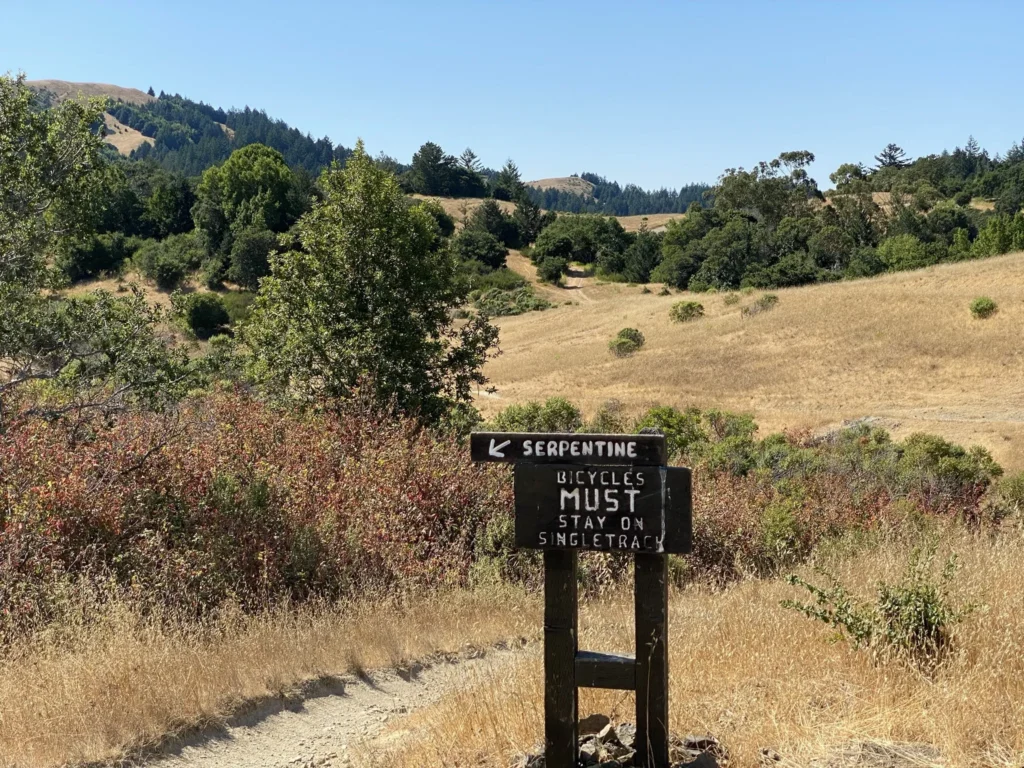
(Photo Courtesy of Kurtis Miller)
Serpentine Trail is honestly one of the tougher sections at Camp Tamarancho in Fairfax. It’s about half a mile long but packs in a solid 750 feet of climbing.
The trail starts out in wide-open terrain, so if it’s a hot day, you’ll feel it—bring more water than you think you need, especially in summer.
What really sets Serpentine apart are its technical rock features. There’s no shortage of rocky bits that’ll keep you on your toes and test your bike handling.
Serpentine is part of the wider Tamarancho loop, which a lot of Marin riders put high on their must-ride list. With this level of difficulty, it’s best for intermediate or advanced folks.
As you roll along, the trail moves from exposed spots into shadier stretches. That little bit of relief is welcome, and the terrain keeps you guessing.
If you’re planning a Tamarancho day, consider hitting Serpentine early to dodge the heat. Those technical climbs will definitely test your endurance and skills.
Wagon Wheel Trail
(Photo Courtesy of Tyler Jackson)
Wagon Wheel Trail in Fairfax is infamous for its steep, chunky rocky terrain. If you’re into technical riding, this trail is like a playground.
Expect rock gardens throughout. It’s not all super hard, but there are definitely spots that’ll trip up newer riders.
People say it’s fastest on 29-inch wheels, but honestly, riders bring all kinds of bikes and have a blast. Pretty much the whole trail runs over rocks, so if you like a challenge, you’ll love it.
This trail links up with Broken Dam, Goldman, Serpentine, and B-17. Together, they create a loop that’s got a bit of everything—cross-country, flow, and plenty of technical bits.
You’ll want a bike with solid suspension and trustworthy brakes. Focus is key here; Wagon Wheel isn’t the place to zone out.
Luxury stays to cozy cottages await, all with instant booking. Find the best deals!
Browse Marin Stays
If you’re looking for rocky, technical singletrack in Marin, Wagon Wheel is a standout—way rougher than the smoother trails you’ll find elsewhere in the county.
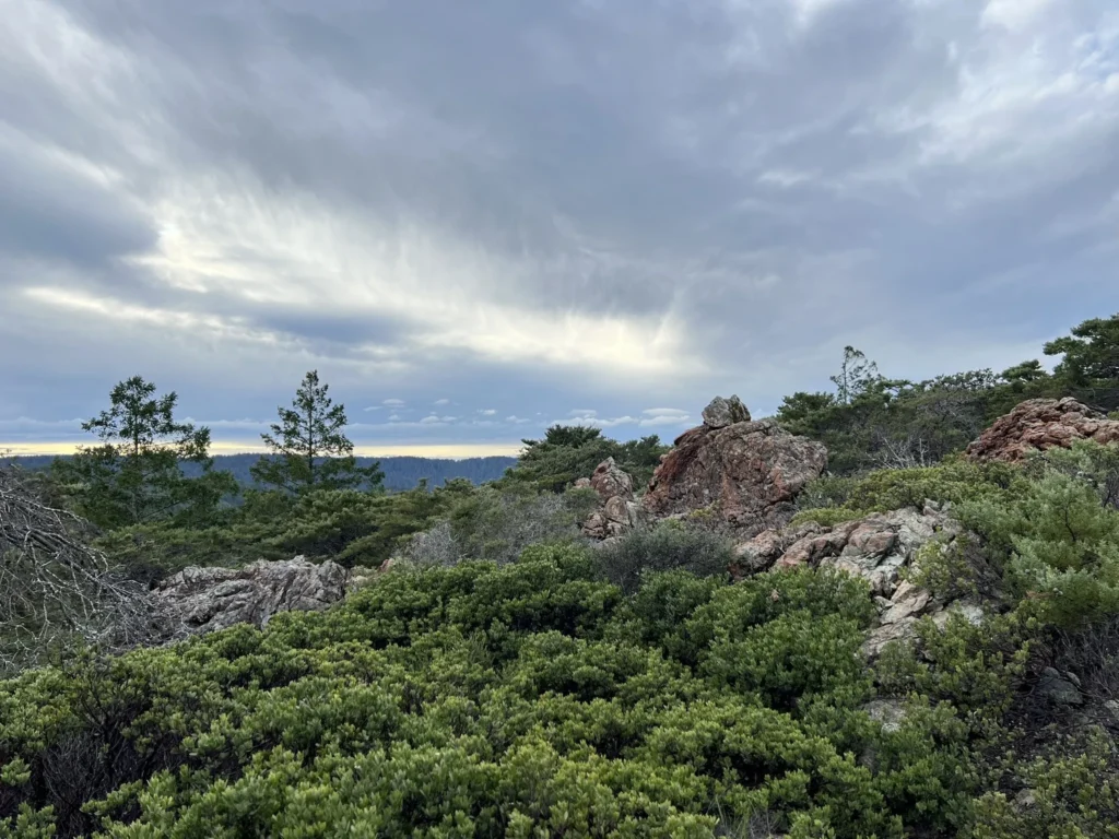
Solstice Trail
(Photo Courtesy of Bob Frommer)
Solstice Trail is about as technical as Marin County gets. It’s tucked near Fairfax and will challenge even seasoned riders with its tricky features.
Plenty of folks say Solstice is a must if you’re mountain biking in Marin. The trail delivers a serious payoff if you can ride its hardest sections clean.
To get there, park at Glen Road and climb up Smith Ridge to 680. The approach winds through Fairfax before you hit the entrance.
If you want to go big, link Solstice with Camp Tamarancho for a roughly 19-mile ride—some of the best Marin has to offer, in my opinion.
If technical trails are your thing, you might also check out UC Santa Cruz or Montara Mountain in Pacifica. Still, a lot of local riders will swear Solstice is a Marin classic that’s tough to top.
You’ll need sharp bike handling and confidence on rough ground. Bring the right gear and plenty of water, especially if it’s a hot day.
Tennessee Valley Trail
(Photo Courtesy of April Strong-Murrell)
Tennessee Valley Trail is easily one of Marin’s most popular rides. It starts with a half-mile of pavement from the trailhead, passing a big barn before you hit dirt. The terrain mixes it up, so just about any rider can find something to enjoy.
It’s part of the Marin Headlands and serves up some amazing ocean views. Lots of folks connect it with the Miwok loop to amp up the challenge. Honestly, this combo is a classic—great scenery and just enough technical riding to keep things interesting.
If you’re new to mountain biking, Tennessee Valley is super approachable. With a 4.7-star average from 3,000+ AllTrails users, it’s got a well-earned reputation. The trail’s intermediate rating means you’ll want to be in decent shape, but it’s not out of reach for most people.
The Coastal View section is a highlight: 2.5 miles of flowy singletrack with epic Pacific views. On a clear day, it’s tough to beat.
You can link Tennessee Valley with other nearby trails for a longer ride. Whether you’re after a quick spin or a full day out, it’s a flexible option for mountain biking around Marin.
Coastal Trail from Cardiac Hill
(Photo Courtesy of Betsy Clarke)
The Coastal Trail in Marin is a tough but rewarding ride. Starting from Cardiac Hill (locals sometimes call it Pantoll), it drops you down toward Highway 1 near the Muir Beach Overlook.
This trail’s changed over the years—it’s not the smooth, fast singletrack it used to be. Erosion and ruts have made it more technical, and intermediate or advanced riders will appreciate the challenge.
You can get on the Coastal Trail from a couple different trailheads. Where you park shapes your ride, so plan ahead if you have a route in mind.
Lots of riders mix this trail with others nearby. A favorite move is climbing Old Railroad Grade, then dropping down Old Stage Road to reach the top of the Coastal Trail.
The full loop is about 10 miles and sits at an intermediate level. Near Mill Valley, it serves up killer ocean views and a real test for your mountain biking skills.
They call it “Cardiac Hill” for a reason—the climb is a grind, but the views out over the coast are worth every pedal stroke.
Get a discount of 15% to 70% on accommodation in Marin County! Look for deals here:
Marin County Hotels, Apartments, B&Bs
Essential Tips for Mountain Biking in Marin County
Riding Marin’s trails takes a bit of prep, some timing, and a lot of respect for local rules. The county’s got something for everyone, but a few basics will make your ride smoother and safer.
Best Times of Year to Ride
Spring (March-May) is pretty much perfect—mild temps, wildflowers everywhere, and the trails are usually firm but not yet dusty after winter rains.
Summer (June-August) brings dry, predictable conditions, though it can get hot, especially on exposed trails like Bolinas Ridge. If you can, start early and pack extra water.
Fall (September-November) is arguably the best—cool, stable weather, golden hills, and fewer people. Rides at China Camp or Mount Tam are especially nice this time of year.
Winter (December-February) can be tricky. Some trails get muddy after rain, and riding wet trails does real damage. Best to wait at least 48 hours after a storm before heading out.

Trail Etiquette and Safety
Always yield to hikers and horses—they get the right of way on Marin’s multi-use trails. Slow down, say hello, and hop off if you’re passing a horse.
Stick to legal mountain bike trails. Some spots, like parts of Mount Tam, have strict restrictions, and rangers do hand out tickets.
Keep your speed in check, especially on busy trails like China Camp Loop. Call out “rider up!” when you’re coming around blind corners.
Stay on marked trails. Marin’s conservation depends on it, and shortcuts just create erosion and wreck the landscape.
Follow the IMBA rule: Leave No Trace. Take your trash with you and respect closures after heavy rain.
Required Gear and Preparation
Must-haves:
- Helmet that fits (non-negotiable)
- Mountain bike with working brakes
- Spare tube, mini-pump, and some basic tools
- At least 1.5 liters of water for every couple hours out
- Cell phone with offline trail maps

Sun protection matters, especially on exposed trails like Tamarancho. Sunscreen, sunglasses, maybe even light sleeves if it’s blazing out.
Give your bike a quick check before you roll: tire pressure, brakes, nothing rattling. Some of Marin’s technical sections aren’t forgiving if your gear fails.
Bring a layer or two for coastal rides. Fog can blow in fast near Bolinas Ridge, dropping temps in a hurry.
Download the Trailforks app for Marin-specific trail info. Cell signal is spotty, so offline maps are your friend.
Navigating Marin County’s Trail Systems
Marin’s trail network is huge and can feel a bit overwhelming at first. Knowing how the trail ratings work and where to park will make your rides a whole lot easier—and probably more fun, too.
Understanding Local Difficulty Ratings
Marin County keeps things straightforward with its mountain biking trail ratings: beginner, intermediate, or advanced. Nothing too mysterious there.
Beginner trails, like the China Camp loop, stick to mostly flat ground and skip the tricky stuff. You’ll roll over gentle slopes and wide paths—honestly, a great place for anyone just starting out.

Intermediate trails, such as parts of the Bolinas Ridge Trail, toss in moderate climbs, some rocky bits, and tighter turns. If you’ve got some basic bike handling skills, you’ll probably have a blast here.
Advanced trails ramp things up with steep climbs, technical descents, and all sorts of obstacles. Take the gnarlier sections around Mount Tamalpais, for example—you’ll want experience and confidence before tackling those.
Lots of Marin trails mix things up. Big Rock Ridge, for instance, gives you both mellow ridge cruising and some surprisingly tough climbs, plus those killer views. Not a bad combo, honestly.
Access and Parking Information
Most popular trails in Marin County have parking lots, but they fill up fast on weekends. If you want a spot at trailheads like Tennessee Valley or China Camp, it’s best to show up early—otherwise, you might be circling or parking farther away than you’d like.
Parking fees usually run between $5 and $10 per day. Some places only take cash, and others prefer payment apps, so it’s smart to be prepared for either. If you ride a lot, those annual passes can actually save you a decent chunk of change.

Amenities vary quite a bit. China Camp, for example, has bathrooms and water fountains, but plenty of trailheads don’t have much of anything. You might want to pack extra water and plan accordingly.
On crowded weekends, the West Marin Stagecoach and a few shuttles can get you to the trails without the headache of parking. They run more often during busy months, which is handy if you’d rather skip the lot altogether.
It’s always a good idea to check trail status before you head out. After heavy rain, Marin often shuts down trails to protect them. The Marin County Parks website and local bike shops usually have the latest info, though sometimes you have to dig a bit to find it.
Find available hotels and vacation homes instantly. No fees, best rates guaranteed!
Check Availability Now


Cities and Towns in Marin County

Things to Do in Marin County

Places to Stay in Marin County
