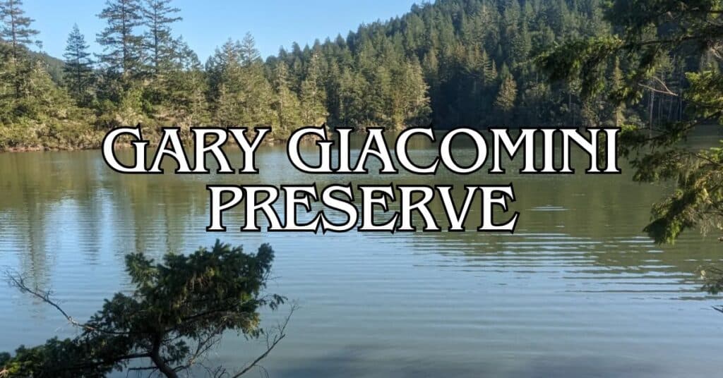
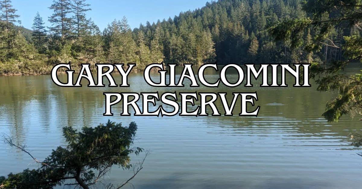
Gary Giacomini Preserve is tucked away in Marin County and really lives up to the “hidden gem” label. This place has a wild mix of landscapes, so whether you’re a casual hiker or someone chasing elevation, you’ll find something that fits. The preserve links up with White Hill and Cascade Canyon preserves, and it borders Marin Municipal Water District land near Kent Lake. That means you get this huge, mostly untouched wilderness full of redwood groves, ridge lines, and some pretty epic Marin County views.
What makes this spot stand out? The terrain’s all over the place—in a good way. You’ll wander over grassy hills on San Geronimo Ridge, down into canyons, and even through a weirdly cool dwarf forest. Some trails are mellow, others will have your legs burning. One of the favorites is the Kent Lake via Candalero Canyon Loop, which gets a lot of love from folks on the trail.
Discover hand-picked hotels and vacation homes tailored for every traveler. Skip booking fees and secure your dream stay today with real-time availability!
Browse Accommodations Now
When you head out to Gary Giacomini, you’re diving into a patchwork of Northern California’s best natural features. It’s a real getaway from city noise, but you don’t have to drive for hours to get there. Multiple entry points and trail connections let you pick your own adventure, whether you’re out for an hour or the whole day.
Overview of Gary Giacomini Preserve
Gary Giacomini Preserve sprawls across a chunk of Marin County, offering all sorts of diverse ecosystems—from shady redwood stands to dry chaparral. It connects with other preserves, so you’re looking at one of Marin’s largest protected areas.
Location and Geography
The preserve sits out in western Marin County, part of the Bay Area’s patchwork of open space. It’s connected to White Hill and Cascade Canyon, so you can roam for miles without retracing your steps. It also hugs the Marin Municipal Water District land above Kent Lake, which just adds to the sense of endless wilderness.
You’ll move between dense forests and wide-open ridges, and that variety means you’ll hit different microclimates as you go. Some trails climb pretty high, while others just meander. There are about 10 trails here, ranging from shaded forest strolls to sun-baked ridges with killer views.
Conservation and Management
Marin County Parks manages Gary Giacomini with an eye on habitat restoration and keeping recreation sustainable. They work to restore damaged spots and have turned old, unofficial trails into a solid system. The Marin County Open Space District crew is out there improving trails and protecting sensitive areas.
They try to balance public access with protecting the land. Sometimes, they’ll close off certain areas during breeding season or after big storms to prevent damage. Thanks to all this, you get well-kept trails and nature that actually feels wild.
Notable Features
One thing that sets this preserve apart is its variety—especially the odd little dwarf forest, which exists thanks to the area’s unique soil and climate. The redwood groves are a lifesaver on hot days, with their deep shade and peaceful vibe. Up on the ridges, you’ll catch sweeping views across Marin.
If you’re short on time, there’s a 3.5-mile “lollipop” trail that hits both redwoods and chaparral, showing off the preserve’s diversity in one go.
Wildlife? There’s plenty. Birds, the occasional deer or bobcat, and thanks to the preserve’s size and links to other open spaces, you’ll see all sorts of critters moving through these wildlife corridors.
Planning Your Visit
If you want your trip to Gary Giacomini to go smoothly, a little planning helps. There are trails through redwoods, up on ridges, and into some truly oddball habitats like the dwarf forest.
Best Times to Visit
Spring and fall are probably the sweet spot here. In spring (March–May), wildflowers are everywhere and the hills go neon green. Fall (September–November) usually means clear skies and crisp air, perfect for long views.
Summer can get toasty, especially on the exposed ridges, so go early if you don’t want to roast. Winter (December–February) brings mud and slippery trails—some folks love the solitude, but it’s not for everyone.
Weekdays are much quieter than weekends. If you’re hoping for a peaceful hike, aim for a Tuesday or Wednesday morning. You’ll have the trails mostly to yourself.
Access and Parking
Getting in isn’t complicated, but parking’s a bit of a scramble:
Main Access Point:
- From Highway 101, exit at Sir Francis Drake Boulevard
- Take Meadow Way in San Geronimo
- Right onto Sylvestris Drive (which turns into Tamarack Road)
- Watch for tiny roadside parking spots
No big parking lots here—just small roadside pullouts. Show up early, especially on weekends, if you want a spot. Carpooling is a smart move.
Since the preserve connects to other open spaces, you can easily extend your hike if you’re feeling ambitious.
Visitor Guidelines
Gary Giacomini Preserve is open to lots of activities, but there are a few rules to keep things wild:
Allowed:
- Hiking (stick to marked trails)
- Mountain biking (on certain routes)
- Horseback riding
- Dogs (leashed or under reliable voice control)
Rules to Know:
- Stay on trails—protects plants and keeps you out of poison oak
- Pack out your trash (there aren’t any bins)
- Let horses pass, and mountain bikers yield to everyone else
- No smoking or fires
No restrooms or water fountains, so bring plenty of water and, well, plan ahead for bathroom breaks.
Trail Experiences
Gary Giacomini’s trails wind through everything from towering redwoods to open ridges and that funky dwarf forest. There’s a trail for every mood.
Popular Hiking Trails
San Geronimo Ridge Trail is the big one—spanning the ridge and linking up with smaller paths. You’ll get both forest shade and wide-open views.
Conifer Fire Road is another go-to, especially if you want to wander under redwoods. On hot days, it’s a lifesaver.
Hunt Camp Trail gets you into the pygmy forest, where the trees are so stunted it almost feels otherworldly.
If you’re after solitude, Contour Trail is less traveled and hugs the natural lay of the land—great for some peace and quiet.
Trail Lengths and Difficulty
There’s about 9 miles of official trail here, mostly in the easy to moderate range. Elevation changes keep things interesting, but nothing too extreme.
- San Geronimo Ridge Trail: about 3.5 miles one-way, with steady climbs and big views
- Hunt Camp Trail: 1.2 miles (moderate)
- Contour Trail: 1.8 miles (easy to moderate)
- Conifer Fire Road: 2.3 miles (easy)
Most trails are dirt, sometimes rocky—good shoes are a must, especially after rain. No paved routes, so it’s not ideal for strollers or anyone needing flat, accessible paths.
Scenic Viewpoints
San Geronimo Ridge has some of the best overlooks. You can see all the way to Mount Tamalpais and, on a clear day, even San Francisco Bay.
Barnabe Peak Vista Point is probably the top spot for panoramas:
- San Pablo Bay to the east
- Mount Tam to the south
- Pacific Ocean to the west (if you’re lucky and it’s super clear)
The redwoods along Conifer Fire Road aren’t about the views, but the way sunlight filters through the branches is something else.
Find the perfect hotel or vacation rental. Instant booking, no fees!
View Top Stays
Views change with the seasons—spring brings wildflowers, fall means crisp, clear air.
Out and Back Hike Routes
If you’re just out for a couple hours, try the 3.5-mile out-and-back from Conifer Trailhead along Conifer Fire Road. It’s an easy stroll through redwoods—about two hours if you take your time.
Feeling energetic? The 5-mile out-and-back from San Geronimo Ridge Trailhead to Barnabe Peak Vista Point has more climbing, but the views are worth it.
Curious about the pygmy forest? Hunt Camp Trail to the dwarf trees makes a neat 2.4-mile round trip. The stunted trees are a weird and fascinating sight.
Early morning or late afternoon hikes are best for spotting wildlife and catching the forest in great light for photos.
Wildlife and Natural Habitats
This preserve packs a surprising variety of habitats into one spot—redwoods, meadows, and some oddball soil types that support rare plants and animals.
Flora: Lupines and Poppies
Come spring and early summer, the wildflowers are impossible to miss. Lupines pop up all over, with their purple spikes and star-shaped leaves. California poppies add those iconic orange bursts in sunlit meadows.
You’ll also see:
- Blue-eyed grass
- Checker bloom
- Shooting stars
- Miner’s lettuce
Some areas have serpentine soils, which are tough for most plants but perfect for certain rare species. If you’re into botany, it’s worth exploring.
Fauna and Bird Watching
Wildlife is everywhere if you know when and where to look. You might spot:
- Black-tailed deer
- Gray foxes
- Bobcats
- Raccoons
- Brush rabbits
Birders love this place—over 100 species hang out here. Red-tailed hawks soar above, and you’ll hear acorn woodpeckers drilling away in the oaks.
Spring migration brings flashes of color as warblers pass through. Year-round residents include spotted towhees, Steller’s jays, and chestnut-backed chickadees.
Dawn and dusk are prime wildlife hours. Just remember: watch from a distance and don’t feed the animals.
Coastal Scrub and Marshlands
Out west, you’ll hit coastal scrub habitat—think tough, drought-loving shrubs and grasses. Fog drifts in and keeps things cool, which these plants seem to love.
Look for:
- Coyote brush
- California sagebrush
- Sticky monkeyflower
- Poison oak (seriously, keep an eye out)
Some shallow marshes pop up where water pools, especially after rain. These spots are magnets for amphibians like Pacific chorus frogs and California newts.
The edges where different habitats meet are where you’ll see the most action. These transition zones support a wild mix of plants and animals—nature’s version of a bustling neighborhood.
Endangered and Protected Species
Gary Giacomini Preserve is a lifeline for several species protected under the Endangered Species Act. The northern spotted owl finds shelter in the preserve’s mature forest—old-growth trees here make perfect nesting grounds.
One of the last populations of the Point Reyes mountain beaver hangs on in these hills, too. This rare little rodent lives only in a handful of Marin County spots. You’ll probably never see one, but you might notice their quirky burrow systems if you’re paying attention.
Some rare plants call this place home as well, like Marin dwarf flax and Tiburon buckwheat. They’ve managed to adapt to the harsh serpentine soils, thriving where most plants can’t handle the heavy metals.
If you visit, please stick to the trails. It really does make a difference for these fragile habitats.
Recreation and Nearby Attractions
Gary Giacomini Preserve is a bit of a playground for outdoor lovers, no matter your age. It’s linked to a web of other parks, so you can really make a day (or several) out of exploring Marin’s wild side.
Riding Trails
San Geronimo Ridge Fire Road is the main event here—a five-mile stretch along a ridgeline with some knockout views. The elevation gain (from 308 up to 2,060 feet) keeps things interesting but manageable for most.
Mountain bikers love the mix of terrain. If you’re looking for even more technical riding, Camp Tamarancho is just down the road and has some tough trails.
Horseback riders are welcome, too. The broad fire roads are horse-friendly, and you can link up to White Hill and Cascade Canyon for longer rides.
A few quick tips:
- Always check trail conditions before heading out
- Bring more water than you think you’ll need
- Weekdays are way quieter if you’re hoping to avoid crowds
Family-Friendly Activities
The redwood groves in the preserve are perfect for wandering with kids. You’ll find wildflowers, funky mushrooms, and maybe even spot a deer or two along the easier trails.
Cascade Falls is just next door in Cascade Canyon—a great family hike, especially in winter and spring when the water’s flowing strong.
Roy’s Redwoods Preserve is a quick drive and has gentle trails under giant trees. Kids seem to love the atmosphere—there’s something magical about those towering redwoods.
Some ideas for younger explorers:
- Nature scavenger hunts
- Bird watching (binoculars make it more fun)
- Tree ID games
- Junior ranger activities
Picnicking Spots
You’ll find a few natural clearings along San Geronimo Ridge that are just right for a picnic—valley views, plenty of shade, and enough space to spread out.
Where the preserve meets White Hill, there are flat areas that work well for small groups. Just remember, there aren’t many trash cans or facilities, so you’ll need to pack everything out.
If you want a more developed spot, Sky Trail and the Inkwells aren’t far. The Inkwells (a set of swimming holes in San Geronimo Creek) are a local favorite for a summer picnic and a quick dip.
Luxury stays to cozy cottages await, all with instant booking. Find the best deals!
Browse Marin Stays
What’s worth bringing?
- A portable water filter
- Sunscreen or a hat
- A light blanket you can stuff in your pack
- Binoculars for checking out birds or distant wildlife
Connections to Other Open Space Preserves
Gary Giacomini Preserve is kind of a lynchpin in Marin’s network of parks. It links up with a handful of other preserves, letting hikers and wildlife move through miles of wild country without interruption.
Close-By Parks and Preserves
The preserve connects right up with White Hill and Cascade Canyon, so you can hike seamlessly between them. From the west side, you can reach Roy’s Redwoods via connecting trails. It also borders Marin Municipal Water District land above Kent Lake, so you’re really at the edge of a huge wilderness.
Baltimore Canyon Open Space Preserve is close, too, and has more redwoods to explore. If you’re the type who likes to hit a few preserves in one day, these links mean you can keep hiking without having to hop in the car.
Indian Tree Open Space Preserve is a short drive away, adding even more variety if you’re on a roll.
State and Regional Park Network
Gary Giacomini is part of a larger patchwork of protected lands, including Samuel P. Taylor State Park to the northwest. This helps safeguard the Lagunitas Creek watershed, which is crucial for endangered species.
The preserve sits in the western part of Marin, within the broader Mount Tamalpais ecosystem. Other big preserves in the Mount Tam area—like Blithedale Summit and Camino Alto—aren’t directly connected but aren’t far.
All together, these parks form a protected corridor stretching from the Marin Headlands up through the county. County, state, and water district lands overlap here, so you get everything from coastal overlooks to deep redwood forests.
Hiking Links and Trail Continuity
The trail network in Gary Giacomini links you to over 25,000 acres of wildlands. San Geronimo Ridge Fire Road cuts through the preserve and connects to a bunch of other trail systems.
You can start in a redwood grove and end up on a ridge with sweeping views, all without leaving the network. If you’re into backpacking, these trails let you plan multi-day trips (permits needed, of course).
Day hikers can mix and match routes to fit their mood or energy level. It’s also a great jumping-off point for the dwarf forest on Pine Mountain and other unique habitats nearby.
Trail signs at the big junctions help you find your way, but honestly, a good old-fashioned map never hurts.
Water Features and Landscapes
Gary Giacomini Preserve has a surprising mix of water features that change with the seasons. Streams, waterfalls, and marshy pockets all create habitat for wildlife—and just make hiking here prettier.
Streams and Marshes
After winter rains, several seasonal streams wind through the preserve, carving deep ravines you’ll see mentioned in hiking books.
The most accessible streams run alongside San Geronimo Ridge Trail, and there are small bridges to help you cross when things get soggy. By summer, a lot of these creeks shrink down or dry up.
Low-lying spots turn marshy, supporting plants like cattails and drawing in amphibians—Pacific chorus frogs, California newts, that sort of thing.
If you’re hoping to see the marshes at their best, aim for December through April. Waterproof boots are a smart call if you’re venturing off the main path.
Buck Gulch Falls and Other Waterfalls
Buck Gulch Falls is a bit of a secret—impressive only right after heavy rain. It drops about 25 feet over mossy rocks, but don’t expect Niagara.
To get there:
- Start on San Geronimo Ridge Trail
- Take Buck Gulch Trail
- Hike about 1.2 miles to the falls viewpoint
Cataract Falls is nearby (technically outside the preserve on water district land), and after winter storms, it puts on a dramatic show.
For photos, shoot for morning light. January to March usually has the best flow.
Proximity to Tomales Bay and Bodega Bay
While the preserve doesn’t touch the coast, some of the higher trails give you distant views of Tomales Bay and Bodega Bay when the weather’s clear.
Tomales Bay is about eight miles northwest—a long, skinny inlet along the San Andreas Fault. It’s a great spot for kayaking or birdwatching if you want to extend your adventure.
Bodega Bay is further—20 miles north, around a 40-minute drive. It’s a working fishing harbor with good seafood, coastal hikes, and whale watching when the season’s right.
From the top of San Geronimo Ridge, you might catch the glint of water on the horizon. The Coastal Trail section is probably your best bet for those long views.
Nearby Towns and Beaches
The preserve is surrounded by some pretty charming coastal towns and beaches. If you want to mix up your hike with a bit of local flavor or a walk on the sand, you’ve got options.
Exploring Bolinas
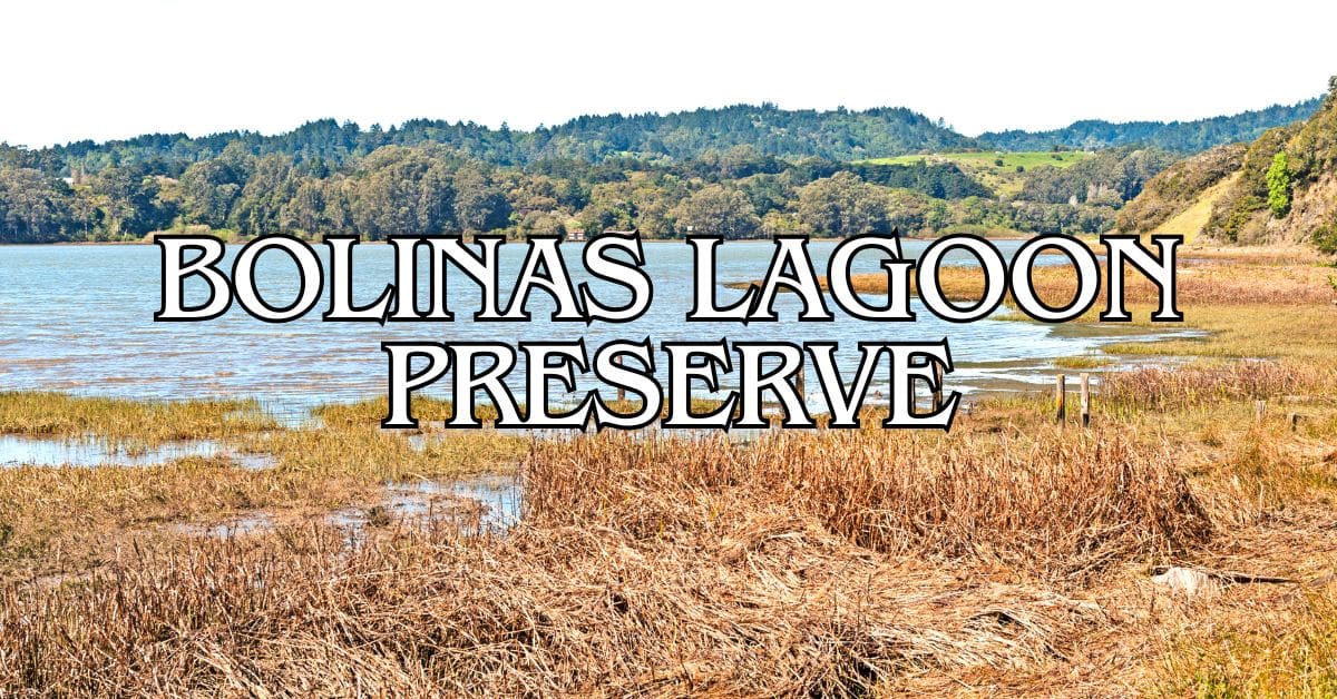
Bolinas is a quirky little beach town—famous for its “hidden” vibe and unmarked roads. It’s about 20 minutes from the preserve, tucked up against Bolinas Lagoon, which is packed with birdlife.
Downtown is small but lively, with local shops, galleries, and a few casual spots for seafood. The Bolinas Museum is worth checking out for a dose of local history and art.
Bolinas Beach is a good spot for beginner surfers. The waves are gentler than at some other Marin beaches, thanks to the protected bay.
If you’re into birding, the Bolinas Lagoon Preserve is a must—over 245 species have been spotted there.
Visiting Stinson Beach and Muir Beach
Stinson Beach is about a 25-minute drive and offers three miles of white sand. It’s popular, so you’ll find:
- Restrooms and showers
- Lifeguards in summer
- Picnic areas with grills
- A little town center with food and shops
The water’s cold year-round, but swimming is doable in the warmer months.
Muir Beach is smaller and quieter, nestled in a cove about 30 minutes away. It’s peaceful, with scenic overlooks and the cozy Pelican Inn (a Tudor-style pub and hotel) nearby. You can also hop onto the Coastal Trail from here.
Both beaches connect to classic Marin hiking trails with big ocean views.
Regional Context and Broader Connections
Gary Giacomini Preserve sits in the middle of Marin’s huge patchwork of protected lands, all the way up to neighboring regions. This place matters for wildlife corridors and the overall health of Northern California’s ecosystems.
Marin County’s Role in Conservation
Marin County’s got a real reputation for land conservation—over 84,000 acres of open space protected so far, with Gary Giacomini being one of the highlights. It neighbors Marin Municipal Water District land, creating a green belt that stretches to Mount Tamalpais.
The way Marin’s communities have rallied to protect these places is honestly inspiring. Their approach has set the standard for other counties in Northern California.
Most of the preserves link up, so wildlife can actually move between them. That’s huge for keeping animal populations healthy and plant life diverse.
Relation to Sonoma County and the Bay Area
Visiting Gary Giacomini means you’re stepping into part of a broader Bay Area green belt. The preserve sits close to the Sonoma County border, helping tie together the region’s wild lands.
The Bay Area’s nine counties—including Marin and Sonoma—collaborate on conservation plans to keep development from carving up these vital corridors.
From the higher trails, you can look out across the bay and see other protected areas. It’s a good reminder that Gary Giacomini isn’t just a local spot—it’s part of a much bigger wild network that weaves through city and country alike.
Open Spaces Across Northern California
Northern California has this sprawling patchwork of protected areas, running from Marin County up toward the Oregon border. Gary Giacomini Preserve is just one piece in that bigger conservation puzzle.
If you keep heading north, you’ll notice similar ecological work happening in Mendocino and Humboldt counties. These places protect coastal redwoods and inland forests, and honestly, a lot of the same plants and animals call both Marin and those northern preserves home.
The conservation strategies at Gary Giacomini have actually shaped how folks approach preservation in spots like Eureka and Crescent City. Up there, people wrestle with the same tricky balance between growth and protecting the environment.
It’s kind of like California’s open spaces form a necklace of protected land. Gary Giacomini sits as one of the southern gems, with the whole chain stretching up toward Washington state.
Find available hotels and vacation homes instantly. No fees, best rates guaranteed!
Check Availability Now
Bolinas Lagoon Preserve Travel Guide – Accessibility, Amenities, Activities, and More!
Bolinas Park Travel Guide – Accessibility, Amenities, Activities, and More!
Dias Ridge Travel Guide – Accessibility, Amenities, Activities, and More!
Forest Knolls Park Travel Guide – Accessibility, Amenities, Activities, and More!
French Ranch Preserve Travel Guide – Accessibility, Amenities, Activities, and More!
Gary Giacomini Preserve Travel Guide – Accessibility, Amenities, Activities, and More!
Lagunitas Skatepark Travel Guide – Accessibility, Amenities, Activities, and More!
Martinelli Ranch Travel Guide – Accessibility, Amenities, Activities, and More!
Maurice Thorner Preserve Travel Guide – Accessibility, Amenities, Activities, and More!
Miller Boat Launch Travel Guide – Accessibility, Amenities, Activities, and More!
Olema Valley Travel Guide – Accessibility, Amenities, Activities, and More!
Point Reyes National Seashore Travel Guide – Accessibility, Amenities, Activities, and More!
Rocky Point Travel Guide – Accessibility, Amenities, Activities, and More!
Roy’s Redwoods Preserve Travel Guide – Accessibility, Amenities, Activities, and More!
Samuel P. Taylor State Park Travel Guide – Accessibility, Amenities, Activities, and More!
San Geronimo Commons Travel Guide – Accessibility, Amenities, Activities, and More!
Tomales Bay State Park Travel Guide – Accessibility, Amenities, Activities, and More!
Upton Beach Travel Guide – Accessibility, Amenities, Activities, and More!
Village Green Park Travel Guide – Accessibility, Amenities, Activities, and More!
Whitehouse Pool Park Travel Guide – Accessibility, Amenities, Activities, and More!


