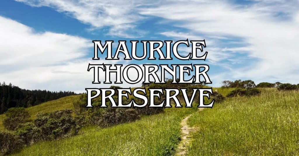
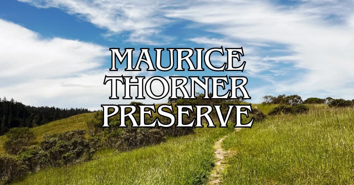
Tucked away in the rolling hills of Marin County, Maurice Thorner Preserve offers a peaceful escape for hikers who crave solitude. This small, lesser-known open space near San Geronimo is strictly for walking—no bikes, horses, or motorized vehicles allowed.
The main highlight here is the Thorner Ridge Trail. Folks who visit tend to rave about the natural beauty and the quiet you get out there. It links up with nearby French Ranch and Roy’s Redwoods preserves, so if you feel like wandering farther, you’ve got options for longer hikes.
Discover hand-picked hotels and vacation homes tailored for every traveler. Skip booking fees and secure your dream stay today with real-time availability!
Browse Accommodations Now
If you’re planning a visit, keep in mind the rules—they’re strict for a reason. No smoking, fires, weapons, hunting, drones, or model airplanes. Those guidelines help keep this place as pristine as possible for everyone who stumbles upon it.
Overview of Maurice Thorner Preserve
Maurice Thorner Preserve is a small, peaceful retreat in Marin County where you can unwind on a single, gently sloping trail with some pretty sweet valley views.
Location and Accessibility
You’ll find Maurice Thorner Preserve just outside San Geronimo in Marin County, California. It’s about 33 acres perched above the San Geronimo Valley, and you can get there from Sir Francis Drake Boulevard—the main drag that ties together a lot of Marin’s open spaces.
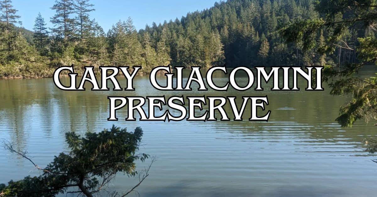
There’s just one trail here, and it climbs gently up to a ridge. That makes it friendly for most hikers, even families with kids. The path isn’t long, but on a clear day, you’ll get great views of White Hill and Gary Giacomini Preserve.
Parking is pretty limited near the trailhead, so if you’re coming on a weekend or holiday, showing up early is smart. The preserve opens at sunrise and closes at sunset, and you don’t have to pay to get in.
History and Conservation Efforts
Maurice Thorner Preserve came about to protect this little slice of Marin’s natural landscape. It’s named after Maurice Thorner, who had some connection to local conservation, though the details aren’t as well-known as with other preserves.
Marin County Parks manages the place, keeping an eye on both public access and the health of the environment. They focus on preserving native plants and wildlife habitats. Even though it’s small, the preserve plays a key role in connecting Marin’s larger network of protected land.
Being so close to the Bay Area’s urban sprawl, it’s a spot that helps keep biodiversity alive in the region.
Natural Landscape and Habitats
This preserve shows off classic Marin County scenery—think grassy hills, chaparral, and patches of woodland. In spring, open meadows burst with wildflowers, brightening up the golden hills.
The gentle change in elevation gives you a mix of plant life. Oak woodlands offer shade along the way, while manzanita and other sun-loving shrubs fill in the open spots.
Wildlife you might bump into (or at least spot from a distance) includes:
- Black-tailed deer
- Rabbits and squirrels
- Plenty of birds
- The occasional coyote
If you make it to the ridge at the end of the trail, you’ll catch panoramic views of the surrounding hills and valleys. On a clear day, you can see how Maurice Thorner ties into Marin’s web of open spaces.
Visitor Experience and Activities
Maurice Thorner Preserve gives you a low-key escape in the San Geronimo Valley. It’s perfect for hikers, birders, and anyone who just wants a dose of nature without the crowds.
Hiking and Paved Trails
There’s just one main trail, gently sloping up to a ridge that looks out over San Geronimo Valley. It’s an easy walk—great for beginners or anyone wanting a mellow outing.
When the weather’s clear, you’ll get lovely views of White Hill and Gary Giacomini Preserve. The trail is well-kept and suits most people, fitness-wise.
Unlike some of the Bay Area’s more packed hiking spots, Maurice Thorner Preserve usually stays quiet. If you’re after a peaceful walk, this is your place.
Trail Details:
- Length: About 1 mile round trip
- Difficulty: Easy to moderate
- Surface: Natural dirt path
- Elevation gain: Minimal
Bird Watching Opportunities
Thanks to its variety of habitats, this preserve is a decent spot for bird watching. The blend of grasslands and woods brings in all sorts of birds year-round.
Keep your eyes peeled for:
- Red-tailed hawks
- California quail
- Acorn woodpeckers
- Western bluebirds
If you’ve got binoculars, bring them—lots of birds hang out near the main trail. Early mornings are usually the best time to catch the most action.
Since there’s just one trail, it’s easy to cover the whole preserve and see a solid variety of birds even on a short visit.
Guided Tours and Educational Programs
Marin County Parks sometimes hosts guided nature walks at Maurice Thorner Preserve. These walks dive into the local ecosystem and a bit of the area’s history.
Topics usually include:
- Native plant ID
- Wildlife habitats
- Conservation work
- What’s changing seasonally
You’ll want to check the Marin County Parks website for schedules and sign-ups. Most programs are free, but spots can fill up, so registering ahead is a good idea.
They offer family-friendly programs throughout the year, so bringing kids or school groups can be a fun way to get outside and learn. The easy trail makes it accessible for all ages.
Wildlife and Plant Life
Maurice Thorner Preserve packs a lot of California’s native ecosystem into its 33 acres. You’ll get a close look at local plants and animals, even on a short hike.
Native Flora
You’ll spot a nice variety of trees—madrone, coast live oak, big-leaf maple, and California bay are everywhere. California nutmeg and hazelnut trees pop up here too, adding to the mix.
Coyote brush is common in the shrubs. It’s a favorite for both insects and birds.
Find the perfect hotel or vacation rental. Instant booking, no fees!
View Top Stays
The plant communities here really show off Northern California’s unique climate—wet winters, dry summers. If you pay attention, you’ll notice something different every time you visit, especially as the seasons shift.
Native Fauna
Wildlife seems to thrive in this protected spot. Birders will find plenty to watch.
The northern spotted owl, which is federally endangered, has been spotted in Roy’s Redwoods Preserve nearby, so it’s possible they pass through here too.
You might see deer, raccoons, and maybe a coyote if you’re lucky (or just out at dawn or dusk). The edges where forest meets meadow are usually the best for spotting wildlife.
If you do see animals, it’s best to keep your distance. Binoculars help you get a closer look without bothering them.
Seasonal Highlights
Spring is wildflower season—look for mariposa lilies tucked among the grass and along the woodland edges. They’re small but add real pops of color.
Come fall and winter, you’ll see the leaves change and the landscape comes alive again after the rains. Big-leaf maples turn gold, which looks great against all the evergreens.
Sometimes, Marin County Parks and the Fire Department do pile burning here. Controlled burns help keep the vegetation in check and lower wildfire risk.
Spring migration brings a burst of bird activity between March and June—prime time for bird watching. Winter rains wake up the mushrooms and new growth, which draws in more wildlife.
Nearby Parks and Preserves
Marin County has a bunch of other open spaces within a short drive of Maurice Thorner Preserve. Each one brings something a little different to the table.
Alto Bowl Open Space Preserve
Alto Bowl Open Space Preserve covers 38 acres between Mill Valley and Corte Madera. You’ll find open grasslands and oak woodlands, plus sweeping views of Mount Tamalpais and Richardson Bay.
The Horse Hill Trail is a moderate 2-mile loop, popular with hikers and horseback riders alike. Horses graze in designated spots, and the preserve even has a horse boarding program.
You’ll often see deer, hawks, and songbirds. In spring, the wildflowers really light up the hills.
Trailheads are at the end of Coach Road in Mill Valley or from Casa Buena Drive in Corte Madera. But heads up—parking is street-only and can fill up.
Baltimore Canyon Open Space Preserve
Baltimore Canyon is a cool, shady spot with 193 acres of redwoods and creeks lined with ferns. It sits in a deep valley in Larkspur, creating a damp, lush microclimate.
The Dawn Falls Trail (1.8 miles one-way) leads you to a seasonal waterfall that really comes alive after winter storms. The thick canopy keeps things cool, so it’s a great place to hike in the summer.
You’ll find sword ferns, trillium, and banana slugs along the creek. Birders can watch for woodpeckers, owls, and thrushes.
Main access is from the end of Madrone Avenue in Larkspur, or you can enter from the Southern Marin Line Fire Road.
Blithedale Summit Open Space Preserve
Blithedale Summit sprawls over 899 acres along the southern slopes of Mount Tamalpais, between Mill Valley and Corte Madera. It connects with other preserves, making for a huge network of trails.
The Southern Marin Line and Blithedale Ridge fire roads are tough climbs but worth it for the Bay Area views. Oak and madrone forests offer plenty of shade.
In spring, look for California poppies, lupine, and shooting stars. Wildlife is varied—deer, foxes, and sometimes even a bobcat.
You can start from a bunch of different trailheads in Mill Valley, including at the end of Summit Avenue and Blithedale Avenue.
Water Features and Scenic Spots
Maurice Thorner Preserve has a few lovely water features that really show off Marin’s landscape. These spots are perfect for photos or just soaking in the quiet.
Buck Gulch Falls
Buck Gulch Falls is a small but charming waterfall tucked inside the preserve. It’s at its best during winter and spring, right after the rains, when the water really gets going.
To get there, follow the main trail for about 0.7 miles from the entrance. Parts of the path are a bit steep but nothing most hikers can’t handle.
The falls are surrounded by coast live oak and California bay, creating a shady little nook. It’s especially pretty in late winter when the water’s flowing strong.
If you’re into photography, bring your camera—catching the falls after a storm makes for some great shots. Morning light is usually best.
Cataract Falls
Cataract Falls sits right near the edge of Maurice Thorner Preserve, spilling over into neighboring public lands. This multi-tiered waterfall tumbles down a series of rocky steps, roaring to life during the rainy season.
You’ll reach the falls by hiking a 1.2-mile trail from the preserve’s western side. The path climbs about 250 feet, and as you go up, the views just keep getting better.
Shady woods of big-leaf maples and California nutmeg trees surround the falls. In spring, wildflowers—especially mariposa lilies—pop up all around.
Luxury stays to cozy cottages await, all with instant booking. Find the best deals!
Browse Marin Stays
Honestly, the best time to see Cataract Falls is between January and April, when the water’s really moving. Wear sturdy shoes; the trail can get slick near the falls, especially after rain.
Connecting Trails and Public Lands
Maurice Thorner Preserve links up with several other Marin County public lands through a web of trails and access points. Hikers and cyclists can easily wander beyond the preserve if they’re up for a longer adventure.
Bothin Marsh Open Space Preserve
Bothin Marsh feels totally different from the ridge trails at Thorner. It’s a wetland along Richardson Bay, with flat, easy paths—perfect for birdwatching or just a mellow stroll.
The Mill Valley-Sausalito Pathway cuts right through Bothin Marsh, making it a handy route for cyclists heading south from Thorner. You might spot over 100 bird species here, especially during migration.
Tidal and seasonal wetlands cover the area. Along the main trail, you’ll see signs explaining the marsh’s ecosystem and ongoing restoration projects. At high tide, the water views get pretty dramatic, with Mount Tamalpais looming in the distance—a seriously photogenic backdrop.
Deer Island Open Space Preserve
Deer Island Preserve, near Novato, connects into Marin’s bigger trail network. The main loop is about 2.1 miles, with some moderate hills.
You can get to Deer Island from Thorner Preserve via connecting roads and trails. Despite the name, it’s not really an island anymore—just a former island now attached to the mainland.
Oak woodlands dominate the scene, giving plenty of shade and shelter for wildlife. In spring, wildflowers dot the grassy hills. From the higher points, you’ll catch views of wetlands and Mount Burdell.
Reserve Access Points
Thorner Ridge Trail hooks up to a bridge over Nicasio Valley Road, letting you cross into Gary Giacomini Preserve. That opens up options for longer hikes or rides.
You’ve got a few ways to enter the preserve:
- Main entrance on Nicasio Valley Road
- Bridge from Gary Giacomini Preserve
- White Hill access trail (parking is pretty limited here)
Trail markers are easy to spot at junctions. Most trails are open to hikers, bikers, and horseback riders. Sometimes, during really wet weather, some trails close to prevent damage.
Planning Your Visit
Heading to Maurice Thorner Preserve? A little planning goes a long way. This compact, 33-acre spot offers a peaceful escape, but you won’t find many amenities—and the seasons make a difference.
Best Times to Visit
Spring (March-May) is honestly the sweet spot—wildflowers bloom, and the weather’s just right. Fall (September-November) is also great for hiking, with cooler temps and fewer people around.
Summer gets hot, and there’s not much shade. If you go then, bring extra water and sun protection.
In winter, expect muddy trails after rain—some spots can get pretty slippery or tough to cross during December through February.
Mornings are usually cooler and better for spotting wildlife. If you want quiet, weekdays beat weekends by a mile.
Rules and Visitor Guidelines
The preserve’s open from sunrise to sunset, free of charge.
Don’t forget:
- Water (no fountains)
- Hat and sunscreen
- Shoes that can handle mud
- Bug spray, especially in spring and summer
Keep pets on a leash and pick up after them—let’s keep it clean for everyone.
Stick to the marked trails to help protect the area. Bicycles aren’t allowed on hiking-only trails.
There aren’t any restrooms or trash cans, so pack out what you bring in and plan bathroom breaks ahead of time.
Parking’s pretty limited, just a few roadside spots. If you can, carpool—especially on weekends.
Local Culture and Community
The area around Maurice Thorner Preserve really shows off what makes Marin County unique—a mix of natural beauty and a community that genuinely cares about the land. You’ll notice a quiet, rural vibe, but also a strong environmental streak.
Marin County Population and Demographics
Marin County has about 260,000 people, spread out across towns and open spaces. Folks here are, on average, a bit older than the rest of California—median age is around 47.
It’s one of the wealthiest counties in the state, which you’ll see reflected in housing prices and local businesses. Lots of residents choose Marin specifically for its open spaces and scenery.
Towns near the preserve, like San Geronimo Valley and Lagunitas, are smaller and feel more rural than places in eastern Marin. You’ll meet artists, remote workers, and nature lovers who wouldn’t trade the quiet for anything.
Environmental protection is a big deal here, which is why there’s such an extensive network of preserved land.
Nearby Colleges and Educational Institutions
The closest college is College of Marin, with campuses in Kentfield and Novato. They offer a range of programs and often put on community events.
Dominican University in San Rafael is about 20 minutes east, offering four-year degrees and grad programs. Their sustainability work fits right in with local values.
UC Berkeley and Sonoma State aren’t in Marin, but they still have an impact here—plenty of faculty and students live nearby and add to the area’s intellectual buzz.
Sometimes, the preserve itself becomes an outdoor classroom for field trips or environmental studies. Local schools use Marin’s preserves to teach kids about ecology and conservation in a hands-on way.
Historical and Archaeological Context
Maurice Thorner Preserve sits on land with a deep cultural history, going back thousands of years. You’ll find traces of everything from indigenous villages to more recent Marin County developments.
Regional History and Early Settlements
Long before Europeans arrived, the Coast Miwok people lived here for over 3,000 years. They built villages in the San Geronimo Valley and had a deep understanding of local plants and wildlife.
Starting in the early 1800s, Spanish missions changed the region, followed by Mexican land grants that turned huge areas into ranchos. Those ranchos eventually became the foundation for today’s Marin communities.
In the late 1800s, logging swept through, and the old-growth redwoods around what’s now Maurice Thorner Preserve were cut to rebuild San Francisco after the Gold Rush.
Maurice Thorner, a local landowner who cared deeply about conservation, donated the land for the preserve.
Archaeological Evidence of the Area
Archaeologists digging near the preserve have found shell middens, stone tools, and grinding stones—clear signs that Coast Miwok people lived here. These discoveries show just how much indigenous communities relied on local resources for food, shelter, and daily life.
Some sites even turn up obsidian points from far-off places, hinting at surprisingly robust trade networks long before Europeans ever set foot here.
People probably set up seasonal camps in the valleys, sticking close to water. The ridge where the preserve’s trail runs? It might’ve been a well-trodden route connecting different villages.
Later on, ranchers and farmers left their mark. You’ll still spot old fence posts, crumbling foundations, and reshaped land—reminders of the agricultural era that really changed the look and feel of the San Geronimo Valley.
Find available hotels and vacation homes instantly. No fees, best rates guaranteed!
Check Availability Now
Bolinas Lagoon Preserve Travel Guide – Accessibility, Amenities, Activities, and More!
Bolinas Park Travel Guide – Accessibility, Amenities, Activities, and More!
Dias Ridge Travel Guide – Accessibility, Amenities, Activities, and More!
Forest Knolls Park Travel Guide – Accessibility, Amenities, Activities, and More!
French Ranch Preserve Travel Guide – Accessibility, Amenities, Activities, and More!
Gary Giacomini Preserve Travel Guide – Accessibility, Amenities, Activities, and More!
Lagunitas Skatepark Travel Guide – Accessibility, Amenities, Activities, and More!
Martinelli Ranch Travel Guide – Accessibility, Amenities, Activities, and More!
Maurice Thorner Preserve Travel Guide – Accessibility, Amenities, Activities, and More!
Miller Boat Launch Travel Guide – Accessibility, Amenities, Activities, and More!
Olema Valley Travel Guide – Accessibility, Amenities, Activities, and More!
Point Reyes National Seashore Travel Guide – Accessibility, Amenities, Activities, and More!
Rocky Point Travel Guide – Accessibility, Amenities, Activities, and More!
Roy’s Redwoods Preserve Travel Guide – Accessibility, Amenities, Activities, and More!
Samuel P. Taylor State Park Travel Guide – Accessibility, Amenities, Activities, and More!
San Geronimo Commons Travel Guide – Accessibility, Amenities, Activities, and More!
Tomales Bay State Park Travel Guide – Accessibility, Amenities, Activities, and More!
Upton Beach Travel Guide – Accessibility, Amenities, Activities, and More!
Village Green Park Travel Guide – Accessibility, Amenities, Activities, and More!
Whitehouse Pool Park Travel Guide – Accessibility, Amenities, Activities, and More!


