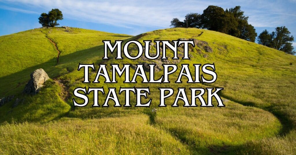
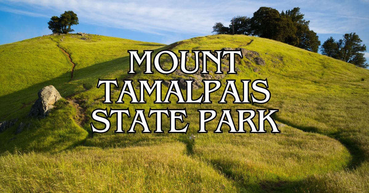
Rising from the heart of Marin County, Mount Tamalpais State Park is a natural treasure just north of San Francisco. Locals call it “Mt. Tam” for short. The park serves up sweeping views of the Bay Area—honestly, you won’t find anything quite like it elsewhere nearby.
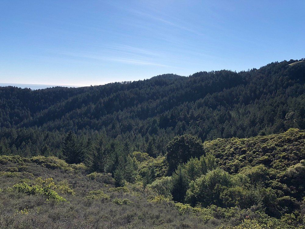
Mt. Tam gives visitors an incredible mix of activities from hiking the Dipsea Trail to mountain biking, camping, and even outdoor theater and stargazing. Deep canyons and rolling hills covered in cool redwood forests make it a haven for nature lovers. Whether you’re looking for a tough climb or a casual stroll, there’s a trail here for you.
Discover hand-picked hotels and vacation homes tailored for every traveler. Skip booking fees and secure your dream stay today with real-time availability!
Browse Accommodations Now
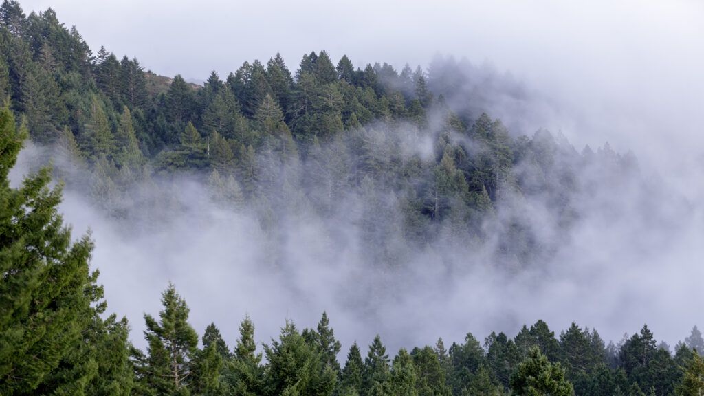
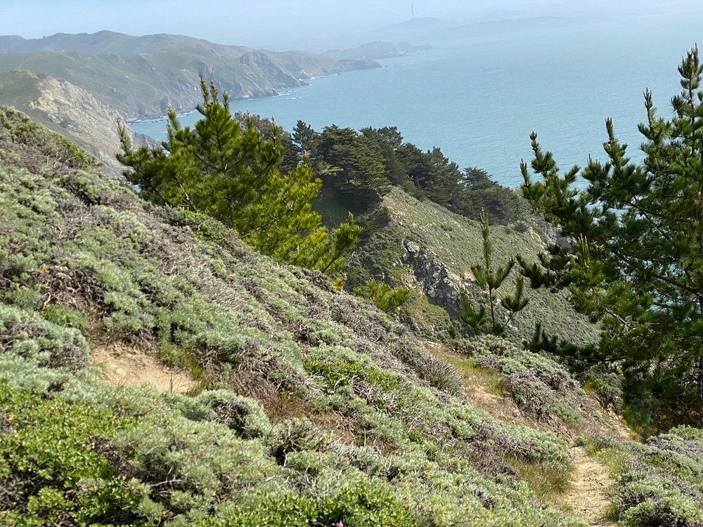
Try to make it up to the East Peak Summit. The winding roads can get crowded with cyclists and hikers, but it’s worth the effort. Mt. Tam is one of the Bay Area’s best outdoor escapes, offering a peaceful break from city life just a short drive from San Francisco.
Planning Your Visit
You’ll want to plan ahead for a smooth trip to Mount Tamalpais State Park. Figuring out the best way to get there, checking hours, and knowing about permits will make everything easier.
Getting to Mount Tamalpais State Park
Mount Tamalpais State Park sits in Marin County, about 20 miles north of San Francisco. Most folks drive up Highway 101 and use one of the main access points.
If you’re coming from San Francisco, cross the Golden Gate Bridge and head north on Highway 101. For East Peak, take the Highway 131/Tiburon Boulevard exit and follow signs to Panoramic Highway. For the west side, take Highway 1 and follow Shoreline Highway to Panoramic Highway.
Golden Gate Transit runs Route 61 from Sausalito to Pantoll Ranger Station on weekends and holidays during summer. It’s an option if you want to skip the parking hassle.
Parking fills up fast on weekends, especially at the popular trailheads. Try to arrive early if you can.
Park Hours and Entry Fees
The park opens at 7:00 AM and closes at sunset every day. Closing times shift with the seasons, so double-check before you head out.
Day use is $8 per vehicle. Got a California State Parks Pass? You’re covered. Seniors and disabled visitors get discounts, too.
Pay at the stations by the main entrances and leave your receipt on the dashboard. Some unofficial parking spots outside the entrances don’t charge, but they fill up even faster on busy days.
Park Rules and Accessibility
Dogs are allowed, but only in developed spots like picnic areas and campgrounds. Keep them on a leash (six feet max), and don’t take them on most trails.
Bicyclists can ride on fire roads and designated mountain biking trails. Single-track trails are for hikers only. Cyclists have to yield to hikers and always wear helmets.
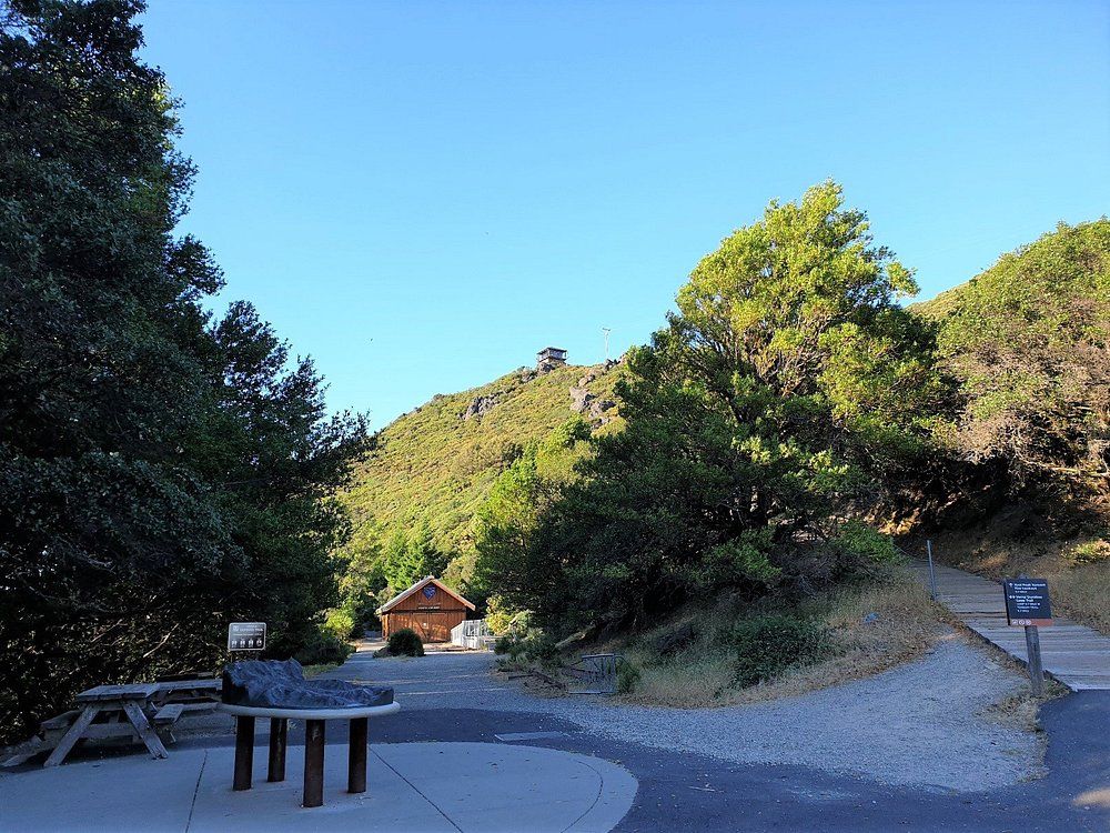
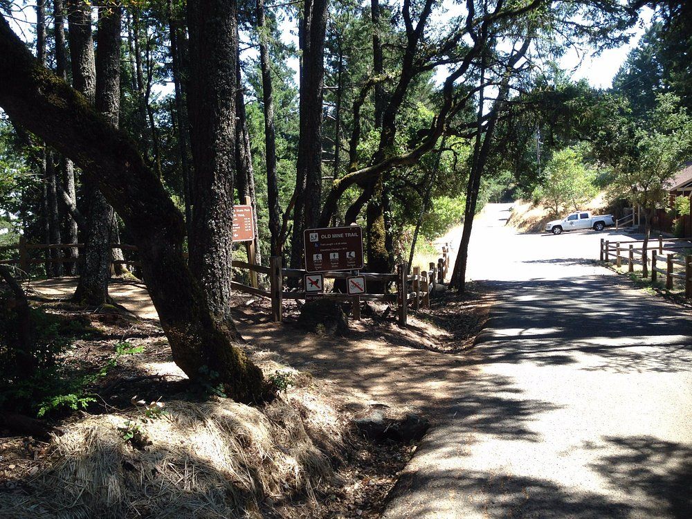
The park has some accessible trails and facilities. The Verna Dunshee Trail near East Peak is fully accessible and has great views. Lower Old Mine and McKennan Gulch trails are also good options for accessibility.
Open fires are only allowed in designated fire rings at campgrounds and picnic areas.
Reservations and Permits
If you’re planning to camp, book a spot up to 6 months ahead at ReserveCalifornia.com or call 1-800-444-7275. Steep Ravine cabins and campsites are super popular, so they tend to book out quickly.
You can reserve the Mountain Theater (Cushing Memorial Amphitheater) for special events. Apply at least 30 days in advance. Mountain Play is also held here.
Commercial filming and photography need permits—contact the park office at least 3 weeks before your shoot.
Group picnic areas at East Peak and Bootjack can handle up to 50 people. If your group is bigger than 25, you’ll need a reservation.
Hotels Near Mount Tamalpais State Park
If you’re doing a destination trip, here’s some nearby lodging options:
- See our article on Marin County Boutique Hotels.
- Read our articles on Marin County Budget Lodging and Marin County Motels.
- Read our articles on Marin County Hotels and Marin County Bed and Breakfasts.
Visitor Centers and Key Facilities
Mount Tamalpais State Park has a few facilities to make your visit smoother. Whether you’re just stopping by or staying a while, these spots offer info and essential services.
Visitor Center Overview
The Mount Tam Visitor Center sits right at the East Peak summit, offering panoramic Bay Area views. It’s only open on weekends, so plan accordingly.
Volunteers staff the center and know the park inside out. You can learn about the area’s history, wildlife, and trails, and check out displays on the mountain’s natural and cultural highlights.
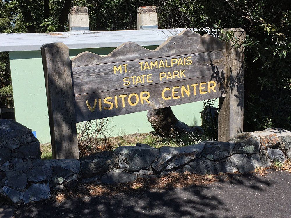
Inside, you’ll find maps, guides, and souvenirs. Volunteers can answer questions about trail conditions, wildlife, and what’s in season.
Outside, the viewing platforms are ideal for photos or just taking it all in.
Pantoll Ranger Station
Just off Panoramic Highway, the Pantoll Ranger Station is a central spot for park info. Unlike the East Peak Visitor Center, Pantoll is open more regularly.
At Pantoll, you can:
- Pick up hiking and camping maps
- Get trail recommendations from rangers
- Pay camping fees
- Learn about current park conditions and closures
The station is next to Pantoll Campground, which has basic tent camping facilities. Picnic tables make it a nice place to pause during your hike.
There are restrooms and water fountains here, which are a real lifesaver for hikers and campers.
Trail Map and Park Information
You can grab trail maps at both the East Peak Visitor Center and Pantoll Ranger Station. There are over 50 miles of trails, from mellow walks to tough hikes.
The park has two drive-in picnic areas:
- Bootjack Picnic Area
- East Peak Picnic Area
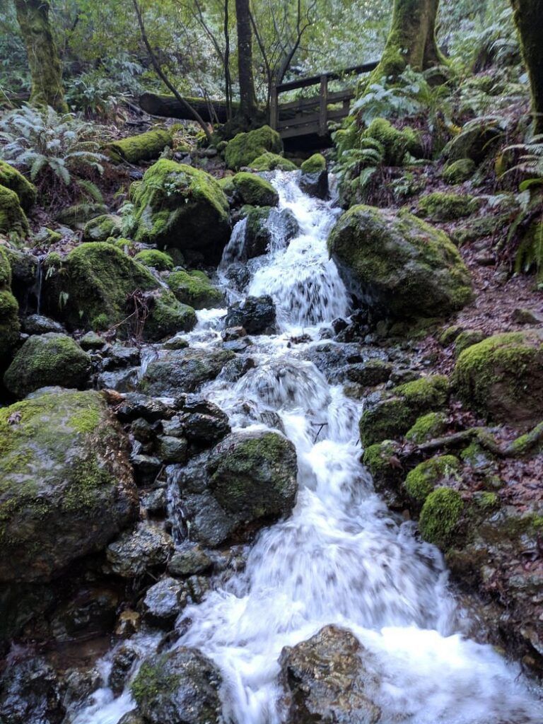
Both have tables, restrooms, and a pretty setting for a picnic.
If you’re visiting on a weekend, chat with park volunteers—they often know about quieter trails and seasonal highlights like wildflowers or bird migrations.
Find the perfect hotel or vacation rental. Instant booking, no fees!
View Top Stays
Always check trail conditions before you set out, especially in winter when rain can make things muddy or even unsafe. Info about current events, like shows at the Mountain Theater, is posted at the information centers.
Exploring Major Park Destinations
Mount Tamalpais State Park has a handful of standout spots that really show off what makes the area special. Each one offers something a little different, whether it’s sweeping summit views, ancient redwoods, or sandy beaches.
East Peak and the Summit Experience
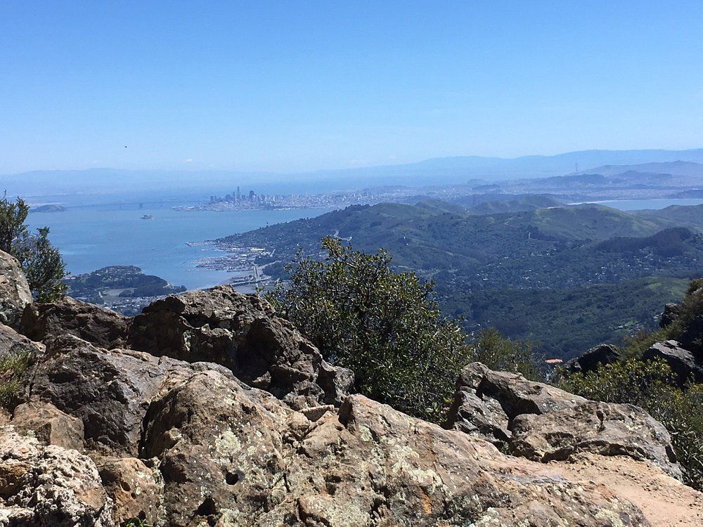
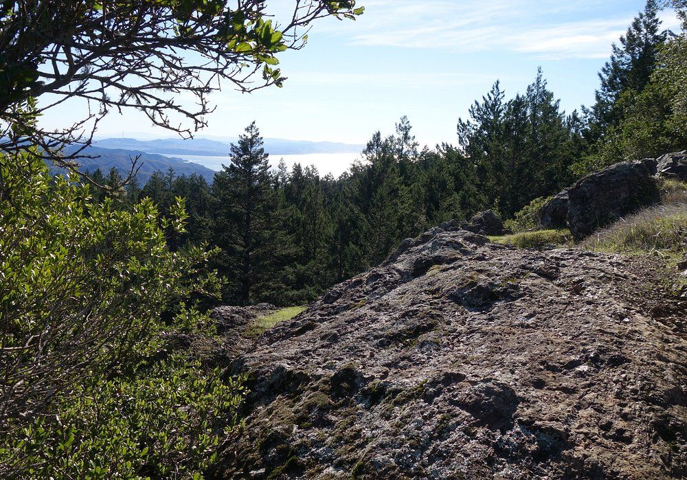
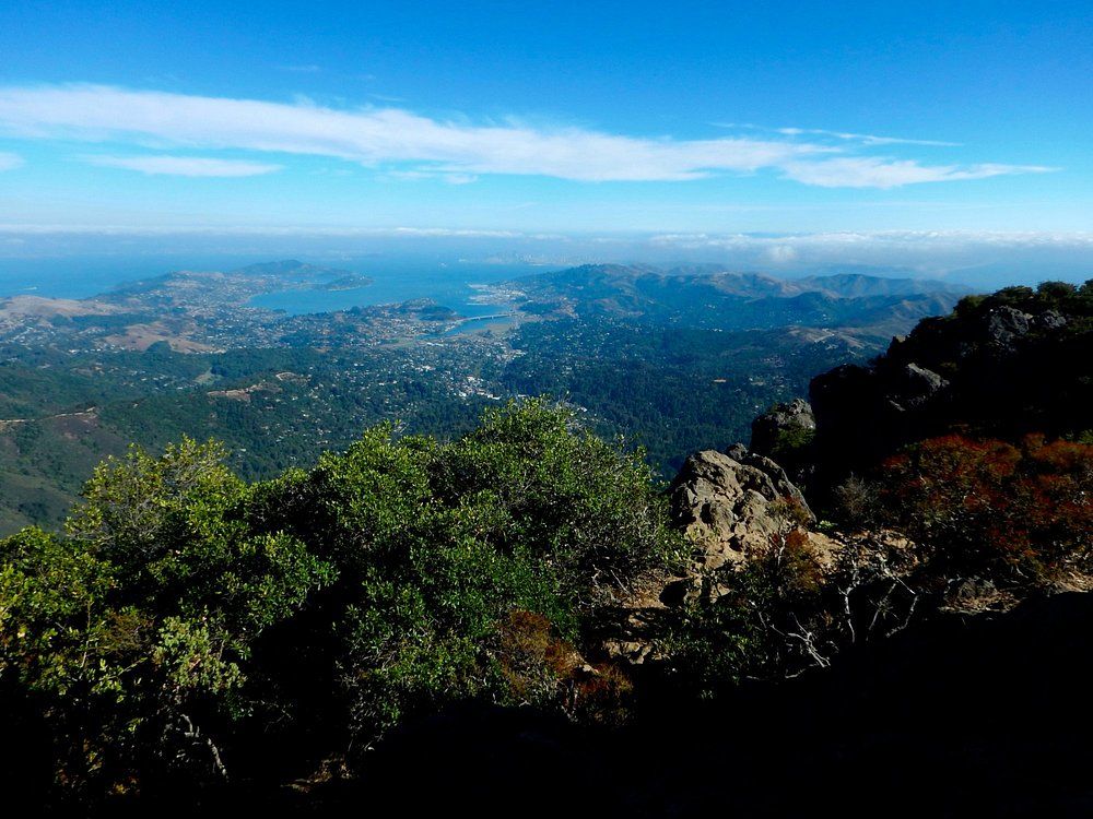
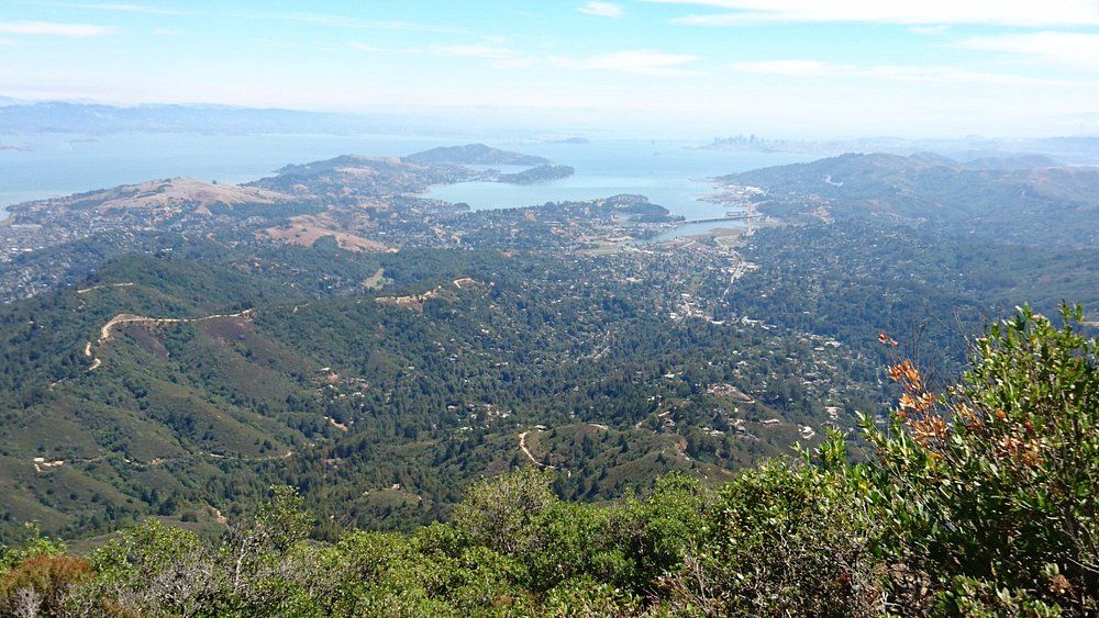
East Peak rises to 2,571 feet and delivers jaw-dropping 360-degree views. On a clear day, you might spot the Farallon Islands, San Francisco Bay, and a good chunk of Northern California.
The Fire Lookout at the summit is a small museum packed with history about the mountain. Bring binoculars if you want to spot distant landmarks or maybe catch some wildlife action.
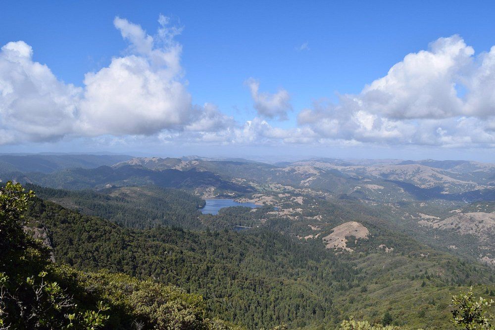
The Verna Dunshee Trail, a 0.7-mile paved loop, circles the summit and is accessible for most folks. There are lots of viewpoints and interpretive signs along the way.
East Peak’s parking area has picnic tables, restrooms, and water fountains. Parking goes fast on weekends, especially in the summer, so arriving early is your best bet.
Muir Woods National Monument
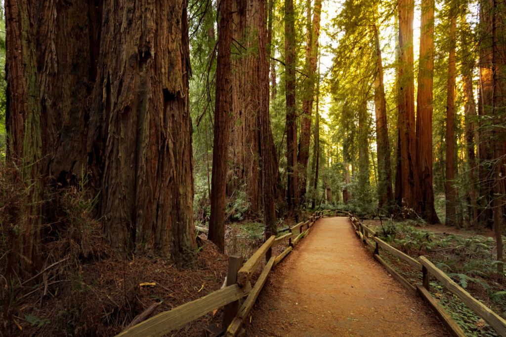
Right next to Mount Tamalpais, Muir Woods National Monument protects 554 acres of old-growth coastal redwoods. Some of these giants soar over 250 feet and have stood for more than 1,000 years.
Important: You need a reservation to visit Muir Woods. Book your parking or shuttle ticket ahead of time on the National Park Service website.
The main trail winds along Redwood Creek through the heart of the forest. Wooden boardwalks and bridges make the 2-mile loop accessible for most people.
If you want a quieter walk, check out the connecting trails that climb away from the main valley. You’ll get a different vibe and usually see fewer people.
Click here to learn more about Muir Woods National Monument.
Stinson Beach
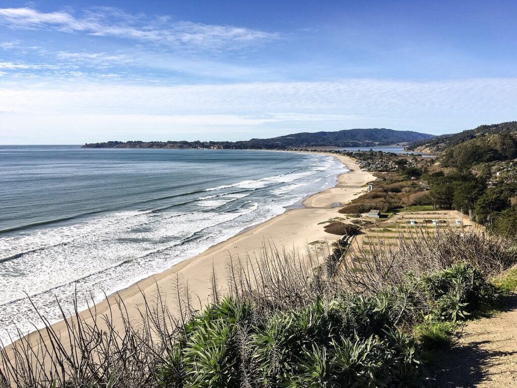
Stinson Beach is the perfect coastal side trip from Mount Tamalpais. This golden-sand beach stretches for 3.5 miles along the Pacific.
The beach has:
- Public restrooms and outdoor showers
- Picnic areas with BBQ grills
- Lifeguards on duty in summer
- A small downtown with restaurants and shops
People swim, surf, and beachcomb here, though the water stays chilly year-round—usually between 50-60°F.
Hiking trails like the Dipsea and Matt Davis connect Mount Tamalpais to Stinson Beach, making for a scenic trek down to the ocean.
Click here to learn more about Stinson Beach.
Top Hikes and Trails
Mount Tamalpais features over 200 miles of trails, from easy walks to steep, challenging climbs. There’s something for everyone, with ocean views, redwood forests, and even waterfalls along the way.
Iconic Hiking Trails
Coast View Trail is a crowd favorite, pulling in a 4.6-star rating on AllTrails. The name says it all—it’s packed with sweeping Pacific views that just don’t quit.
East Peak Summit Plank Trail takes you straight to the highest point. The hike’s short but gets steep, and the views of San Francisco and the Bay are worth every step.
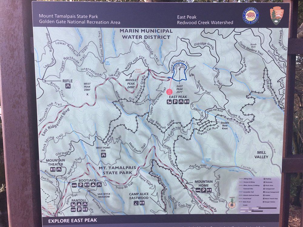
The Verna Dunshee Loop Trail circles the summit. It’s a paved, accessible 0.75-mile walk—ideal for soaking in summit views without breaking a sweat. Interpretive signs along the way share cool facts about the park’s ecology and history.
Plenty of trails connect to fire roads, letting you find less crowded routes if you’re looking for a quieter experience.
Dipsea Trail and Steep Ravine
The Dipsea-Steep Ravine-Matt Davis loop is a local gem. This 7-mile adventure can start at Stinson Beach or Pantoll Ranger Station, and it packs a ton of variety into one hike.
If you start from Stinson, the Matt Davis Trail climbs through coastal scrub, then heads into lush forest. You’ll hit switchbacks with ocean views before reaching Pantoll.
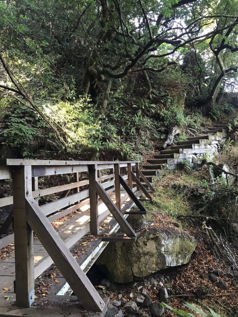
Steep Ravine Trail follows Fern Creek through a redwood canyon, complete with wooden ladders, footbridges, and even a 10-foot ladder. During rainy months, you’ll spot several small waterfalls, and the trail stays nice and cool even on hot days.
This loop really shows off Mt. Tam’s diverse landscapes—coast, forest, and everything in between—all in one moderately challenging hike. Many consider it the park’s signature trail experience, and honestly, it’s hard to argue with that.
Family-Friendly Walks
If you’re bringing kids or just want an easier stroll, Mount Tam has a bunch of gentle trails. The Verna Dunshee Loop circles the summit and gives you those big views without any real climbing—pretty much perfect for families.
Old Mill Park is a great starting point. Short nature trails twist through the redwoods here, and you barely notice any elevation gain. Along the way, little interpretive signs point out local plants and critters—nice for curious kids (and adults who like to pretend they’re experts).
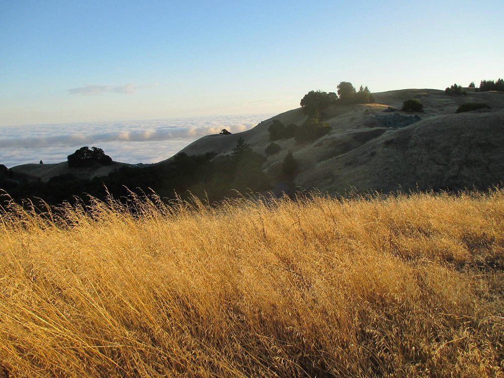
Cataract Falls Trail really comes alive after winter rains, when the waterfalls are at their best. The full trail can be tough, but families often just walk the first stretch to the lower falls and call it a day—totally worth it.
Plenty of paved park roads double as walking paths, so strollers work fine and you still get some killer views. Around the East Peak parking lot, you’ll find a handful of super short trails. They’re easy, the scenery’s wild, and you barely have to break a sweat.
Natural Environments and Wildlife
Mount Tamalpais State Park has a surprising mix of ecosystems and a ton of plant and animal life. Thanks to its varied elevations, you get different habitats packed into one mountain, and honestly, the variety is half the fun.
Redwoods and Grasslands
The redwood groves are jaw-dropping, especially in the cooler, shaded ravines. These ancient giants create quiet, almost cathedral-like spaces. Some of the trees here shoot up over 200 feet—it’s humbling, really.
Then you pop out into open grasslands, which sweep over the hills and ridges. In winter, they’re impossibly green, but come spring, wildflowers explode everywhere—March through May is just stunning.
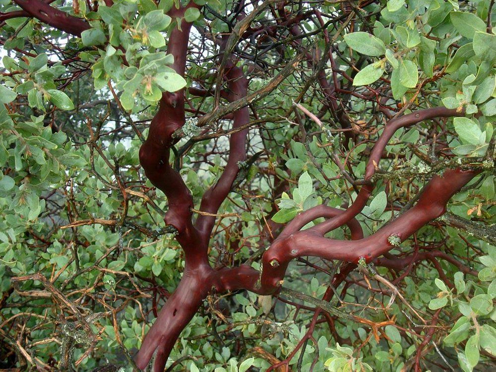
Chaparral areas are thick with manzanita shrubs—look for the smooth, red bark and twisty branches. Oak woodlands, Douglas fir stands, and scrubby chaparral all mix together, each with their own little plant communities doing their thing.
Wildlife and Ecosystems
Wildlife is all over the place here, and you never know what you’ll see. Common mammals include:
Luxury stays to cozy cottages await, all with instant booking. Find the best deals!
Browse Marin Stays
- Black-tailed deer (most active at dawn and dusk)
- Coyotes
- Bobcats
- Gray foxes
- Raccoons
Birders, get your binoculars: more than 150 species show up here, including:
- Red-tailed hawks
- Turkey vultures
- Northern spotted owls
- All sorts of migratory songbirds
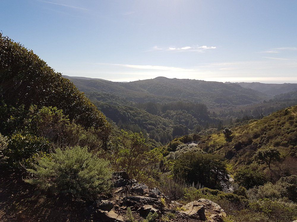
As you climb, the mix of plants and animals shifts. The coast has its own lineup, and the higher elevations feel different again. Streams cut through the park, creating shady riparian corridors—amphibians love these spots, and so do certain plants you won’t find elsewhere.
Try to keep your distance from the animals, and don’t feed them. It messes with their habits and can actually hurt them.
Weather and Best Times to Visit
Mount Tam has that classic Mediterranean climate—think dry, warm summers (June-September) with highs in the 70s or 80s. Fog sometimes rolls in at lower elevations but usually burns off by lunchtime.
Winter (December-February) brings most of the rain, turning everything lush and green. It rarely gets below 45°F, so honestly, you can visit year-round. Spring is probably my favorite—mild temps, wildflowers everywhere.
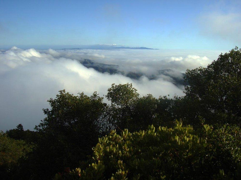
In fall (September-November), the air clears up, and the views go forever. The light gets golden, crowds thin out, and if you’re into photography, this is your season.
Weather flips fast up here. Pack layers, no matter when you come—the difference between sun and shade can be dramatic.
Outdoor Activities Beyond Hiking
Mount Tamalpais isn’t just about hiking. The park’s landscape is made for camping, picnicking with killer views, and exploring on horseback or by bike.
Camping in Mount Tamalpais State Park
There are two main campgrounds, each with its own vibe. Pantoll Campground sits in the woods and has 16 first-come, first-served sites for $25 a night. Every site gets a picnic table, food locker, and restrooms with running water.
Steep Ravine Environmental Campground is the wild card—some sites, some rustic cabins, all perched above the Pacific. The cabins are tough to snag and need reservations months ahead, but they’re worth it if you can plan that far out.
Both campgrounds offer drinking water and fire rings (when allowed), but you’ll need to bring your own firewood. Don’t collect wood from the park—it’s not allowed.
Lock up your food. Raccoons and deer know their way around a campsite and aren’t shy about checking things out.
Picnicking and Scenic Overlooks
Up at East Peak, picnic tables wait for you with some of the best Bay Area views around. On a clear day, you can spot San Francisco, the East Bay, and even the Sierra Nevada way off in the distance.
Mountain Theater (Sidney B. Cushing Memorial Amphitheater) is another good picnic spot, plus it hosts outdoor shows with rolling hills as the backdrop.
Bootjack Picnic Area tucks its tables under redwoods—great for hot days when you want some shade. It’s also right by several trails, so you can walk off your lunch if you feel like it.
Each picnic area has trash and recycling bins, but honestly, it’s best to pack out whatever you bring. Keeps the park looking good for everyone.
Horseback Riding and Biking
With over 60 miles of fire roads and trails open to bikes, Mount Tam is a magnet for cyclists. The Old Railroad Grade is a mellow climb for casual riders, while single-track trails like Coastal Trail challenge even experienced mountain bikers.
Horseback riders get in on the action too. Some trails are just for equestrians—Matt Davis Trail and parts of the Dipsea Trail are local favorites, winding through all kinds of scenery from forest to open coast.
No horse? No problem. Local stables offer guided rides, and you can rent bikes in Mill Valley or Stinson Beach.
Pay attention to trail signs—some are open to everyone, others have restrictions. Always yield to horses, let people know when you’re passing, and double-check the rules before you head out.
Cultural and Historical Highlights
There’s more to Mount Tam than just pretty views. The park’s history is full of quirky railroads, outdoor theater, and a whole lot of conservation work that’s still going strong.
Railroad Grade and Civilian Conservation Corps
The Railroad Grade trail traces the route of the old “Crookedest Railroad in the World.” This winding train hauled visitors up Mt. Tam from 1896 to 1930, until a fire wiped out most of the tracks. Now, you can hike or bike the same path, enjoying its gentle 7% incline and a bit of local lore along the way.
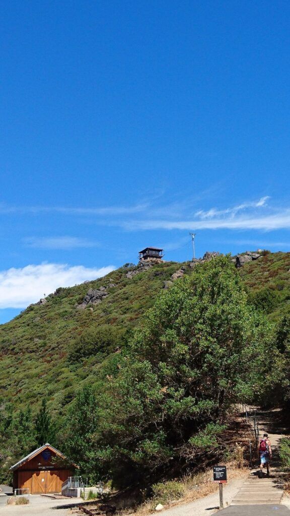
In the 1930s, the Civilian Conservation Corps (CCC) left their mark on the park. Young men built trails, fire roads, and stone structures—many are still standing. Look for their handiwork in the retaining walls, steps, and buildings scattered through the park.
You’ll spot CCC projects at places like the East Peak Visitor Center and along main trails. Their work just blends right in, both useful and surprisingly beautiful.
Mountain Theater and Mountain Play
The Mountain Theater (Cushing Memorial Amphitheater) is perched right on the mountainside. Built in 1913 from local stone, it seats over 3,700 people and the views are something else.
Since 1913, the annual Mountain Play has been a big deal—one of the country’s oldest outdoor theater traditions. Each spring and summer, you can catch a full-on musical production surrounded by nature. It’s a classic Bay Area experience.
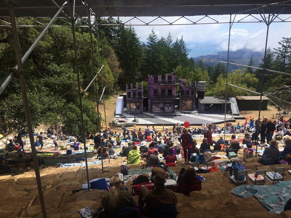
The CCC upgraded the theater in the ’30s, adding seats and fixing up the stage. These days, the shows keep that tradition alive—mixing culture, scenery, and a little bit of hiking or picnicking for good measure.
Park Volunteers and Stewardship
Volunteers are the backbone of Mt. Tam. Groups like the Tamalpais Conservation Club (since 1912!) and Friends of Mt. Tam organize trail work, restoration, and educational events year-round.
Volunteer-led hikes are a real treat—they share stories about the park’s plants, history, and what makes the place special. You end up seeing things you would’ve missed otherwise.
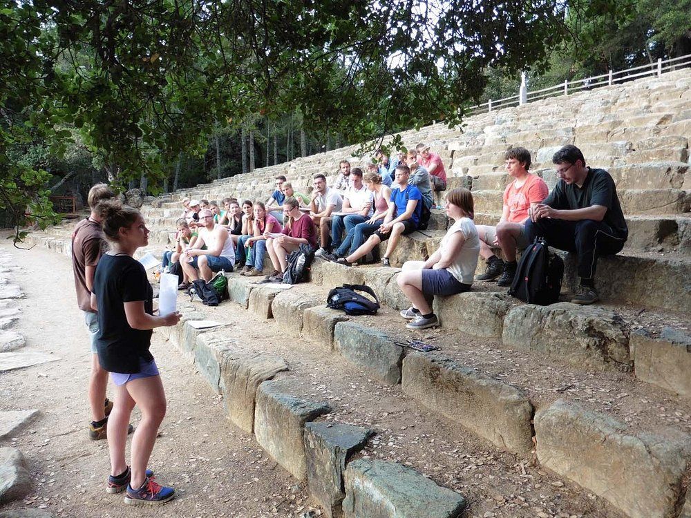
Some folks have volunteered here for decades, passing along what they know about the mountain’s quirks and secrets. Their efforts keep invasive species in check, trails in shape, and historic spots preserved.
Visitor centers are often run by these passionate volunteers. They’ll hand you a map, give honest trail tips, and probably tell you a story or two if you ask.
Nearby Attractions and Bay Area Connections
Mount Tamalpais is a great jumping-off point for the rest of the Bay Area. The park links up with nearby towns and nature spots that round out your visit—there’s always something else to explore.
Mill Valley Overview
Mill Valley sits right at Mount Tam’s base, making it a perfect gateway for visitors. This laid-back town has a small-town vibe but still manages cool restaurants and shops. The Depot Bookstore & Cafe, set in an old train station, is a local favorite for post-hike snacks or coffee.
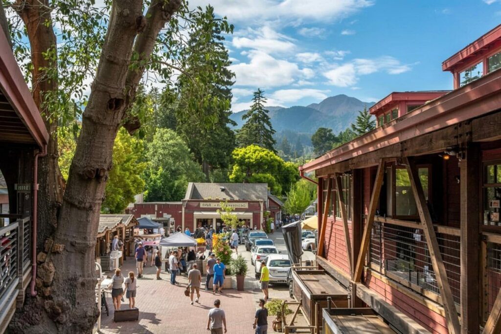
Streets wind through redwoods, and every fall the Mill Valley Film Festival brings movie lovers from all over.
Several trailheads start right in town, including the famous Dipsea Trail. It’s just 0.6 miles to the main network—super convenient if you want to hit the mountain without driving far.
Click here to learn more about Mill Valley.
Marin County and Surrounding Parks
Marin County wraps around Mount Tam and is loaded with other nature spots. Muir Woods National Monument is minutes away, protecting ancient redwoods in a quiet valley.
Point Reyes National Seashore lies to the north, with rugged coastlines, wildlife, and a lighthouse that’s been there for a century and a half.
The Marin Headlands are famous for Golden Gate Bridge views, plus hiking, old military sites, and the Marine Mammal Center.
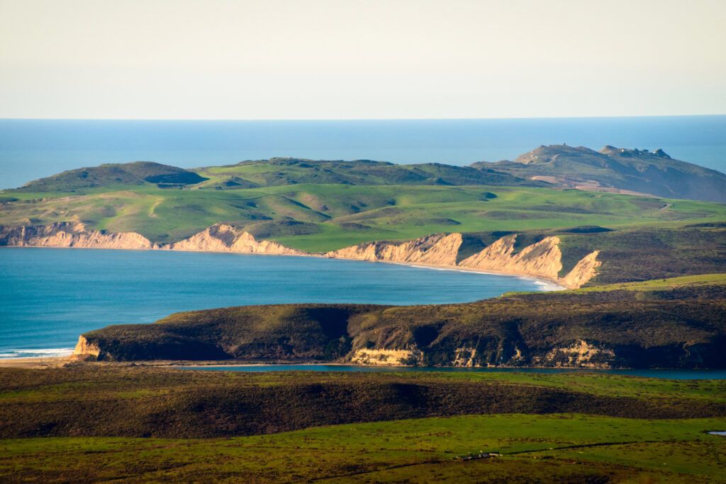
Other nearby parks worth a look:
- Angel Island State Park (take the ferry)
- China Camp State Park
- Samuel P. Taylor State Park
All these spots show off Marin’s wild range of landscapes—from the bay to redwood forests—and they’re just a short drive from Mount Tamalpais.
Click here to learn more about Marin County’s Parks.
San Francisco Day Trips
San Francisco sits just 14 miles south of Mount Tamalpais, so popping into the city for a day trip is totally doable. Cross the Golden Gate Bridge and you’re right there, staring down some of California’s most iconic sights.

Some favorite San Francisco spots:
- Golden Gate Park—museums, gardens, and a lot of quirky locals
- The nonstop buzz of Fisherman’s Wharf
- Alcatraz Island (definitely get your tickets ahead of time)
- The Mission District, which is just bursting with color and life
If you’re in the mood to wander, check out neighborhoods like North Beach, Chinatown, or Haight-Ashbury. They all have their own vibe, cool old buildings, and plenty of places to eat or just people-watch.
Getting into the city from Mount Tam is pretty straightforward. Ferries from Sausalito or Tiburon not only connect you to San Francisco, but the bay views are honestly worth the trip alone.
Find available hotels and vacation homes instantly. No fees, best rates guaranteed!
Check Availability Now
Adrian Rosal Park Travel Guide – Accessibility, Amenities, Activities, and More!
Alto Bowl Preserve Travel Guide – Accessibility, Amenities, Activities, and More!
Bald Hill Preserve Travel Guide – Accessibility, Amenities, Activities, and More!
Baltimore Canyon Preserve Travel Guide – Accessibility, Amenities, Activities, and More!
Bayside Park Travel Guide – Accessibility, Amenities, Activities, and More!
Blithedale Summit Preserve Travel Guide – Accessibility, Amenities, Activities, and More!
Bothin Marsh Preserve Travel Guide – Accessibility, Amenities, Activities, and More!
Buck’s Landing Travel Guide – Accessibility, Amenities, Activities, and More!
Camino Alto Preserve Travel Guide – Accessibility, Amenities, Activities, and More!
Candy’s Park Travel Guide – Accessibility, Amenities, Activities, and More!
Cascade Canyon Preserve Travel Guide – Accessibility, Amenities, Activities, and More!
Charles F. McGlashan Pathway Travel Guide – Accessibility, Amenities, Activities, and More!
China Camp State Park Travel Guide – Accessibility, Amenities, Activities, and More!
Corte Madera Pathway Travel Guide – Accessibility, Amenities, Activities, and More!
Hal Brown Park Travel Guide – Accessibility, Amenities, Activities, and More!
Horse Hill Preserve Travel Guide – Accessibility, Amenities, Activities, and More!
King Mountain Preserve Travel Guide – Accessibility, Amenities, Activities, and More!
Lagoon Park Travel Guide – Accessibility, Amenities, Activities, and More!
Loma Alta Preserve Travel Guide – Accessibility, Amenities, Activities, and More!
Lucas Valley Park Travel Guide – Accessibility, Amenities, Activities, and More!
Lucas Valley Preserve Travel Guide – Accessibility, Amenities, Activities, and More!
McInnis Park Travel Guide – Accessibility, Amenities, Activities, and More!
McNears Beach Park Travel Guide – Accessibility, Amenities, Activities, and More!
Mill Valley-Sausalito Pathway Travel Guide – Accessibility, Amenities, Activities, and More!
Mount Tamalpais State Park Travel Guide – Accessibility, Amenities, Activities, and More!
Muir Woods National Monument Travel Guide – Accessibility, Amenities, Activities, and More!
Pueblo Park Travel Guide – Accessibility, Amenities, Activities, and More!
Ring Mountain Preserve Travel Guide – Accessibility, Amenities, Activities, and More!
San Pedro Mountain Preserve Travel Guide – Accessibility, Amenities, Activities, and More!
Santa Venetia Marsh Preserve Travel Guide – Accessibility, Amenities, Activities, and More!
Tennessee Valley Travel Guide – Accessibility, Amenities, Activities, and More!
Terra Linda/Sleepy Hollow Preserve Travel Guide – Accessibility, Amenities, Activities, and More!
White Hill Preserve Travel Guide – Accessibility, Amenities, Activities, and More!


