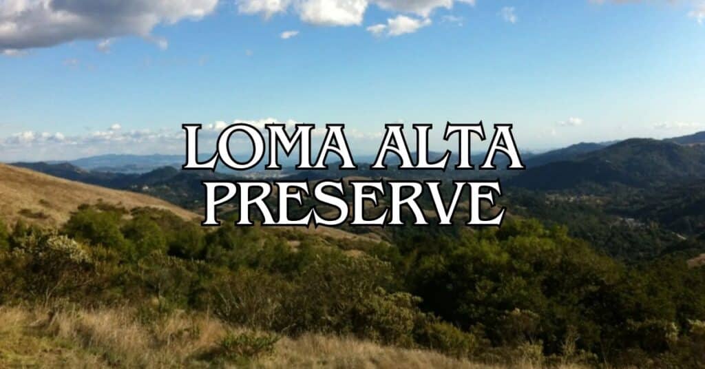
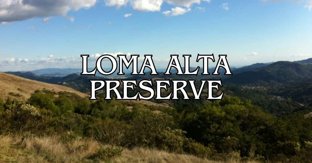
Loma Alta Preserve is one of Marin County’s highest peaks and a surprisingly quick escape from city noise. Just minutes from nearby towns, you can step right into open space and some pretty jaw-dropping views. The trails here wind through different landscapes and let you check out four major watersheds that shape the region.
As you hike the preserve’s network of fire roads and trails, the mountain divides Miller, Corte Madera, and Lagunitas watersheds. The preserve is open to visitors, but you’ll need to stick to the basics: no smoking, no fires, and no motorized vehicles.
Discover hand-picked hotels and vacation homes tailored for every traveler. Skip booking fees and secure your dream stay today with real-time availability!
Browse Accommodations Now
For hikers and nature fans, Loma Alta has a handful of trail options: Oak Manor, Smith Ridge, Sunrise, and the Old Railroad Grade Loop are all worth a try. You might have to yield to horses now and then, but it’s a small price for the scenery. Spring is a favorite for wildflowers, and on clear days, the views stretch forever.
Overview of Loma Alta Preserve
Loma Alta Preserve rises to 1,592 feet—one of the highest points in Marin County. Up top, you’ll find panoramic views and a variety of hiking experiences. This grassy peak is a big deal for both ecology and recreation in the North Bay.
History and Significance
Loma Alta means “high hill” in Spanish, and it’s been a Marin County landmark for generations. The preserve protects a chunk of open space in an area that’s seeing more and more development. Its height makes it visible from all over the county.
People used this land for ranching back in the day, and you can still spot old signs of that history. The county bought the land for public open space to keep it from turning into housing and to protect the natural resources.
Loma Alta splits up the watersheds. From the summit, rainwater heads into Miller Creek, Corte Madera Creek, Lagunitas Creek, and another major watershed—making it a pretty important spot for more than just great hikes.
Location and Geographic Features
You’ll find Loma Alta Preserve smack in the middle of northern Marin County, towering above Fairfax. It connects to other open spaces, so you can string together longer hikes if you want.
The place is mostly rolling, grassy hills. In spring, wildflowers light up the slopes. On a clear day, the views from the peak are some of the best in Marin.
Ridges converge here, creating natural routes between different parts of the county. These ridges also mark the boundaries between watersheds and different microclimates.
A web of fire roads and trails crisscrosses the preserve, offering routes for all sorts of hikers. The terrain is open and exposed, so on hot days, bring extra water and sun protection—shade is scarce.
Managing Organization
Marin County Parks runs the show at Loma Alta Open Space Preserve. They keep up the trails, protect the area’s natural features, and provide maps and info for visitors.
They try to strike a balance between letting people enjoy the place and keeping it healthy. That means fire prevention, habitat restoration, and regular trail maintenance.
Volunteers pitch in for maintenance and educational programs, which helps stretch budgets and builds a sense of community around these open spaces.
You can check the Marin County Parks website for trail updates, closures, or upcoming events. The rangers there are a good resource if you want tips about what’s blooming or which trails are less crowded.
Essential Trip Planning Information
A little planning goes a long way for a trip to Loma Alta Preserve. Here’s the stuff you’ll want to know before heading out to this Marin County gem.
Best Time to Visit
Spring (March–May) is hands-down the best time to hike Loma Alta. The hills turn bright green, wildflowers pop up everywhere, and the weather usually hovers around 60–75°F.
Fall (September–November) is also a solid choice, with clear skies and killer visibility. Summer can get toasty—think 85°F or more—and there’s barely any shade on those grassy hills.
In winter (December–February), the landscape is lush after rains, but you might find muddy trails. Weekday mornings are typically quieter than weekends.
Definitely check the weather first. Fog sometimes rolls in and blocks the views, which is kind of a bummer if you’re hoping for panoramas.
How to Get There
Loma Alta Preserve has a few access points, but the main entrance is at the end of Glen Drive in Fairfax.
By car:
- From Highway 101, take the Sir Francis Drake Boulevard exit.
- Drive west toward Fairfax for about 5 miles.
- Turn right onto Glen Road and follow it to the trailhead parking.
The main parking lot is tiny—maybe 8–10 spaces—so if you’re coming on a weekend, get there early.
If you’re on public transit, take Marin Transit bus #23 to Fairfax, then walk about a mile to the entrance.
There’s no entrance fee, so it’s a budget-friendly outdoor activity.
Distance and Elevation Gain
The main loop at Loma Alta is about 3.8 miles with roughly 1,300 feet of elevation gain. The climb to the 1,592-foot summit is steady but doable for most folks.
Popular Trail Options:
- Smith Ridge Trail: 2.4 miles one-way, 1,000 ft elevation gain
- Old Railroad Grade: 1.5 miles one-way, moderate climb
- Oak Manor Trail: 1.2 miles one-way, easier grade
Most people finish the main loop in 2–3 hours, depending on how often they stop for photos or a breather. Reviews on TripAdvisor say the views make the uphill worth it.
The trails connect to other preserves, so you can tack on extra miles if you’re feeling ambitious. Bring plenty of water—there aren’t any water sources on the trails.
Top Hiking Trails in Loma Alta Preserve
Loma Alta Preserve has some top-notch hiking options with 360-degree views of Marin County. It’s a key link in the Bay Area Ridge Trail system, and you’ll find both open grasslands and the rare patch of wooded singletrack.
Main Loma Alta Summit Trail
The main trail to the summit is one of the best hikes you’ll find in suburban Marin. It’s a moderate challenge, but the views at the top are worth every step. The trail climbs through wide-open grasslands, so you’ll want sunblock and water—especially if it’s hot.
At 1,592 feet, the summit offers views of Mount Tamalpais, San Francisco Bay, and the valleys all around. Spring is prime time for wildflowers—keep an eye out for:
- California poppies (orange)
- Lupines (purple)
- Buttercups (yellow)
You’ll probably spot deer, hawks, or other native birds along the way. Early mornings and evenings are best for cooler temps and good light for photos.
Fire Roads and Access Routes
A bunch of fire roads cut through the preserve. The Loma Alta Fire Road is the main artery—wide, well-kept, and popular with hikers and mountain bikers.
Find the perfect hotel or vacation rental. Instant booking, no fees!
View Top Stays
Oak Manor Fire Road is a quieter option. It’s a bit rocky in spots but holds up well. These roads connect to form loops like:
- Oak Manor, Smith Ridge, Sunrise, and Old Railroad Grade Loop—a favorite on AllTrails
- Glen Fire Road—from the south entrance
- Smith Ridge—for panoramic views
If it’s rained recently, expect some mud, especially in winter and early spring. It’s worth checking trail conditions before you go.
Connections to Adjacent Trails
Loma Alta links up with several nearby trail systems, so you can make your hike as long as you want. The 680 Trail is a standout—it’s one of the few wooded singletrack trails in Marin County Open Space.
From the north, the trail drops gently to the Big Rock trailhead at Lucas Valley Road, great if you want a longer or point-to-point hike and can arrange a ride.
You can also hop onto the Bay Area Ridge Trail, a 550+ mile multi-use trail circling the whole Bay Area. If you’re feeling adventurous, Loma Alta can be part of a much bigger trek.
Want something short and sweet? Try the Old Railroad Grade for a bit of history and a gentler climb.
Biking and Multi-Use Trails
Cyclists get plenty of love at Loma Alta Preserve. The trails are well-kept, and both fire roads and marked multi-use trails are open to bikes, with options for all skill levels.
Popular Biking Routes
The Loma Alta Fire Road is the main route for cyclists. This 3-mile dirt/gravel stretch near Fairfax is a go-to for uphill rides. Riders like its steady grade and big views.
If you want to branch out, Oak Manor, Smith Ridge, and Sunrise trails make for excellent biking adventures. The Old Railroad Grade is also a hit with mountain bikers for its history and ride quality.
Most trails connect to other open spaces, so you can extend your ride. Trail lengths are marked on preserve maps, so planning your trip is pretty straightforward.
Trail Etiquette and Regulations
When biking at Loma Alta, stick to the signed fire roads and trails marked for bikes and multiuse. Going off-trail isn’t allowed—it helps protect the environment.
The speed limit is 15 mph or less. It’s not just a rule; it keeps everyone safe, especially on blind corners or busy days.
Always yield to hikers and horses. Give a heads-up if you’re coming up behind someone—no one likes surprises on the trail.
A helmet is a must for your own safety. Also, bring water and sun protection, since shade is pretty much nonexistent in summer.
Scenic Views and Photography
Loma Alta Preserve delivers some of the best panoramic views in Marin County. From 1,592 feet up, photographers can capture the Bay Area’s rolling hills and wild open spaces.
Best Viewpoints
Smith Ridge is arguably the best spot for views at Loma Alta. From there, you can see miles of wilderness, hills, and ravines stretching out in every direction. The 360-degree view is absolutely worth the effort.
Sunrise Fire Road is brutally steep, but the views at the top, especially at dawn, are unreal. Early morning light makes the whole place glow.
For sunset, the western-facing lookouts are magical. The sun sets behind the hills, and the whole landscape turns gold—honestly, it’s hard not to take a million photos.
If you want something less strenuous, Glen Fire Road has easier access points for soaking in the scenery.
Landscape and Nature Photography Tips
Early morning and late afternoon are prime for photos—the “golden hour” makes everything pop. The light’s warm, shadows are long, and the hills look extra dramatic.
A wide-angle lens is great for those big panoramas from Smith Ridge. If you want to zoom in on distant peaks or watershed divides, bring a telephoto.
Fog is common, especially on summer mornings. Instead of skipping your hike, use it to add a mysterious vibe to your shots.
For wildflower photos, late spring is your window. The serpentine soils bloom with colorful native flowers. Try getting low for a shot with flowers in front and hills behind.
If you’re shooting sunrise or sunset, a tripod helps with stability when the light’s low.
Photo Gallery
The dramatic elevation changes at Loma Alta set the stage for those classic layered hill shots—especially when the air’s clear but there’s just enough haze to add depth. If you’re a fan of landscapes that look like they go on forever, this is your spot.
Wildlife photographers can have a field day here, too. The dry, rocky grasslands pull in some less-common birds, and honestly, they make fantastic subjects if you’re patient.
Spring’s a treat for anyone with a camera. Wildflowers burst into color against the preserve’s serpentine soils. The contrast? It’s pretty striking and you won’t find it just anywhere.
Every season brings something new. Summer’s all golden hills, winter turns everything lush and green, and fall? The grasses get these wild textures and colors you don’t want to miss.
Want something for your feed? Try framing your shot so you catch the four major watersheds from the ridge tops in the background. It’s a little extra, but it’s worth it.
Natural Features and Ecosystems
Loma Alta Preserve packs in a surprising range of natural systems for its size. Sitting near the top of Marin County, it supports a mix of habitats that keep plant and animal life thriving.
Flora and Fauna
Plant life at Loma Alta changes as you climb. Lower down, oak woodlands take over, while higher up, wind-battered coastal scrub rules. Keep an eye out for poison oak—those shiny clusters of three leaves love to crowd the trail edges, especially in spring and summer.
Open hillsides are covered in native grasses. They start out neon green in winter and fade to gold by summer. Wildflowers pop up from March through May—look for:
- California poppies
- Lupines
- Buttercups
- Shooting stars
Birds? They’re everywhere. Red-tailed hawks circle overhead, woodpeckers hammer away on oaks, and if you pause in the brushy spots, you’ll hear wrentits and spotted towhees calling.
Coastal Scrub and Habitat Types
Most of the higher ground is classic coastal scrub, tough and wind-shaped. Expect to see:
Luxury stays to cozy cottages await, all with instant booking. Find the best deals!
Browse Marin Stays
- Coyote brush
- California sagebrush
- Sticky monkeyflower
- Coffee berry
These plants aren’t here by accident—they’re built to handle fog, wind, and dry spells. Their deep roots keep the slopes from sliding away.
Down in the low spots, seasonal wetlands fill up with winter rain. Rushes and sedges take over these soggy patches.
Protected valleys shelter oak woodlands. Coast live oaks (those with the spiny, small leaves) and bay laurels (smell that spicy leaf?) are the main characters here.
Wildlife Spotting Opportunities
If you’re hoping to see wildlife, aim for dawn or dusk. Black-tailed deer are pretty common near the meadows. Coyotes sometimes hunt in open grasslands, especially early in the morning.
Other critters you might spot:
- Brush rabbits
- Grey squirrels
- Bobcats (rare, but they’re out there)
Tule elk don’t live here, but they’ve made a comeback in nearby areas. Loma Alta helps keep those wildlife corridors open for bigger animals.
On sunny days, reptiles get active. Western fence lizards do their signature push-ups on rocks, and you might see a gopher snake crossing the trail. Don’t worry, all the snakes here play important roles in the ecosystem.
Butterfly fans—visit in spring. Painted ladies, buckeyes, and swallowtails flock to the wildflowers along sunny stretches of trail.
Guided Adventure and Experience Recommendations
Loma Alta Preserve has a handful of guided experiences for folks who want a little extra from their visit. Local guides know the land, the wildlife, and those little details you’d probably miss wandering solo.
Family-Friendly Activities
Families are more than welcome here. Early morning nature walks (9-11 AM) are a good pick for kids—the air’s cool, and animals are more likely to show up.
Don’t forget water and snacks for the little ones. Glen Fire Road trail has a gentle grade, so even strollers can handle it.
Spring’s prime time for bird watching, since migratory species pass through. Bring some binoculars and maybe a simple bird guide; it makes spotting way more fun.
For something different, check the Marin County Parks calendar for seasonal ranger-led programs. Sometimes they run scavenger hunts or nature crafts for kids.
Recommended Itineraries
Half-Day Adventure (3-4 hours)
- Start at Glen Fire Road trailhead
- Hike up to Smith Ridge Fire Road (it’s moderate, not too tough)
- Soak in the bay views at the top
- Head back the same way
Most visitors give this one 4.5 out of 5 stars—manageable and the views are a real payoff.
Sunrise Special (2-3 hours)
- Show up about half an hour before sunrise
- Take Sunrise Fire Road (it’s steep, so only for folks who like a challenge)
- Catch that golden morning light over the bay
- Wrap up before it gets hot
If you’re into photography, this is the hike for you. Bring a tripod if you want sharp shots.
Weekdays are usually quieter. Early mornings and late afternoons are the sweet spot for both weather and wildlife.
Nearby Parks and Natural Attractions
There’s no shortage of wild places near Loma Alta. Marin County’s loaded with everything from windswept coasts to redwood giants.
Point Reyes National Seashore
Point Reyes National Seashore sprawls over 71,000 acres of protected coastline about half an hour west of Loma Alta. You’ll find beaches, dramatic cliffs, and rolling grasslands.
The Chimney Rock Trail (1.8 miles round-trip) gets you ocean views and, in spring, wildflowers everywhere. December through April, check out the Elephant Seal Overlook—those huge marine mammals are something else during breeding season.
Up for a challenge? Try the Alamere Falls hike (13 miles round-trip from Palomarin Trailhead). It’s one of California’s rare tidefall waterfalls that actually drops onto the beach.
Over on Tomales Bay, you can kayak. And the historic Point Reyes Lighthouse sits way out on the western tip.
Muir Woods National Monument
Muir Woods National Monument protects 554 acres of old-growth coastal redwoods about 20 minutes south of Loma Alta. Some of these trees are over 250 feet tall and more than a thousand years old—kind of mind-blowing, really.
The Main Trail loop (2 miles) is a solid intro to the redwoods. If you want fewer people around, branch off onto the Ben Johnson or Dipsea trails into Mount Tamalpais State Park.
Mount Tamalpais (locals call it Mt. Tam) rises right above Muir Woods, with 60+ miles of trails and views stretching from the Pacific to the Bay and beyond.
Close by, you’ll find Muir Beach (a quiet cove with tide pools) and Stinson Beach, which is great for swimming or just soaking up the sun—when the weather cooperates.
Exploring the Greater Marin County Area
Marin County’s got more than just Loma Alta. You’ll find coastlines, redwoods, and small towns, all within a quick drive.
Nearby Towns and Villages
Mill Valley is only 15 minutes south and blends outdoor fun with a cozy downtown. Grab a coffee, browse a bookstore, or catch a show at Sweetwater Music Hall if you’re sticking around after dark.
Fairfax hugs the edge of Loma Alta and makes a good launchpad for your hike. It’s got a bohemian vibe, organic cafes, and the famous Scoop for ice cream when you’re done.
San Anselmo is known for antiques and restaurants along Sir Francis Drake Boulevard. On weekends, the farmers market is worth a stroll—local produce is always a win.
In Corte Madera, you’ll find great shopping at Town Center and Village at Corte Madera, plus some nice bay views from the parks nearby.
Day Trips and Scenic Drives
The Marin Headlands are just 30 minutes away, offering iconic Golden Gate Bridge views and a web of hiking trails. You can visit Point Bonita Lighthouse or poke around the old military bunkers.
Take Highway 1 north for a classic California drive. Stop at Stinson Beach for a swim, or keep going to Point Reyes National Seashore for whale watching and cliffside hikes.
Head east to the Sonoma Baylands for wetland trails and top-notch bird watching. The flat paths are great for families with small kids.
Feeling ambitious? Cross the Golden Gate into San Francisco and check out Crissy Field. It’s a former airfield turned waterfront park with killer city views—only about 45 minutes from Loma Alta.
Additional Outdoor Destinations Across the Bay Area
There’s a whole world of parks and preserves beyond Loma Alta. The Bay Area’s packed with places to hike, bike, or just take a breather in nature.
Notable Hiking and Biking Parks
Mount Diablo stands tall as one of the region’s most impressive peaks. On a clear day, you can see all the way to the Sierra Nevada. You can drive up or take on the challenging trails—either way, the views are wild.
Tilden Park in Berkeley covers more than 2,000 acres of natural beauty. It’s got a carousel, a botanical garden, Lake Anza for swimming, and trails for every skill level.
Briones Regional Park is all about rolling hills and oak woodlands—perfect for a moderate hike. Keep your eyes peeled for:
- Cattle grazing
- Spring wildflowers
- Birds year-round
The Contra Costa Canal Trail is a flat, paved path—great for casual biking or walking. At 13.5 miles, it links up a bunch of East Bay communities with almost no hills to worry about.
Redwood Forest Experiences
Big Basin State Park, California’s oldest state park, protects coast redwoods that soar over 300 feet. With more than 80 miles of trails winding through these ancient giants, there’s a lot to explore. Some paths, like the Redwood Loop Trail, are perfect for families—no need to be a seasoned hiker.
Purisima Creek Redwoods Open Space Preserve has shady trails weaving through second-growth redwoods. I love how you can walk from bright, sunlit ridges straight into the cool, misty groves. It’s a refreshing change, honestly—sometimes it even feels like you’ve stepped into another world.
If you’re looking for redwoods but don’t want to leave the city, Mount Davidson in San Francisco is a quirky option. At 928 feet, it’s the city’s highest point, and there’s still a patch of redwoods up there, plus a massive 103-foot concrete cross at the summit. It’s an odd mix, but that’s San Francisco for you.
Closer to Loma Alta, you’ll find redwoods at Samuel P. Taylor State Park—a quick way to get lost among towering forests without much planning. The main paved path follows Lagunitas Creek, making it easy for just about anyone to wander beneath the giants.
Find available hotels and vacation homes instantly. No fees, best rates guaranteed!
Check Availability Now
Adrian Rosal Park Travel Guide – Accessibility, Amenities, Activities, and More!
Alto Bowl Preserve Travel Guide – Accessibility, Amenities, Activities, and More!
Bald Hill Preserve Travel Guide – Accessibility, Amenities, Activities, and More!
Baltimore Canyon Preserve Travel Guide – Accessibility, Amenities, Activities, and More!
Bayside Park Travel Guide – Accessibility, Amenities, Activities, and More!
Blithedale Summit Preserve Travel Guide – Accessibility, Amenities, Activities, and More!
Bothin Marsh Preserve Travel Guide – Accessibility, Amenities, Activities, and More!
Buck’s Landing Travel Guide – Accessibility, Amenities, Activities, and More!
Camino Alto Preserve Travel Guide – Accessibility, Amenities, Activities, and More!
Candy’s Park Travel Guide – Accessibility, Amenities, Activities, and More!
Cascade Canyon Preserve Travel Guide – Accessibility, Amenities, Activities, and More!
Charles F. McGlashan Pathway Travel Guide – Accessibility, Amenities, Activities, and More!
China Camp State Park Travel Guide – Accessibility, Amenities, Activities, and More!
Corte Madera Pathway Travel Guide – Accessibility, Amenities, Activities, and More!
Hal Brown Park Travel Guide – Accessibility, Amenities, Activities, and More!
Horse Hill Preserve Travel Guide – Accessibility, Amenities, Activities, and More!
King Mountain Preserve Travel Guide – Accessibility, Amenities, Activities, and More!
Lagoon Park Travel Guide – Accessibility, Amenities, Activities, and More!
Loma Alta Preserve Travel Guide – Accessibility, Amenities, Activities, and More!
Lucas Valley Park Travel Guide – Accessibility, Amenities, Activities, and More!
Lucas Valley Preserve Travel Guide – Accessibility, Amenities, Activities, and More!
McInnis Park Travel Guide – Accessibility, Amenities, Activities, and More!
McNears Beach Park Travel Guide – Accessibility, Amenities, Activities, and More!
Mill Valley-Sausalito Pathway Travel Guide – Accessibility, Amenities, Activities, and More!
Mount Tamalpais State Park Travel Guide – Accessibility, Amenities, Activities, and More!
Muir Woods National Monument Travel Guide – Accessibility, Amenities, Activities, and More!
Pueblo Park Travel Guide – Accessibility, Amenities, Activities, and More!
Ring Mountain Preserve Travel Guide – Accessibility, Amenities, Activities, and More!
San Pedro Mountain Preserve Travel Guide – Accessibility, Amenities, Activities, and More!
Santa Venetia Marsh Preserve Travel Guide – Accessibility, Amenities, Activities, and More!
Tennessee Valley Travel Guide – Accessibility, Amenities, Activities, and More!
Terra Linda/Sleepy Hollow Preserve Travel Guide – Accessibility, Amenities, Activities, and More!
White Hill Preserve Travel Guide – Accessibility, Amenities, Activities, and More!


