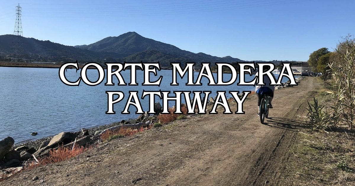
The Corte Madera Pathway is a peaceful escape right in the heart of Marin County. This 3.5-mile trail is flat and wide, so just about anyone can enjoy it—doesn’t matter if you’re a casual walker, a jogger, or out for a mellow bike ride. The path hugs Corte Madera Creek, serving up views that remind you why people love the Bay Area.
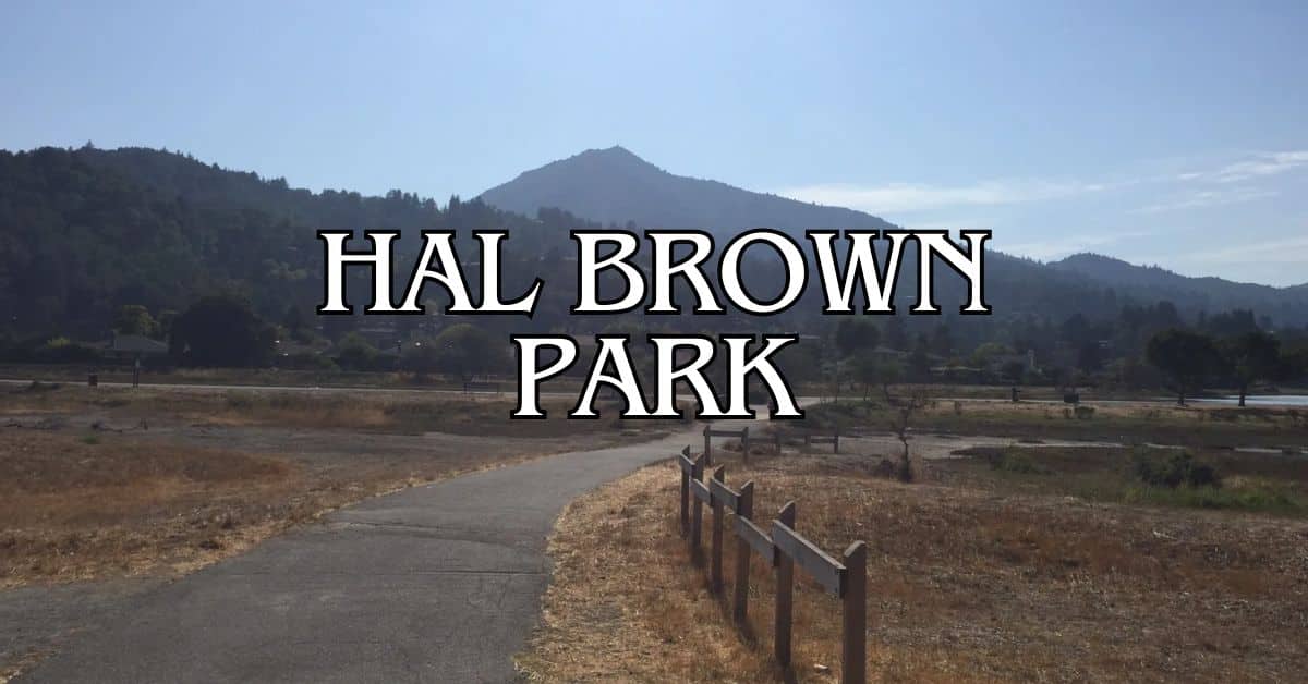
You’ll pass by Hal Brown-Creekside Park along the way—a good spot for a family picnic or a quick breather. No need for special gear or hiking know-how; just show up and go. Locals use the trail daily, so you’ll blend right in. It’s squeezed between Larkspur (yep, the ferry to SF is here) and Corte Madera (think shopping and coffee), so you can easily tack on other adventures if you’ve got a little extra time.
Discover hand-picked hotels and vacation homes tailored for every traveler. Skip booking fees and secure your dream stay today with real-time availability!
Browse Accommodations Now
Essential Guide to the Corte Madera Pathway
The Corte Madera Pathway gives you a flat, easy 3.5-mile route through some pretty classic Marin scenery. It’s a multi-use trail that’s friendly to everyone—walkers, bikers, families, you name it.
Overview of the Corte Madera Pathway
This trail is well-kept and stretches through Marin County for 3.5 miles. You’ll see hikers, joggers, parents with strollers, and folks using wheelchairs out there. It’s an easy way to get outside without dealing with steep hills or tricky footing. The path links up Larkspur, Corte Madera, and Ross, so you can use it for recreation or as a shortcut between towns.
Marin County Parks looks after the trail, which follows Corte Madera Creek for much of its length. There are a few benches if you want to sit and take in the view. Even though plenty of people use the path, it rarely feels packed.
Trail Map and Navigation
The pathway runs from Remillard Park on Sir Francis Drake Boulevard in Larkspur up to Lagunitas Road and Sylvan Lane in Ross. It’s a pretty direct route, with clear signs along the way.
Key Navigation Points:
- North end: Ross (Lagunitas Road/Sylvan Lane)
- South end: Larkspur (Remillard Park)
- Middle: Passes through Corte Madera
Trail markers pop up often, so you won’t get lost—even if it’s your first time. The main path follows the creek, which helps with orientation.
If you’re feeling adventurous, you can tack on side trips toward Mount Tamalpais or Blithedale Ridge. Trailhead maps are posted at the main entrances, and you can always check the Marin County Parks website for more info.
Find the perfect hotel or vacation rental. Instant booking, no fees!
View Top Stays
The path stays mostly flat, with barely any hills to worry about.
Access Points, Parking, and Logistics
There are a bunch of spots where you can hop on the Corte Madera Pathway:
Main Trailheads with Parking:
- Remillard Park (Larkspur) – Street parking
- Piper Park (Larkspur) – Big parking lot
- Town Park (Corte Madera) – Decent amount of parking
- College of Marin (Kentfield) – Weekend parking usually open
If you’re just going for a short stroll, you might find a spot at nearby shopping centers in Corte Madera—just watch for time limits.
Restrooms are at Piper Park and Town Park. Water fountains show up here and there along the route.
The path is open from dawn until dusk, every day. No fees, no permits—just show up and enjoy.
Bus stops are close to several trailheads, so public transit is an option too.
Terrain, Scenery, and Key Landmarks
The terrain is mostly flat, with a mix of paved and packed dirt sections. The path’s wide enough for groups, bikers, and the occasional dog walker to all get by.
Along the way, you’ll catch:
Luxury stays to cozy cottages await, all with instant booking. Find the best deals!
Browse Marin Stays
- Corte Madera Creek winding along
- Mount Tamalpais off in the distance
- Peeks at San Francisco Bay
- Oak woodlands and some redwoods here and there
If you’re into birds, bring binoculars—herons, egrets, and plenty of water birds hang out by the creek. Near the bay, you’ll spot the Richmond-San Rafael Bridge.
You’ll also pass close to the Corte Madera shopping district and Larkspur’s historic downtown.
In spring, wildflowers are everywhere. By summer, the hills turn gold. Many sections are shaded, so even on hot days, it’s still comfortable.
Experiencing the Corte Madera Pathway
This trail gives you 3.5 miles of flat, paved path that just about anyone can use. It follows Corte Madera Creek and connects a bunch of Marin communities, so it’s as practical as it is scenic.
Popular Activities and Recreation
Walking and jogging are the main things people do out here. The surface is easy on your knees, and you don’t have to dodge cars or deal with steep grades. Locals use it year-round for their daily workouts.
Lots of people bike the path, too. It’s smooth, safe, and connects easily to other routes—so if you want to pedal toward Mill Valley or San Rafael, you can.
Wildlife fans, keep your eyes peeled for herons, egrets, and all sorts of other birds. Depending on the season, you might even spot a river otter or some migratory visitors.
The path links up with other area trails, so if you want a longer or tougher route, you can head toward Phoenix Lake or the Huckleberry Trail. There’s always a new corner to explore if you’re up for it.
Nearby Towns and Points of Interest
Larkspur sits right on the pathway, with charming shops and restaurants. Its historic downtown is a great place to pause, maybe grab a coffee, or just wander for a bit.
Corte Madera brings you shopping options at its town center. You can rest, snack, or poke around the stores—nothing fancy, but it’s a solid stop right off the path.
San Anselmo and San Rafael connect through nearby paths, so if you’re feeling curious, you can keep exploring. Both towns have their own vibe and a few surprises if you’re willing to look.
If you’re up for a bigger adventure, this pathway works as a launchpad for day trips to Sausalito, Tiburon, or even all the way across the bay to San Francisco. That’s a lot of options, honestly.
And hey, the Northern Coast isn’t far by car. After you’ve had your fill of the pathway, it’s easy to head west and check out the wild Pacific coastline—totally different scenery and worth the extra drive if you’ve got time.
Find available hotels and vacation homes instantly. No fees, best rates guaranteed!
Check Availability Now
Adrian Rosal Park Travel Guide – Accessibility, Amenities, Activities, and More!
Alto Bowl Preserve Travel Guide – Accessibility, Amenities, Activities, and More!
Bald Hill Preserve Travel Guide – Accessibility, Amenities, Activities, and More!
Baltimore Canyon Preserve Travel Guide – Accessibility, Amenities, Activities, and More!
Bayside Park Travel Guide – Accessibility, Amenities, Activities, and More!
Blithedale Summit Preserve Travel Guide – Accessibility, Amenities, Activities, and More!
Bothin Marsh Preserve Travel Guide – Accessibility, Amenities, Activities, and More!
Buck’s Landing Travel Guide – Accessibility, Amenities, Activities, and More!
Camino Alto Preserve Travel Guide – Accessibility, Amenities, Activities, and More!
Candy’s Park Travel Guide – Accessibility, Amenities, Activities, and More!
Cascade Canyon Preserve Travel Guide – Accessibility, Amenities, Activities, and More!
Charles F. McGlashan Pathway Travel Guide – Accessibility, Amenities, Activities, and More!
China Camp State Park Travel Guide – Accessibility, Amenities, Activities, and More!
Corte Madera Pathway Travel Guide – Accessibility, Amenities, Activities, and More!
Hal Brown Park Travel Guide – Accessibility, Amenities, Activities, and More!
Horse Hill Preserve Travel Guide – Accessibility, Amenities, Activities, and More!
King Mountain Preserve Travel Guide – Accessibility, Amenities, Activities, and More!
Lagoon Park Travel Guide – Accessibility, Amenities, Activities, and More!
Loma Alta Preserve Travel Guide – Accessibility, Amenities, Activities, and More!
Lucas Valley Park Travel Guide – Accessibility, Amenities, Activities, and More!
Lucas Valley Preserve Travel Guide – Accessibility, Amenities, Activities, and More!
McInnis Park Travel Guide – Accessibility, Amenities, Activities, and More!
McNears Beach Park Travel Guide – Accessibility, Amenities, Activities, and More!
Mill Valley-Sausalito Pathway Travel Guide – Accessibility, Amenities, Activities, and More!
Mount Tamalpais State Park Travel Guide – Accessibility, Amenities, Activities, and More!
Muir Woods National Monument Travel Guide – Accessibility, Amenities, Activities, and More!
Pueblo Park Travel Guide – Accessibility, Amenities, Activities, and More!
Ring Mountain Preserve Travel Guide – Accessibility, Amenities, Activities, and More!
San Pedro Mountain Preserve Travel Guide – Accessibility, Amenities, Activities, and More!
Santa Venetia Marsh Preserve Travel Guide – Accessibility, Amenities, Activities, and More!
Tennessee Valley Travel Guide – Accessibility, Amenities, Activities, and More!
Terra Linda/Sleepy Hollow Preserve Travel Guide – Accessibility, Amenities, Activities, and More!
White Hill Preserve Travel Guide – Accessibility, Amenities, Activities, and More!


