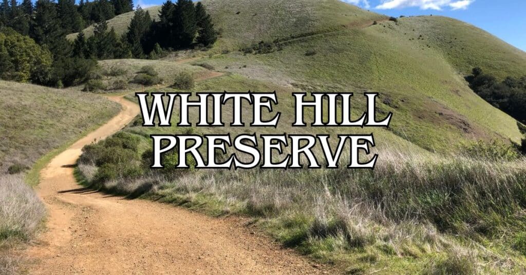
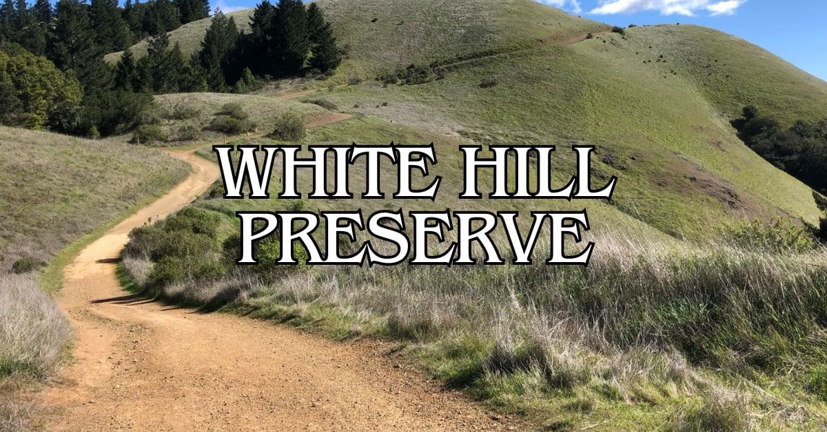
White Hill Preserve is a favorite spot for anyone who loves the outdoors in Marin County. Just outside Fairfax, this open space hooks you into a big web of trails—whether you hike, bike, or ride horses. The fire roads and trails here are well-kept and wind through classic California scenery.
You’ll get some great views of Marin’s rolling hills as you wander the easy-to-follow trails. The main trailhead sits right off Sir Francis Drake Boulevard, so finding it isn’t a hassle. White Hill Fire Road is a crowd-pleaser for good reason: it’s a straightforward climb with north-facing views that go on for miles.
Discover hand-picked hotels and vacation homes tailored for every traveler. Skip booking fees and secure your dream stay today with real-time availability!
Browse Accommodations Now
Dogs are welcome—bring a leash or use voice control where allowed. It’s smart to grab the preserve map from the Marin County Parks website before you head out. White Hill is a nice intro to Marin’s outdoors, with hikes for most ability levels. You don’t need to be a pro to enjoy it.
Overview of White Hill Preserve
White Hill Preserve gives you a front-row seat to sweeping views and a mix of trails in Marin County. At 1,430 feet up, it connects to other open spaces and works as a solid jumping-off point for longer treks.
Location and Accessibility
You’ll find White Hill Preserve just west of Fairfax. The main trailhead is right on Sir Francis Drake Boulevard, so it’s easy to reach from nearby towns. There’s parking at the trailhead—usually enough unless it’s a super busy weekend.
Blue Ridge Fire Road cuts across the hill’s summit and acts as the backbone of the preserve. Hikers, mountain bikers, and horseback riders all share this wide path. The preserve links up with a bigger network of trails, so you can keep going if you’re feeling ambitious.
All the main paths are marked, and preserve maps show distances in miles. Handy for figuring out what you’re up for on any given day.
History and Conservation
White Hill Preserve is part of Marin’s big effort to keep wild spaces wild but still open for people to enjoy. The area’s long been valued for its views and as a spot to get your bearings in the region.
These days, conservation here means balancing people-time with protecting the animals and plants that live on the hill. Native species do well, adapting to the different little climates the hill creates with its slopes and exposures. If you’re lucky, you’ll catch glimpses of wildlife—especially early or late in the day.
The preserve connects with other protected lands, creating wildlife corridors so critters can move around more freely.
Top Hiking Trails at White Hill Preserve
The trails at White Hill wind through manzanita, chamise, and open hillsides with killer views. You can stick to short walks or string together longer routes by connecting to nearby preserves.
Trail Highlights and Routes
White Hill Fire Road is the go-to trail—hikers give it a 4.6-star rating, and it’s easy to see why. The climb is steady, the path is wide, and the views are classic Marin. Springtime brings wildflowers all over the place.
Wagon Wheel Trail is another gem, with manzanita and chamise above steep, rocky slopes. When the chaparral blooms in spring, it’s a real treat.
If you want to go big, link up multiple preserves. Try the Old Railroad Grade, Glen Fire, Smith Ridge, and Sunrise loop—it’ll take you into Loma Alta Open Space for a longer, more varied outing.
Difficulty Levels and Trail Lengths
The trails here range from mellow to pretty tough, depending on what you pick.
Beginner-Friendly Options:
- Short out-and-backs on White Hill Fire Road (2–3 miles round-trip)
- Easy stretches of Wagon Wheel Trail (1–2 miles)
Intermediate to Advanced Routes:
- Full White Hill Fire Road traverse (4–5 miles one-way)
- Loops with Old Railroad Grade or into other preserves (6+ miles)
There aren’t a ton of internal loops, but you can make your own by connecting to Loma Alta or Cascade Canyon. Those combos are usually 5–8 miles with some elevation gain.
Most trails have at least a little climbing. Fire roads are more gradual, while single-tracks can be steeper. Not much shade, so pack water and sunscreen.
Wildlife and Natural Beauty
White Hill Preserve is a patchwork of habitats, which means you’ll find all sorts of plants and animals if you keep your eyes open. It feels pretty lively, especially in spring.
Find the perfect hotel or vacation rental. Instant booking, no fees!
View Top Stays
Common Animal and Plant Species
You might spot black-tailed deer grazing or see a gray fox darting through the brush. Coyotes live here too, though they usually keep their distance.
Birders, bring your binoculars. Red-tailed hawks often circle overhead, and you’ll hear woodpeckers and songbirds if you pause in the woods. Spring is especially good for warblers and thrushes.
Plants shift with the terrain. Oak woodlands have coast live oak and bay laurel. Meadows pop with California poppies and lupines in spring. Chaparral slopes are thick with manzanita and chamise—easy to spot by their reddish bark.
Best Times for Wildlife Viewing
Want to see animals? Show up early or late, when it’s cooler—April to June is prime time.
Spring (March–May) is wildflower season and the birds are everywhere, singing and nesting. The meadows get splashed with color.
In fall (September–November), deer are more visible, sometimes gathering in bigger groups. It’s fun to watch them as they get ready for winter.
Winter (December–February) is quieter, but with the leaves down, you might spot animals you’d usually miss. Plus, the trails are less crowded.
Best Photography Spots
White Hill Preserve is a dream for photographers—big views, changing light, and plenty of wildlife if you’re patient. The landscape is always shifting with the seasons.
Scenic Vistas and Lookouts
The summit tops out at 1,430 feet, and the views are worth the effort. You get a sweeping look at Mount Tam’s north side and the hills all around. Blue Ridge Fire Road takes you right up there.
For sunrise, head to the east side of the summit—the first light is beautiful, casting long shadows. If you’re into sunsets, the west side glows gold as the sun drops.
Spring brings wildflower carpets, and fall paints the hills with warm colors. Dawn and dusk are the best times for dramatic lighting—everything just looks more three-dimensional somehow.
Tips for Capturing Wildlife
If wildlife photography is your thing, patience pays off here. A telephoto lens (200mm or more) lets you snap animals without getting too close.
Raptors like hawks and eagles are often up in the morning—look near the ridges. Try to keep the sun behind you for the best light.
Ground animals show up early or late. Move quietly, camera ready. For action shots, bump your shutter speed up (1/500 or faster). Burst mode helps you catch those quick movements.
Wearing neutral colors helps you blend in—animals notice less, and you might get a better shot.
Nearby Attractions in Marin County
If you’ve got extra time, Marin County has plenty more to see. These spots are all worth a side trip.
Ring Mountain Open Space
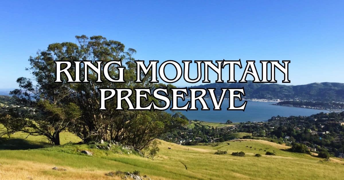
On the Tiburon Peninsula, Ring Mountain Open Space gives you huge views of San Francisco Bay. The 367-acre preserve is famous for rare wildflowers—some only grow here.
The rocky serpentine soil supports endangered plants like the Tiburon mariposa lily. If you’re into wildflowers, visit April–May.
Take the 2-mile loop to the summit for sweeping views of San Francisco, the Bay Bridge, and Mount Tamalpais. The trail is moderate, with a few steep bits.
Best time: Spring for wildflowers, or crisp fall days for clear views
Facilities: Limited parking, no restrooms
Pet policy: Dogs on leash
Point Reyes
Point Reyes National Seashore covers 71,000 acres of wild coastline. There’s a lot to do—hike through forests, watch for whales, or just take in the ocean.
Luxury stays to cozy cottages await, all with instant booking. Find the best deals!
Browse Marin Stays
The Point Reyes Lighthouse sits at the tip of the peninsula. It’s a trek down 308 steps, but the view is worth it—unless the fog rolls in, which happens a lot.
Popular activities:
- Over 150 miles of hiking trails
- Wildlife spotting (tule elk, elephant seals)
- Visiting Drakes Beach and its cliffs
- Checking out the old shipwreck
Stop by the Bear Valley Visitor Center for maps and advice. You’ll want at least half a day to see the highlights.
Stinson Beach
Stinson Beach is a classic spot—3.5 miles of sand, about 35 minutes from White Hill. Swimmers, surfers, sunbathers, everyone shows up when it’s warm.
The water’s calmest in the morning; waves pick up later. Summer is best for swimming (lifeguards are on duty), but the water’s always chilly.
The town has a few good places to eat—try Parkside Cafe for breakfast with a view. If the fog rolls in, nearby trails connect to Mount Tamalpais State Park. The Dipsea Trail is tough but the coastal views are fantastic.
Parking tip: Get there before 10am on weekends for a shot at the main lot.
Twin Peaks
Twin Peaks is one of San Francisco’s best viewpoints, just across the Golden Gate. The twin hills rise to 922 feet, with 360-degree city and bay views.
Christmas Tree Point is the main overlook, with parking and a deck. On clear days, you can see the Golden Gate Bridge, downtown, Alcatraz, and even the East Bay.
Sunset is gorgeous, or go early to beat the crowds. Fog can wipe out the view, so check the forecast. You can drive, take public transit, or hike up—the road’s winding but not bad. Bring a jacket; it’s usually windier and cooler at the top.
Travel Tips for Visitors
A little planning goes a long way for a smooth trip to White Hill Preserve. Think about parking, pack the essentials, and check the weather before you head out. There’s nothing like a good day on the trails—just don’t forget water, snacks, and maybe a camera.
Getting There and Parking
White Hill Preserve sits just off Sir Francis Drake Boulevard in Marin County. If you’re coming from San Francisco, hop on Highway 101 north, take the Sir Francis Drake exit, and head west. The trailhead parking’s right along Sir Francis Drake Boulevard, close to the preserve sign—just keep your eyes peeled.
Parking fills up fast, especially on weekends and holidays, so getting there early is a good idea. Weekdays? Usually less crowded. There’s no entrance fee, which is always a plus.
Prefer public transit? Marin Transit buses cruise along Sir Francis Drake Boulevard. It’s smart to check current schedules at marintrail.org before heading out, since times can change.
The preserve opens at sunrise and closes at sunset, every day. If you’re after the best weather, summer and fall usually deliver.
What to Pack and Wear
Layer up for White Hill. Marin County weather can flip on you—one minute it’s sunny, the next, fog’s rolling in.
Essentials to toss in your pack:
- Water bottle (at least 1 liter per person)
- Sunscreen and a hat
- Trail map (find it online or grab one at the trailhead)
- Solid hiking shoes with decent grip
- Some snacks or a light meal
- Camera—trust me, you’ll want photos
Hiking poles? Not a must, but they make the steeper bits easier. Cell service gets pretty spotty out here, so download your maps ahead of time or just go old-school with paper.
Spring and winter bring mud, so waterproof boots are your friend. In summer, bring extra water—shade can be pretty limited on some trails.
Responsible Recreation and Safety
Heading out to White Hill Preserve? It’s worth brushing up on safety basics. Looking out for yourself and the land means everyone gets to enjoy this place a little longer.
Leave No Trace Principles
White Hill Preserve asks visitors to follow Leave No Trace guidelines, which honestly just makes sense. Check trail conditions and the weather before you go. Stick to marked trails—it’s better for the plants and keeps the hills from eroding.
Carry out everything you bring in, even those tiny snack wrappers or orange peels. Please don’t pick wildflowers or mess with rocks and logs. Try to keep noise down—wildlife and fellow hikers appreciate the quiet.
Bring enough water and snacks, but make sure any trash goes home with you. If nature calls, head at least 200 feet from water, and bury waste 6-8 inches deep. It’s not glamorous, but it’s the right thing to do.
Emergency Contacts and Trail Etiquette
If something goes wrong at White Hill Preserve, just call 911. For less urgent stuff, Marin County Parks can help at (415) 473-6387, but only during business hours—so maybe add those to your contacts before you go.
On those tight, twisty trails, hikers heading uphill get the right of way. When you spot mountain bikers barreling down, best to step aside—these are multi-use trails, after all. If you’re passing someone from behind, just give a quick heads-up.
Dogs? Keep them leashed, always. And yeah, picking up after them isn’t optional—it keeps the place nicer for everyone (and the wildlife will thank you, probably).
If the trails are muddy, maybe skip them for now. Walking on them when they’re wet just tears things up. Weather can turn fast out there, so it’s smart to have an exit plan. Cell service drops out in spots, so let someone know where you’re headed before you wander off.
Find available hotels and vacation homes instantly. No fees, best rates guaranteed!
Check Availability Now
Adrian Rosal Park Travel Guide – Accessibility, Amenities, Activities, and More!
Alto Bowl Preserve Travel Guide – Accessibility, Amenities, Activities, and More!
Bald Hill Preserve Travel Guide – Accessibility, Amenities, Activities, and More!
Baltimore Canyon Preserve Travel Guide – Accessibility, Amenities, Activities, and More!
Bayside Park Travel Guide – Accessibility, Amenities, Activities, and More!
Blithedale Summit Preserve Travel Guide – Accessibility, Amenities, Activities, and More!
Bothin Marsh Preserve Travel Guide – Accessibility, Amenities, Activities, and More!
Buck’s Landing Travel Guide – Accessibility, Amenities, Activities, and More!
Camino Alto Preserve Travel Guide – Accessibility, Amenities, Activities, and More!
Candy’s Park Travel Guide – Accessibility, Amenities, Activities, and More!
Cascade Canyon Preserve Travel Guide – Accessibility, Amenities, Activities, and More!
Charles F. McGlashan Pathway Travel Guide – Accessibility, Amenities, Activities, and More!
China Camp State Park Travel Guide – Accessibility, Amenities, Activities, and More!
Corte Madera Pathway Travel Guide – Accessibility, Amenities, Activities, and More!
Hal Brown Park Travel Guide – Accessibility, Amenities, Activities, and More!
Horse Hill Preserve Travel Guide – Accessibility, Amenities, Activities, and More!
King Mountain Preserve Travel Guide – Accessibility, Amenities, Activities, and More!
Lagoon Park Travel Guide – Accessibility, Amenities, Activities, and More!
Loma Alta Preserve Travel Guide – Accessibility, Amenities, Activities, and More!
Lucas Valley Park Travel Guide – Accessibility, Amenities, Activities, and More!
Lucas Valley Preserve Travel Guide – Accessibility, Amenities, Activities, and More!
McInnis Park Travel Guide – Accessibility, Amenities, Activities, and More!
McNears Beach Park Travel Guide – Accessibility, Amenities, Activities, and More!
Mill Valley-Sausalito Pathway Travel Guide – Accessibility, Amenities, Activities, and More!
Mount Tamalpais State Park Travel Guide – Accessibility, Amenities, Activities, and More!
Muir Woods National Monument Travel Guide – Accessibility, Amenities, Activities, and More!
Pueblo Park Travel Guide – Accessibility, Amenities, Activities, and More!
Ring Mountain Preserve Travel Guide – Accessibility, Amenities, Activities, and More!
San Pedro Mountain Preserve Travel Guide – Accessibility, Amenities, Activities, and More!
Santa Venetia Marsh Preserve Travel Guide – Accessibility, Amenities, Activities, and More!
Tennessee Valley Travel Guide – Accessibility, Amenities, Activities, and More!
Terra Linda/Sleepy Hollow Preserve Travel Guide – Accessibility, Amenities, Activities, and More!
White Hill Preserve Travel Guide – Accessibility, Amenities, Activities, and More!


